


Stockpile Volume Measurement with DJI Matrice 4E and DJI Terra
From RTK mission planning to point-cloud reconstruction, base-plane selection, volume QA and inventory reporting—build a repeatable workflow for aggregate, construction, mining and material-management sites.

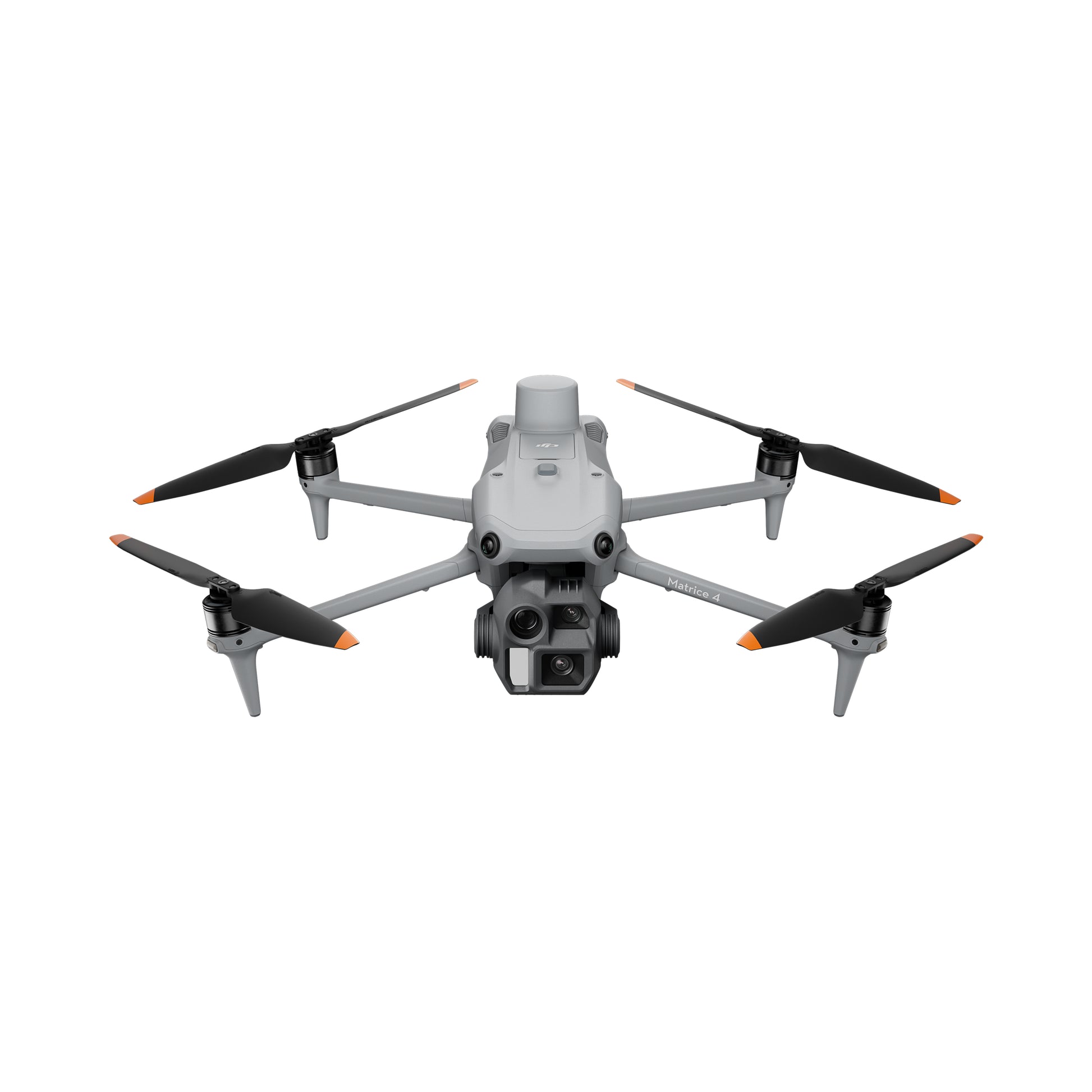
Fly a repeatable nadir mapping mission with Matrice 4E, preserve RTK positioning and independent checkpoint evidence, reconstruct a dense point cloud and surface in DJI Terra, outline each pile, select the correct base plane, and report volume separately from any tonnes calculation.
Stockpile inventory is simple to ask about—and difficult to measure consistently
Quarry managers, contractors, mines, municipalities and material suppliers need to know how much material is available, moved, sold or consumed. Traditional methods may involve walking irregular slopes, taking sparse points, estimating truck counts or waiting for a survey crew. Aerial photogrammetry can collect the visible surface quickly and create a repeatable digital record.
Know what is on site
Measure gravel, sand, topsoil, salt, ore, coal, mulch, silage or other visible material stored in piles.
Compare opening and closing balances
Use consistent survey dates to support production, purchasing, sales and month-end reconciliation.
Track cut, fill and movement
Measure changing terrain, temporary piles and material movement around construction or mining operations.
Reduce walking on unstable piles
Aerial capture can reduce some climbing and ground exposure, subject to the site’s approved safety workflow.
Measure more often
Portable capture can support weekly, monthly or event-based surveys without rebuilding the workflow each time.
Do not confuse a model with audited inventory
Financial, contractual or legal use may require independent review, controlled procedures or professional sign-off.
DJI’s earthwork workflow: Matrice 4E collects mapping imagery, DJI Terra produces dense point clouds and 3D models, and the operator measures stockpile volume or exports the point cloud for third-party cut-and-fill analysis.
What Matrice 4E and DJI Terra each contribute
Efficient photogrammetric data capture
- 4/3-inch CMOS wide camera with 20 MP effective pixels
- Mechanical shutter from 2 seconds to 1/2000 second
- 0.5-second minimum photo interval
- RTK positioning support
- Up to 49 minutes published flight time in windless testing
- Up to 21 m/s mapping speed in supported workflows
- Portable 1,219 g aircraft with propellers
Reconstruction, QA and volume analysis
- Visible-light 2D and 3D reconstruction
- Dense point-cloud, DSM, DEM and 3D model outputs
- GCP and checkpoint management
- Annotation and measurement tools
- Cut-and-fill volume calculations
- Mean Plane and Lowest Point base-plane options
- LAS, TIFF and other export pathways
Current software note: DJI’s download page listed Terra V5.2.8 on June 30, 2026. DJI now describes Terra as supporting visible-light photogrammetry, LiDAR processing and newer reconstruction technologies including Gaussian Splatting. Stockpile volume work remains a metric surface-analysis task, not a visual-rendering contest.
Plan → Control → Capture → Check → Reconstruct → Validate → Delineate → Measure → Report
Plan
Define materials, site limits, frequency, accuracy need and reporting purpose.
Control
Select RTK source, coordinate system, GCP strategy and independent checkpoints.
Capture
Fly a sharp, overlapping nadir mission with full pile and toe coverage.
Check
Inspect images, RTK status, coverage, motion blur and missing pile faces.
Reconstruct
Generate aerotriangulation, dense point cloud, DSM and 3D surface in Terra.
Validate
Review quality report, checkpoints, surface noise, holes and coordinate system.
Delineate
Trace where each pile meets the underlying ground or containment structure.
Measure
Select Mean Plane or Lowest Point and record cut and fill volume.
Report
Document volume, QA, base plane, material, density source and limitations.
Repeatability rule: save the flight route, control method, camera settings, coordinate system, pile names and measurement conventions. A consistent workflow is often more valuable than one unusually detailed survey.
RTK improves positioning—but checkpoints prove the project
Matrice 4E supports RTK positioning. The correction source may come from a compatible network service or a local base station such as D-RTK 3, depending on the site and workflow. RTK helps geotag images consistently and can reduce the number of ground-control points required.
- Confirm the project coordinate reference system before flying
- Use a stable RTK correction source appropriate to the site
- Record RTK fix status during acquisition
- Use independent checkpoints to test the finished model
- Keep checkpoints away from pile edges and unstable ground
- Preserve survey method, coordinates and residuals with the report
DJI’s stockpile guidance notes that RTK-equipped aircraft can reduce GCP needs, but still recommends checkpoints to verify survey accuracy. For financial or contractual inventory, independent evidence is especially important.
Position the image centres
RTK supports more consistent geotagging and alignment between repeated surveys. It does not remove image-quality or modeling error.
Constrain the reconstruction
Ground-control points can anchor the model where project requirements, RTK conditions or coordinate transformations justify them.
Independently test accuracy
Checkpoints should not be used to adjust the model. Compare their known coordinates with reconstructed values.
Do not report the aircraft’s RTK specification as the stockpile result. DJI lists RTK positioning specifications under suitable conditions. Final model accuracy must be evaluated from the delivered dataset and project controls.
Flight-planning settings for reliable pile surfaces
DJI’s published stockpile workflow recommends a mapping mission with nadir imagery, Smart Oblique disabled, elevation optimization disabled, terrain follow where relief is large, and approximately 80% front overlap with 70% side overlap as a starting point. Adapt those settings to pile shape, height, surface texture and required ground-sampling distance.
Swipe the table left on smaller screens.
| Setting | Practical starting point | Why it matters | When to adjust |
|---|---|---|---|
| Mission type | 2D mapping mission | Creates repeatable grid capture and full surface coverage | Add targeted passes only when pile faces or occlusions require them |
| Camera orientation | Nadir | DJI’s stockpile workflow recommends downward capture for volume analysis | Complex vertical faces may require supplementary imagery and separate QA |
| Front overlap | Approximately 80% | Supports feature matching along the flight line | Increase for uniform material, steep piles, lower texture or difficult light |
| Side overlap | Approximately 70% | Supports cross-track reconstruction and pile-edge coverage | Increase for steep faces, changing relief or high accuracy demands |
| Altitude | Set from required GSD and safe clearance | Controls image resolution, coverage and mission time | Lower for small piles or fine edges; increase only if resolution remains adequate |
| Terrain follow | Use where site relief is significant | Maintains more consistent distance to ground and image scale | Validate terrain data, pile heights and obstacle clearance |
| Shutter | Mechanical shutter with sufficiently fast exposure | Reduces motion distortion and image blur | Adjust speed, aperture or ISO for light and wind |
| Dewarping | Follow current DJI photogrammetry guidance and project workflow | Camera calibration and image treatment affect reconstruction | Keep the setting consistent across repeated surveys |
| Smart Oblique | Off for DJI’s basic stockpile workflow | Keeps acquisition focused on the upper surface and toe boundary | Use a validated custom method if vertical geometry cannot be reconstructed |
| Site margin | Extend beyond every pile toe | Terra needs surrounding ground to infer the base plane | Increase around walls, bunkers, conveyors and adjacent piles |
Critical capture detail: do not crop the mission tightly around the visible top of the pile. Capture the full toe and enough surrounding ground to support pile-boundary tracing and base-plane estimation.
Inspect the dataset while a reflight is still possible
Confirm fixed positioning
Review correction connection, position status and any interruption that could affect image geotags or survey consistency.
Look for missed toes and faces
Confirm every pile boundary, containment edge and surrounding base area is visible in multiple sharp images.
Check blur and exposure
Review representative frames from the start, centre and end of the mission, including the steepest and darkest pile surfaces.
Record site activity
Loaders, trucks, conveyors and active dumping can create inconsistent geometry between images.
Verify targets are visible
Confirm checkpoints are not blocked, moved, shadowed or too small to identify reliably during processing.
Document changing conditions
Strong wind, rain, snow, dust, glare and rapidly changing light may reduce capture quality or comparability.
Reflight rule: if the toe is missing, critical images are blurred, RTK failed or the pile changed during acquisition, a short reflight is usually cheaper than defending an uncertain inventory result later.
From image folder to dense point cloud and surface model

-
Create a visible-light reconstruction mission. Use a clear project name that includes site and survey date.
-
Import the original Matrice 4E images. Preserve metadata and do not resize or recompress the source imagery.
-
Confirm coordinate information. Verify the source and output reference systems before processing.
-
Manage control and checkpoints. Tag GCPs where used and preserve independent checkpoints for validation.
-
Select required outputs. Typical products include 2D map, dense point cloud, DSM and 3D model.
-
Run aerotriangulation and reconstruction. Use hardware that meets the project’s image count and output demands.
-
Review the quality report and model. Inspect residuals, image use, holes, noise and surface completeness.
Useful for pile naming, site overview, boundaries and communication.
Primary surface representation for measurement, QA and export.
Represents visible top surfaces including piles, equipment and structures.
Helps inspect pile shape, holes, boundary interpretation and stakeholder communication.
The pile boundary and base plane control the volume result
In DJI Terra, open Annotation and Measurement, choose the Volume tool, and click around the point where the material meets the underlying surface. Double-click to close the polygon. Terra reports cut and fill relative to the selected base plane.
- Trace the pile toe rather than the top edge
- Use enough vertices to follow irregular boundaries
- Avoid including adjacent piles, equipment or berms
- Inspect the boundary in both top and oblique 3D views
- Record the selected base-plane method
- Save a consistent pile name and survey date
- Export annotations and measurement results where required

Best starting point for free-standing piles
DJI describes Mean Plane as averaging the elevations around the annotation to estimate the bottom surface. DJI recommends it for most free-standing stockpiles.
Useful for selected contained piles
DJI describes Lowest Point as a method for piles in bunkers or against walls where the rear base cannot be measured directly.
The base plane is not a cosmetic setting. Two operators can use the same 3D model, draw slightly different boundaries or choose different base planes and produce materially different volumes. Standardize the method before comparing surveys.
Separate model quality, absolute accuracy and inventory repeatability
A visually clean model can still be shifted in position, vertically biased or measured against an unsuitable base. Conversely, a model may have modest absolute geolocation error while still producing consistent relative volumes if acquisition and measurement methods remain stable.
Consistent exposure, no critical blur and full coverage.
Small localized blur away from measured piles.
Blur, glare or missing imagery affects pile edges or faces.
RTK status documented and checkpoints within project tolerance.
One checkpoint outlier with explained cause.
Unknown datum, systematic residual or unverified coordinate transform.
Toe, crest and steep faces reconstruct without material holes.
Minor noise that does not affect the measured polygon.
Major holes, floating points or smoothed-away geometry.
Surrounding ground visible and base-plane method documented.
Wall, bunker or adjacent pile complicates the base.
Underlying ground cannot be inferred or boundary is hidden.
Saved route, naming, polygon rules and report template.
Manual judgment required but documented.
No standardized method or audit trail.
Checkpoint principle: checkpoints evaluate the position of the finished model. They do not directly validate bulk density, hidden pile geometry or the operator’s base-plane choice.
Cubic metres become tonnes only after applying bulk density
What the drone measures
The photogrammetric model estimates the visible three-dimensional space above or below the selected base.
What the site must verify
Density may come from sampling, weighbridge reconciliation, supplier data or an approved material-management procedure.
Why tonnes can vary
Moisture, void space, compaction, contamination and material grading can change tonnes per cubic metre.
Do not publish a generic internet density as audited mass. Use a site-approved value, document its source and keep the original cubic-metre result.
What a professional stockpile report should include
Pile name, volume and change
Summarize each pile’s current cubic metres, previous result, net change and status.
Orthomosaic with pile IDs
Show the measured polygons, coordinate grid, checkpoints and date of capture.
Point cloud or model views
Include screenshots that make boundaries, base conditions and problem areas visible.
Control and processing evidence
Record RTK method, GCPs, checkpoint residuals, image count, software version and coordinate system.
Boundary and base plane
Identify Mean Plane or Lowest Point, polygon conventions and any manual exclusions.
State what is not measured
Note hidden surfaces, vegetation, water, walls, active machinery, density assumptions and inaccessible ground.
Best practice: keep the raw images, Terra project, control coordinates, quality report, measurement export and final report under a consistent file-naming and retention policy.
Common stockpile measurement failure modes
Pile meets wall, berm or adjacent pile
The underlying surface cannot be inferred reliably, so base-plane assumptions dominate the result.
Steep faces fail to reconstruct
Uniform aggregate and sharp slopes may require more overlap, lower altitude or supplementary imagery.
Flight speed exceeds available light
Mechanical shutter helps, but exposure must still freeze motion and preserve texture.
Loader or conveyor changes the pile
Photogrammetry assumes one coherent scene. Material movement between images creates inconsistent geometry.
Feature matching weakens
Water, snow, strong glare or homogeneous fine material can reduce reconstruction quality.
Visible surface is not bare earth
Photogrammetry reconstructs the visible canopy. A different sensor or ground model may be needed.
Model shifts or elevations misalign
Datum, projection and geoid mistakes can create systematic horizontal or vertical error.
Operators draw different polygons
Standardize where the pile toe is traced and how shared edges are handled.
Volume is converted with the wrong factor
The drone volume may be sound while the reported tonnes are wrong because material density was assumed.
Current equipment prices and additional cost categories
SpeedyDrone price checked July 21, 2026.
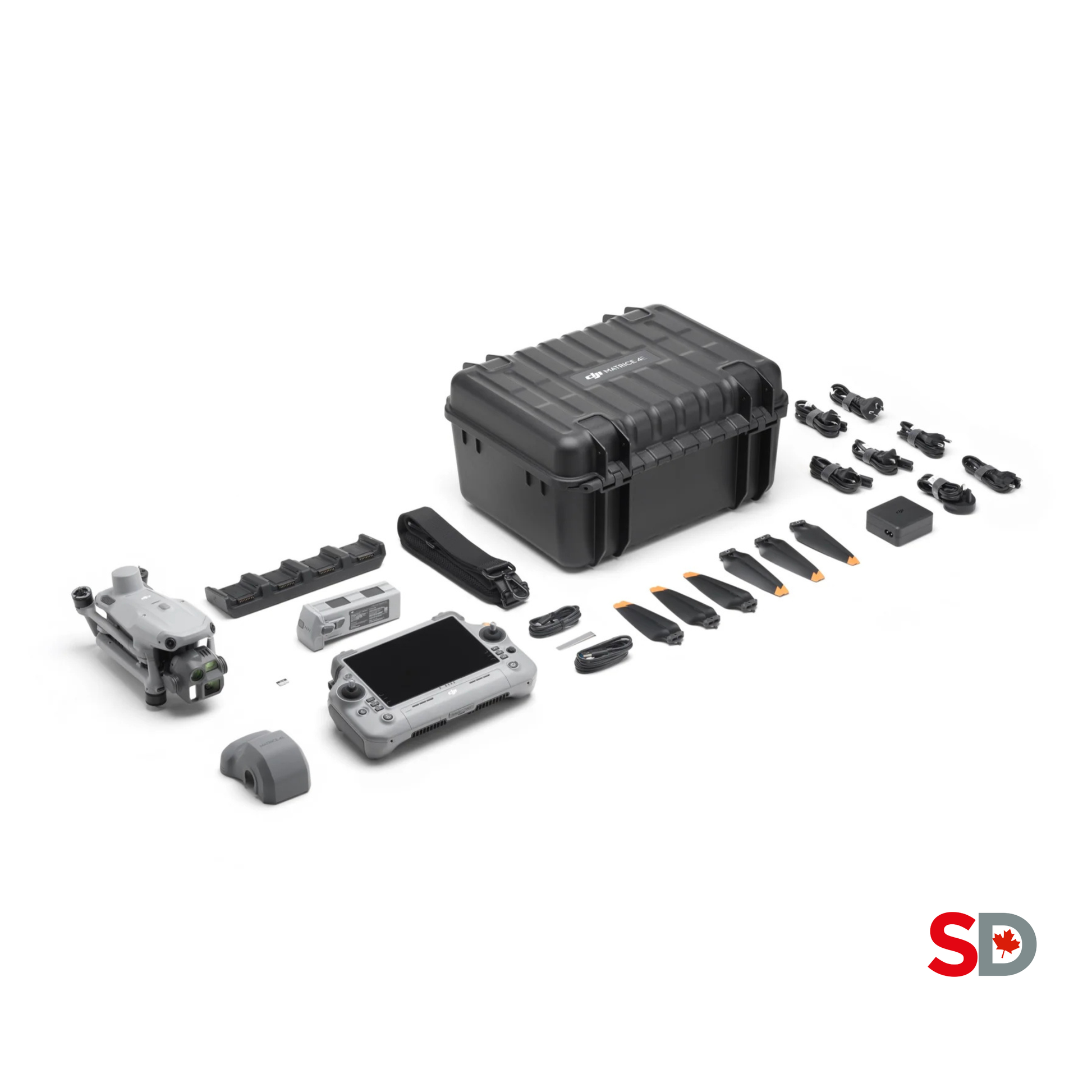
SpeedyDrone listing with three batteries and a landing pad.
SpeedyDrone price checked July 21, 2026.
Standard and Flagship licences are available through official dealers.
Control, targets and safety
Budget checkpoints or GCP targets, survey equipment, cones, PPE, memory cards, spare batteries and cases.
Windows workstation
Image count, output resolution and reconstruction type determine GPU, RAM, storage and processing-time needs.
Training and procedures
Include flight training, Terra training, survey QA, site induction and report development.
Insurance and maintenance
Include batteries, propellers, repairs, calibration procedures and lifecycle replacement.
Audit and data retention
Financial inventory may require controlled access, review, approval and documented change history.
Survey or engineering review
Budget qualified support where legal, contractual or professional requirements demand it.
Stockpile mapping still requires the correct RPAS operating category
Matrice 4E weighs more than 250 g and must be registered in Canada. The pilot certificate and aircraft requirements depend on the site, airspace, distance from people and operation category.
Lower-risk VLOS sites
A remote uncontrolled-airspace stockpile site may fit Basic rules when every Basic condition is satisfied.
Controlled airspace or closer to people
Advanced operations require an Advanced pilot certificate and the correct aircraft safety assurance for the specific operation.
Do not infer permission from equipment capability
EVLOS, BVLOS or other complex missions require the applicable Transport Canada framework, operator certificate or SFOC.
Check airspace and hazards
Review aerodromes, controlled airspace, people, cranes, conveyors, powerlines, blasting and vehicle activity.
Verify the exact operation
Transport Canada states that advanced and complex operations require the relevant RPAS Safety Assurance.
Integrate with site controls
Coordinate with supervisors, loaders, blasting schedules, haul roads and emergency procedures.
Operational disclaimer: equipment ownership does not authorize flight. Verify current Transport Canada requirements, NAV CANADA permissions, site procedures and aircraft eligibility before each mission.
Stockpile survey checklist
Plan the mission
- Define pile list and report purpose
- Confirm airspace and site authorization
- Select coordinate system and RTK source
- Prepare checkpoints or GCPs
- Load saved route and naming convention
Control the environment
- Brief site personnel and stop moving material
- Place and survey targets safely
- Inspect weather, obstacles and takeoff area
- Confirm RTK fix and camera settings
- Capture full pile toes and surrounding ground
Review the dataset
- Check image sharpness and exposure
- Confirm complete coverage
- Verify checkpoint visibility
- Record site changes and exceptions
- Reflight while conditions remain available
Build and validate
- Use original images and correct CRS
- Tag control and preserve checkpoints
- Review quality report and residuals
- Inspect point cloud for holes and noise
- Save software version and project settings
Standardize every pile
- Trace the toe consistently
- Select and record base plane
- Exclude machinery and adjacent material
- Review cut and fill values
- Save annotation name and date
Make the result defensible
- Report cubic metres first
- Document density source separately
- Include checkpoint and QA evidence
- State limitations and assumptions
- Retain raw data and exports
Build a repeatable Matrice 4E and DJI Terra stockpile workflow
SpeedyDrone Canada supports Canadian surveyors, contractors, mines, quarries, municipalities and material-management teams evaluating Matrice 4E, D-RTK 3, DJI Terra, training and enterprise workflow design. Send your site size, pile count, accuracy target, control method, reporting needs and operating location for a system and workflow assessment.
Product pricing, software licensing, aircraft eligibility, operating rules, package contents and lead times can change. Confirm the final project before purchase.
Stockpile volume measurement FAQ
Can DJI Matrice 4E measure stockpile volume?
Matrice 4E captures overlapping mapping images with a mechanical-shutter 20 MP wide camera and RTK support. DJI Terra reconstructs the images into a point cloud and surface from which the operator can calculate stockpile volume.
Why is Matrice 4E better suited to mapping than Matrice 4T?
Matrice 4E uses a 4/3-inch 20 MP wide camera with a mechanical shutter and 0.5-second minimum photo interval. Matrice 4T is primarily configured for thermal inspection and response.
How much does DJI Matrice 4E cost in Canada?
SpeedyDrone Canada listed DJI Matrice 4E at CAD $6,229 and the Mission Edition at CAD $6,739 when checked July 21, 2026. Confirm current pricing before purchase.
Does DJI Terra calculate stockpile volume directly?
Yes. In Annotation and Measurement, select the Volume tool, draw a polygon around the pile toe, close the polygon and select a base plane. Terra reports cut and fill volume.
What is the difference between Mean Plane and Lowest Point?
DJI describes Mean Plane as averaging boundary elevations and recommends it for most free-standing piles. Lowest Point uses the lowest elevation as the base and can be useful for selected piles in bunkers or against walls.
Do I need ground-control points when using Matrice 4E RTK?
RTK can reduce the need for GCPs, but the correct strategy depends on project tolerance, correction quality, coordinate system and reporting purpose. Independent checkpoints are still recommended to evaluate the finished model.
What image overlap should I use for stockpiles?
DJI’s published stockpile workflow uses approximately 80% front overlap and 70% side overlap as a starting point. Increase overlap when pile faces, texture, lighting or accuracy requirements make reconstruction more difficult.
Should I use oblique imagery for stockpile volume?
DJI’s basic stockpile workflow recommends nadir imagery with Smart Oblique and elevation optimization disabled. Complex steep faces may require a separately validated supplementary method.
How accurate is a drone stockpile survey?
Accuracy depends on image quality, RTK or control, checkpoints, coordinate systems, overlap, ground visibility, reconstruction, boundary placement and base-plane choice. Evaluate the finished dataset rather than quoting the aircraft specification as project accuracy.
Can drone volume be converted directly into tonnes?
Only by applying a verified bulk-density value in tonnes per cubic metre. Density varies with material, moisture, compaction and void space, so report the measured cubic metres and density source separately.
What outputs can DJI Terra generate?
DJI’s earthwork workflow lists 3D models, DSM, DEM and point clouds. Terra also supports visible-light 2D and 3D reconstruction and export for third-party earthwork software.
What is the current DJI Terra version?
DJI’s official download page listed DJI Terra V5.2.8 on June 30, 2026. Confirm the current version and compatibility before starting a project.
Can I measure piles against walls or in bunkers?
Yes, but the hidden base introduces additional uncertainty. DJI provides the Lowest Point base-plane option for selected contained piles. Document the assumption and consider independent validation.
Can Matrice 4E fly in rain?
DJI and SpeedyDrone state that Matrice 4 Series does not have a standard waterproof rating. Do not treat it as an all-weather aircraft.
Where can a Canadian company request a Matrice 4E stockpile workflow assessment?
Contact SpeedyDrone Canada for Matrice 4E, D-RTK 3, DJI Terra, training, Canadian pricing and surveying-workflow consultation.
- DJI Matrice 4 Series official product page
- DJI Matrice 4 Series official specifications
- DJI Earthwork and stockpile measurement workflow
- DJI Mining Survey workflow with Matrice 4E and DJI Terra
- DJI Enterprise stockpile measurement step-by-step guide
- DJI Terra official product page
- DJI Terra downloads, current version, manuals and white papers
- SpeedyDrone Canada DJI Matrice 4E listing
- SpeedyDrone Canada Matrice 4 Series pricing and comparison
- SpeedyDrone Canada D-RTK 3 listing
- SpeedyDrone Canada surveying and mapping solutions
- Transport Canada Advanced operations
- Transport Canada RPAS Safety Assurance guidance
- Transport Canada drone safety and current rules
Information and Canadian pricing were checked July 21, 2026. Product specifications, software features, licence terms, aircraft eligibility, regulations, package contents, prices, warranty and lead times can change. Manufacturer maximum figures are controlled-test results, not guarantees. Verify the exact aircraft, workflow, coordinate system, controls, software version and professional requirements before using results for contractual, financial or legal purposes.


