


DJI Mavic 3M + Agras T50: Smart Farming Workflow for Canada
Mavic 3 Multispectral helps a farm observe crop variability with synchronized RGB and multispectral imagery. Agras T50 performs the approved spraying or spreading task. The value comes from the complete decision loop—not from assuming a vegetation index automatically becomes an application prescription.
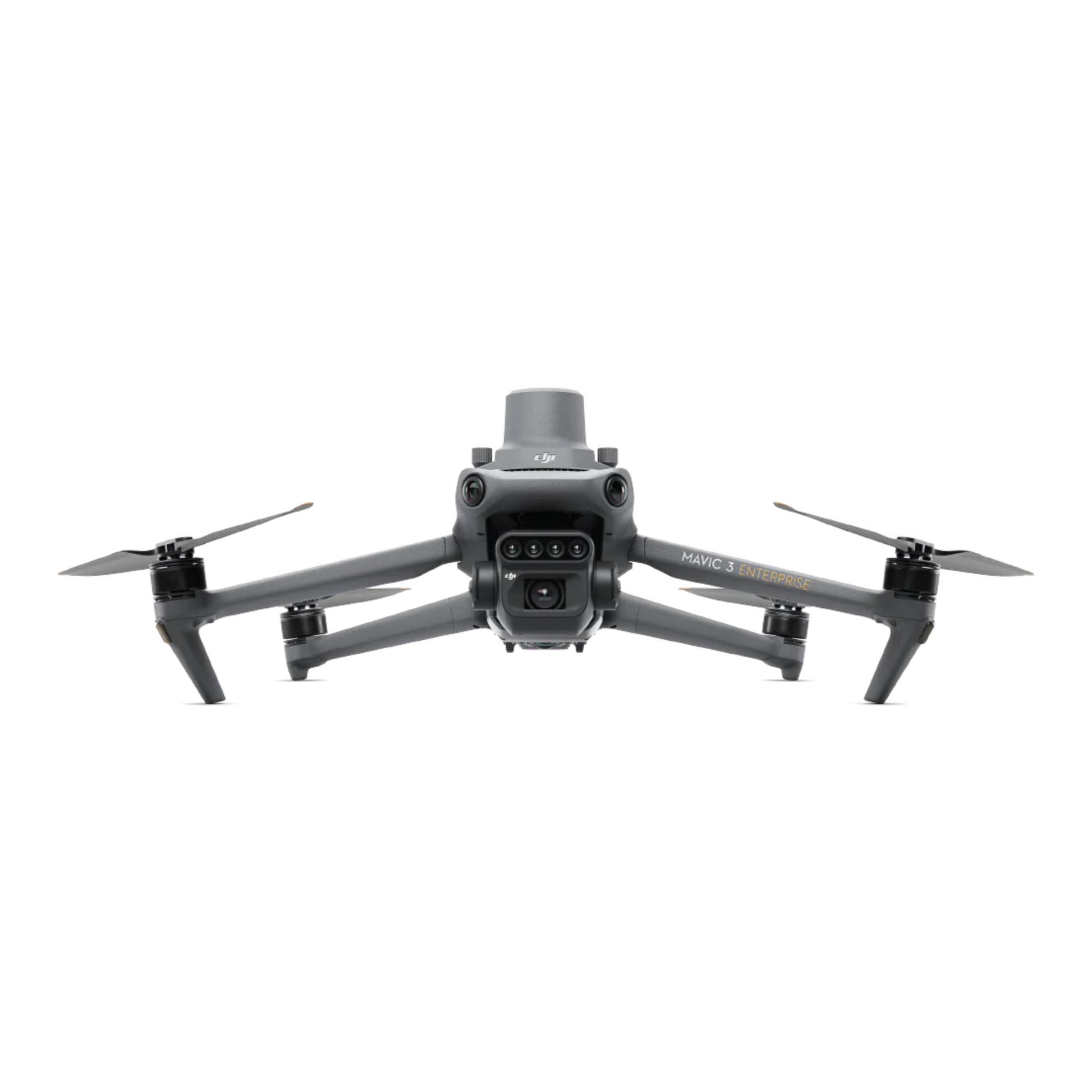
Mavic 3 Multispectral
20 MP RGB, four 5 MP multispectral bands, RTK and a manufacturer flight-time reference of 43 minutes.
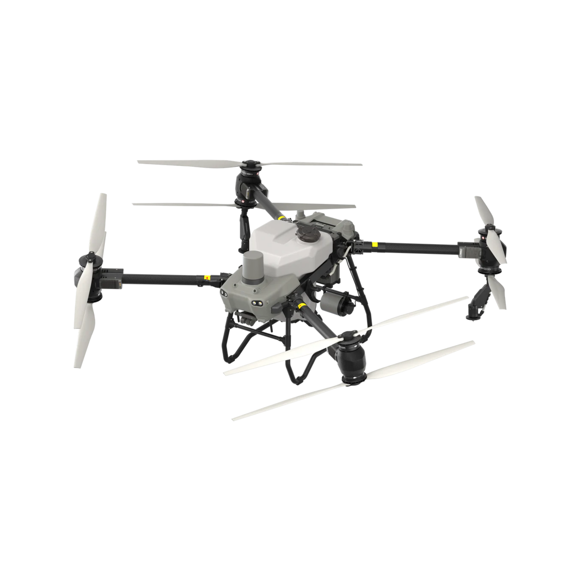
DJI Agras T50
40 kg spraying payload, 50 kg spreading payload, dual atomizing system, radar, vision and RTK workflows.
Use M3M to find patterns. Use people and evidence to decide. Use T50 to execute.
The strongest combined workflow is not “scan and spray.” It is a controlled cycle in which imagery guides field scouting, field evidence guides a prescription, and application records guide verification. Farms should preserve a human approval point before any liquid or granule is loaded into T50.
Observe crop variability and create a georeferenced map.
- Collect 20 MP RGB images for visual context.
- Collect green, red, red-edge and near-infrared bands.
- Build NDVI, NDRE, GNDVI or other supported layers.
- Flag zones that need ground inspection.
- Repeat missions to track change when conditions are comparable.
Turn a colour map into an agronomically defensible action.
- Confirm the cause of the pattern in the field.
- Review crop stage, soil, weather, disease, pests and nutrient history.
- Choose whether to treat, scout again or do nothing.
- Set legal product, rate, carrier volume and buffer requirements.
- Approve zones and no-apply areas before export.
Apply the approved liquid or granule task and create records.
- Import or recreate a verified field and route.
- Confirm units, rates, swath, terrain and obstacle assumptions.
- Calibrate flow and material behaviour.
- Operate with a planned mixing, refill and battery crew.
- Save completed task data for traceability and review.
Observe > Map > Analyze > Decide > Apply > Verify > Record > Improve
This eight-stage loop keeps the sensing aircraft, application aircraft, agronomic decision and compliance records connected without pretending they are one automatic function. Each handoff has a quality-control gate.
Observe
Define the field question: emergence, crop stress, drainage, pest scouting, nutrient variability or treatment response.
Map
Fly M3M with suitable altitude, overlap, light, RTK, battery reserve and repeatable field boundaries.
Analyze
Reconstruct RGB and multispectral layers, inspect anomalies and compare them with previous data when valid.
Decide
Ground-truth zones, identify the likely cause and approve a treatment—or decide that no treatment is justified.
Apply
Load the legal product or material, verify the T50 route, calibrate and execute the approved spraying or spreading task.
Verify
Check route completion, actual volume or mass, swath, skipped zones, weather and representative field outcomes.
Record
Archive imagery, prescription, label, calibration, crew, weather, batch, flight log, application log and incidents.
Improve
Compare response, refine scouting thresholds, adjust logistics and build a stronger field-specific protocol.
Two aircraft, two jobs and one controlled data handoff.
M3M and T50 are complementary rather than interchangeable. The first is optimized for efficient observation and mapping. The second is a medium agricultural aircraft built to carry and distribute liquid or granules.
| Category | Mavic 3 Multispectral | Agras T50 | Planning impact |
|---|---|---|---|
| Primary role | RGB and multispectral scouting, mapping and change monitoring Observe | Automated or manual spraying and spreading Apply | Do not collapse observation, diagnosis and application into one unreviewed step. |
| Aircraft weight | 951 g with propellers and RTK module; 1,050 g maximum takeoff weight | Approximately 52 kg including battery before payload; spraying MTOW 92 kg and spreading MTOW 103 kg at sea level | M3M is a small RPAS; T50 is a medium RPAS in Canada. |
| Imaging or payload | 20 MP 4/3 RGB camera plus four 5 MP multispectral cameras | 40 L spray tank with 40 kg operating payload; 75 L spreader with 50 kg payload | Map first, then choose whether a compatible liquid or granule task is justified. |
| Spectral bands | Green 560 ± 16 nm, red 650 ± 16 nm, red edge 730 ± 16 nm and NIR 860 ± 26 nm | Not a multispectral analysis platform | Index layers show relative reflectance patterns, not the cause of the pattern. |
| Positioning | RTK module with fixed-RTK reference of 1 cm + 1 ppm horizontal and 1.5 cm + 1 ppm vertical | RTK-supported field surveying, route planning and operations | Coordinate systems, boundaries and task alignment still need verification. |
| Flight reference | Up to 43 minutes in DJI's wind-free sea-level test; up to 200 ha per flight is a manufacturer benchmark | Application time depends on payload, rate, route, refill, battery, terrain and weather | Build estimates from the actual field and legal operating limits. |
| Spray flow | Not applicable | Up to 16 L/min with two sprinklers or 24 L/min with four sprinklers | Maximum flow is not automatically the correct label rate or droplet outcome. |
| Droplet reference | Not applicable | 50–500 μm with six droplet-size levels | Confirm the approved product label, nozzle setup, swath, weather and drift controls. |
| Spreading reference | Maps zones that may support a spreading decision | 0.5–5 mm dry granules; up to 108 kg/min and approximately 8 m spread width under stated conditions | Calibrate each material because density, size, moisture and flow behaviour change output. |
| Obstacle and terrain sensing | Omnidirectional binocular vision and terrain-follow mapping support | Front and rear phased-array radar plus binocular vision for terrain following and obstacle sensing | Sensing performance changes with light, rain, fog, terrain texture and obstacle geometry. Wires remain a critical hazard. |
| Weather limitation | DJI states M3M is not waterproof | Application quality is strongly affected by wind, temperature, humidity, rain and crop canopy | Create separate weather limits for mapping and application. |
| Software handoff | DJI Pilot 2 plus supported reconstruction and analysis tools, including SmartFarm workflows | DJI RC Plus and supported Agras field, route and task tools | Confirm firmware, region, file type, units, prescription support and task preview before field deployment. Compatibility gate |
A useful prescription starts with a useful question.
The farm should decide what it is trying to detect before flight. A high-resolution map without a field question can create attractive colours but weak decisions. Build zones that can be inspected, explained and implemented—not hundreds of tiny pixels the applicator cannot reliably follow.
Translate reflectance into management zones, buffers and check points.
This diagram is conceptual. A real map should show field boundaries, exclusion areas, obstacles, access points, sensitive receptors, scouting locations and the final approved rate zones.
Use indices to prioritize scouting.
- Inspect RGB images beside the index layer.
- Check for shadows, clouds, bare soil, lodged crop and water.
- Compare zones within the same field and growth stage.
- Avoid treating a map legend as a crop diagnosis.
Convert evidence into a rate strategy.
- Ground-truth representative high, medium and low zones.
- Define whether the response should be zero, uniform or variable.
- Confirm product, label, carrier volume and safe rate limits.
- Simplify zones to operationally meaningful polygons.
Review the actual T50 task—not only the source map.
- Confirm field boundary and geolocation.
- Confirm rate units and zone values.
- Confirm swath, speed, altitude and terrain mode.
- Preview buffers, turns, obstacles and refill points.
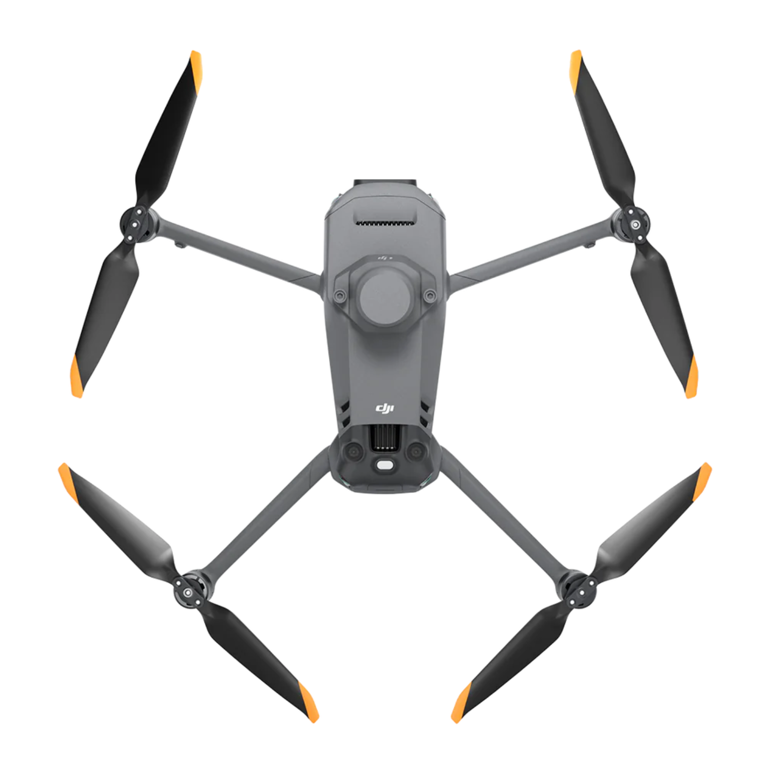
M3M combines visual context, crop reflectance and RTK positioning.
The system's practical strength is synchronized collection. The RGB camera helps the reviewer understand what is physically visible, while the multispectral cameras measure four narrow bands used in vegetation-index workflows.
Review RGB and multispectral layers together.
RGB context can expose tramlines, bare soil, standing water, shadows and visible damage that might otherwise be misread as a vegetation response.
Build consistent boundaries, routes and field records.
RTK positioning helps align data, but repeatability also depends on light, altitude, overlap, camera settings, crop stage, reconstruction and the exact field boundary used.
Useful for relative vegetation-vigour patterns.
NDVI uses red and near-infrared reflectance. It can saturate in dense canopies and should be interpreted with RGB imagery and field observations.
Scouting layerOften useful later in the crop cycle.
Red-edge information may preserve differentiation where red-based indices become less sensitive. Crop-specific interpretation remains essential.
Scouting layerAdd a green-band perspective.
GNDVI can be used in supported workflows, but its relationship to nitrogen status or other variables must be validated for the crop and field.
Scouting layerSupport compensation across changing irradiance.
Keep the sunlight sensor unobstructed. Strongly changing cloud conditions can still reduce comparability and may justify postponing the mission.
Field disciplineMaintain mapping geometry over variable ground.
Use an appropriate terrain source, safe altitude and obstacle plan. Vision sensing is not a substitute for route review or visual line of sight.
Mission planningMap when the data can be compared.
M3M is not waterproof. Avoid rain, rapidly changing shadows and wind that causes severe crop movement or prevents consistent overlap.
Quality gateT50 turns an approved plan into a repeatable field operation.
The aircraft is only one part of the application system. Rate, carrier volume, droplet, swath, speed, height, wind, mixing, agitation, refilling, battery rotation and cleaning determine whether the plan is delivered as intended.
Match flow and droplets to the approved application.
DJI publishes up to 16 L/min with two sprinklers, up to 24 L/min with four and a 50–500 μm droplet range. The product label and calibration determine the usable setting.
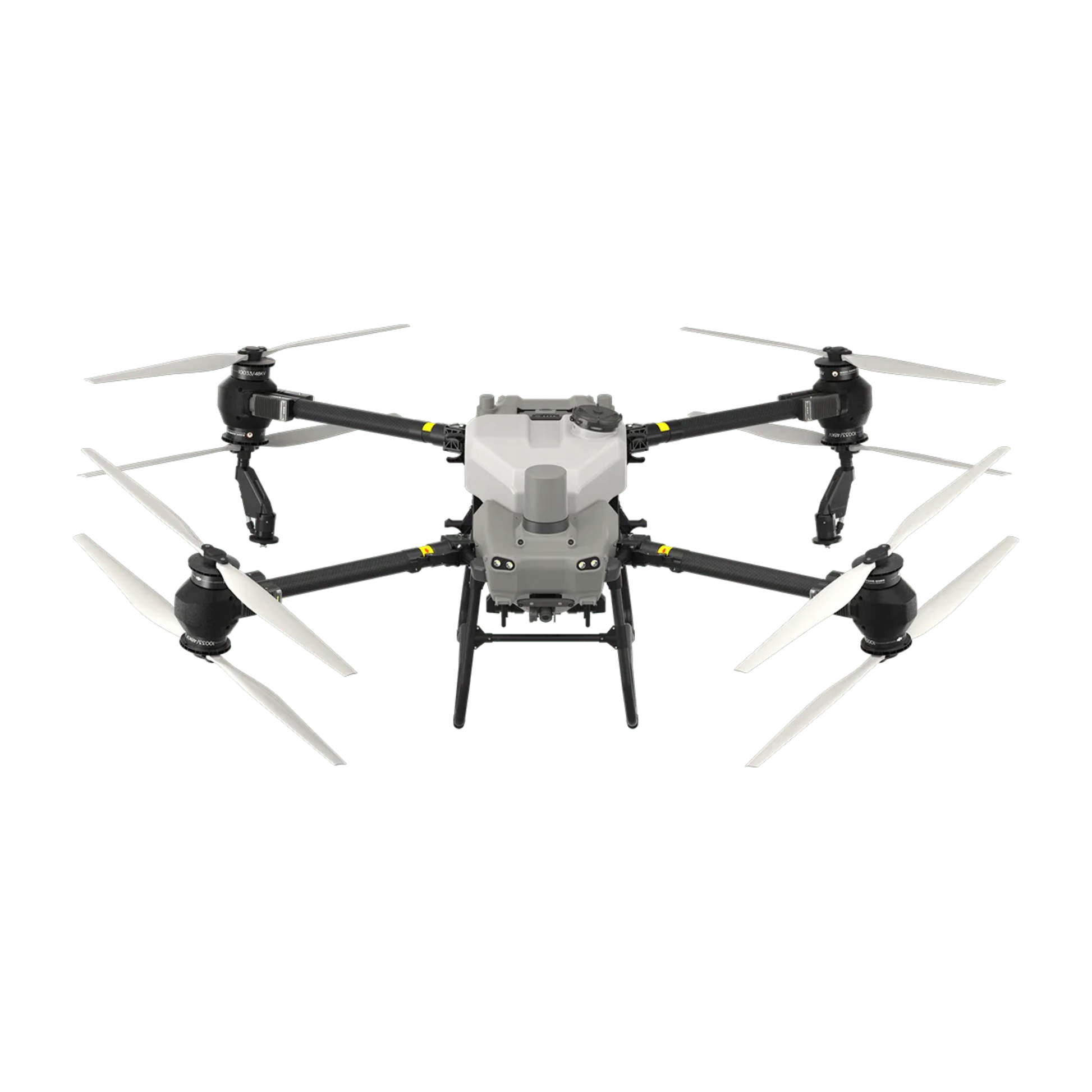
Plan for obstacles rather than relying on automatic bypass.
Radar and binocular vision support terrain following and obstacle sensing, but performance varies with the environment. Power lines, guy wires and thin branches require conservative planning.
Treat selected polygons instead of the entire field.
Potential value comes from avoiding unnecessary passes and material, but only when scouting has identified a treatment-responsive problem and boundaries are operationally reliable.
Targeted applicationChange the approved rate by management zone.
Verify that the selected software and T50 task support the required rate commands, units and range. Always review the controller preview and final task totals.
Compatibility requiredReach areas a ground rig cannot enter.
A drone may protect a weather window and avoid wheel traffic, but launch access, refill logistics, bystander control and wind still constrain the operation.
Access advantageCalibrate for the actual product.
Granule density, size, coating, moisture and bridging behaviour affect flow and spread pattern. A saved setting from another material is not a calibration.
Material testKeep the aircraft supplied without losing control.
Separate pilot, visual observer where required, mixer-loader, battery, refill and record tasks. Health Canada policy may restrict combining pilot and mixer-loader roles for pesticide work.
Crew designClean, inspect and archive the task.
Follow product-label cleanup, manage rinsate legally, inspect pumps and lines, document maintenance and preserve application records.
TraceabilityUse the combined system where sensing changes an operational decision.
The return on M3M plus T50 comes from better timing, more focused scouting, fewer unnecessary passes, access to difficult areas, stronger documentation or a new service workflow. It does not come from adding technology to every field regardless of need.
Prioritize zones for nutrient, disease or emergence checks.
Map the field, sample representative zones, then decide whether the response is targeted application, uniform application, another scouting pass or no action.
M3M firstSeparate patterns from causes.
Use RGB and multispectral layers to direct scouting for drainage, compaction, stand gaps, weed pressure or crop stress before creating any treatment zone.
Scout then decideCombine canopy observation with 3D route planning.
Tree geometry, slopes, wires, posts and sensitive edges make route design critical. Verify orchard-map and Agras-route compatibility for the exact software version.
Route validationAct during a narrow weather window.
M3M can identify or document affected areas; T50 can reach selected zones without driving a heavy ground machine through saturated soil.
Access workflowUse a mapped field with a calibrated spreader.
Confirm seed or granule size, density, label or agronomic rate, spread pattern and emergence verification. Multispectral data may later support outcome review.
Map + spread + verifySell a documented result, not only flight time.
Package field intake, mapping, scouting support, prescription preparation, legal application, logs and post-treatment verification with clear responsibility boundaries.
Service modelBuild the farm workflow before the busy season.
A system that works in a showroom may fail at the field edge when files, power, crew roles, chemical handling, weather limits or records have not been tested. Rehearse with water and a non-production field before relying on the workflow commercially.
Define the decision.
- Crop, stage and field history.
- Question the map must answer.
- Ground-truth protocol.
- Responsible agronomic approver.
Standardize M3M collection.
- Legal altitude and VLOS plan.
- Overlap, speed and sun conditions.
- RTK correction and field boundary.
- Battery reserve and no-rain rule.
Control data quality.
- RGB and spectral reconstruction.
- Cloud, shadow and bare-soil review.
- Index thresholds and zone simplification.
- Scouting evidence attached to zones.
Approve legal rates.
- Product and current label.
- Crop and target pest.
- Carrier volume and buffers.
- Rate units and no-apply polygons.
Test the software handoff.
- Supported file and coordinate system.
- Firmware and region.
- Controller task preview.
- Zone rates and estimated totals.
Design field logistics.
- Mixing, loading and PPE station.
- Battery charging and cooling.
- Clean water, spill and emergency plan.
- Refill route and secure launch area.
Calibrate and monitor.
- Actual swath and flow.
- Droplet or spread pattern.
- Weather and drift controls.
- Task completion and exception handling.
Close the loop.
- Application and flight logs.
- Product, batch and weather.
- Repeat scouting or mapping.
- Post-season workflow review.
Aviation rules and pesticide rules are separate layers.
Legal ownership of M3M or T50 does not authorize every flight or application. The operator must satisfy the aviation category for the aircraft and mission, then separately satisfy pesticide-label, federal policy, provincial or territorial and workplace requirements.
Small M3M and medium T50 follow different operating paths.
- Both aircraft must be registered because they exceed 250 g.
- M3M is a small RPAS; Basic, Advanced or another category depends on where and how it is flown.
- T50 exceeds 25 kg and is a medium RPAS; operations are Advanced or beyond.
- A medium-drone VLOS operation requires the applicable pilot privileges and an aircraft with the necessary RPAS Safety Assurance declaration.
- Controlled airspace, proximity to people, EVLOS, BVLOS, altitude and other conditions can add permissions or change the category.
- Verify the exact aircraft model, declaration and mission in the current Transport Canada portal before operation.
Use the current label, Health Canada policy and provincial rules.
- Health Canada's June 30, 2026 policy permits RPAS use for products already registered for conventional aerial application.
- A product without aerial application on its approved label still needs an approved label amendment for RPAS use.
- Follow aerial directions including crop, pest, rate, minimum spray volume, application interval, buffer zones, PPE and other restrictions.
- Calibrate actual swath, droplet, flow and uniformity rather than assuming a DJI maximum is compliant.
- Check provincial or territorial licensing, permits, certification, notification, records and worker-safety requirements.
- In Quebec, aerial pesticide work by drone may require the relevant C1 or D1 company permit and CD1 personal certificate or supervision.
| Activity | Aviation layer | Pesticide layer | Practical rule |
|---|---|---|---|
| M3M crop mapping | Small-RPAS registration, pilot certificate and mission category | Normally no pesticide application because no product is being dispersed | Respect privacy, land access, airspace, VLOS and data-quality requirements. |
| T50 water-only demo | Medium-RPAS Advanced or beyond; exact safety assurance and operating conditions | No pesticide product, but site and environmental controls still matter | Use water-only demos for training and workflow validation—not as proof of pesticide authorization. |
| T50 pesticide application | Medium-RPAS aviation compliance | Health Canada policy, approved aerial label, province or territory, PPE, calibration and records | All layers must be satisfied before loading the product. |
| T50 granular material | Medium-RPAS aviation compliance | Depends on whether the material is a pesticide, fertilizer, seed or another regulated product | Identify the material and applicable regulation before treating it as a generic spreading job. |
Measure value per field decision—not per drone feature.
A complete budget includes aircraft, batteries, charging, RTK, software, training, insurance, transport, mixing equipment, PPE, water, labour, maintenance, calibration, storage and compliance time. The visible hardware price is only the starting point.
Public SP Basic 1 Year reference.
- Checked July 21, 2026.
- SP Basic 2 Years and SP Plus options were listed separately.
- The live page displayed conflicting availability language.
- Confirm batteries, RTK service, software and delivery in the quote.
- Budget staff time for mapping, reconstruction and scouting.
One public three-battery package reference.
- Checked July 21, 2026.
- Listing specified a new T50 aircraft.
- Listing specified a pre-owned C10000 station and three pre-owned DB1560 batteries with stated cycle range.
- Confirm condition, health reports, warranty, package contents and freight.
- Training, compliance, mixing and site equipment may be additional.
Not a complete deployed-system price.
- Simple sum of the two public references before tax.
- Does not include every battery, charger, generator, RTK service or software need.
- Does not include agronomy, training, insurance, certification, labour or transport.
- Package condition and availability must be confirmed.
- Request a farm-specific bill of materials and financing review.
| Value driver | How to measure it | Common mistake |
|---|---|---|
| Input reduction | Compare approved product or material used against a valid baseline on similar fields | Claiming savings from a lower application total without measuring crop or pest outcome |
| Weather-window access | Track acres completed when ground equipment could not enter or would have caused damage | Ignoring wind, refill or medium-RPAS constraints that may also close the window |
| Soil compaction avoided | Estimate wheel traffic, rutting, crop loss and remediation avoided in the relevant field condition | Using a generic compaction number that is not tied to soil moisture and equipment |
| Scouting efficiency | Measure field area screened and number of productive ground checks generated by M3M | Substituting imagery for field inspection |
| Service revenue | Track margin by mapping, analysis, application, travel, setup and reporting stage | Quoting only per-acre flight time while absorbing compliance and logistics cost |
| Decision quality | Compare treatment timing, avoided mistakes, repeatability and documented outcomes | Measuring success only by hectares flown |
Buy the combined system when you can operate the full loop.
M3M plus T50 is strongest for farms, agronomy teams and service providers that can consistently map, scout, approve, apply and verify. A missing decision process or compliance pathway can turn two capable aircraft into disconnected equipment.
Farm with repeatable crop-monitoring questions.
The team has defined fields, ground scouting, agronomic oversight and enough seasonal use to standardize mapping and application.
Integrated farmCustom operator building a premium service.
The business can sell mapping, prescription support, legal application, documentation and follow-up instead of competing only on flight price.
Service revenueResearch or demonstration program.
The organization can compare treatment zones, preserve control areas and evaluate where multispectral-guided application works or fails.
Evidence programFarm without a confirmed pesticide pathway.
Start with mapping, water-only demonstrations, provincial review and a written operating plan before buying a chemical-application system.
Compliance fit-checkUncertain annual application volume.
Model utilization, crew, travel, charging and maintenance. A demo, rental or service partnership may be more capital-efficient initially.
Utilization reviewTeam expecting one-click diagnosis and prescription.
No multispectral drone removes the need for agronomic interpretation, field inspection, compatible software, calibration or legal application controls.
Process before equipmentMavic 3M and Agras T50 questions answered.
How do DJI Mavic 3M and Agras T50 work together?
DJI Mavic 3M collects synchronized RGB and multispectral imagery for crop scouting and field mapping. The data can be reconstructed and reviewed in supported software, where a qualified user may define management zones or a prescription map. DJI Agras T50 then performs the approved spraying or spreading task. The workflow is not automatic from image to application: agronomic interpretation, file compatibility, rate settings, calibration and regulatory checks are still required.
Does Mavic 3M automatically tell the T50 how much product to apply?
No. Multispectral indices can highlight relative differences in crop reflectance, but they do not automatically identify the cause of stress or create a defensible application rate. A grower, agronomist or other qualified decision-maker should combine imagery with field scouting, crop stage, weather, soil information, product labels and local agronomic guidance before approving any prescription.
Which crop indices can Mavic 3M support?
Mavic 3M captures green, red, red-edge and near-infrared bands and supports workflows involving indices such as NDVI, NDRE and GNDVI. Each index is a scouting layer rather than a diagnosis. Its usefulness depends on crop, growth stage, lighting consistency, calibration, reconstruction quality and ground verification.
Can Mavic 3M data be used for variable-rate spraying or spreading?
It can support a variable-rate workflow when the software, file format, prescription logic, Agras route and material are compatible. The operator must verify zone boundaries, units, rate ranges, no-apply areas, headlands, obstacles, swath settings and the T50 task preview before application. Variable-rate performance also depends on calibration and the physical behaviour of the liquid or granule.
Can Mavic 3M map every Canadian farm in one flight?
No. DJI publishes an up-to-200-hectare single-flight benchmark under stated test conditions. Actual coverage changes with legal altitude, overlap, terrain, field shape, battery reserve, wind, image settings and line-of-sight requirements. Canadian mission planning should be based on the real field and operating category, not the maximum marketing figure.
What are the main T50 spraying and spreading specifications?
DJI publishes a 40-litre spray tank, 40-kilogram spraying payload, 16 litres per minute with the standard two-sprinkler system, up to 24 litres per minute with four sprinklers, and a 50 to 500 micrometre droplet range. For spreading, DJI publishes a 75-litre hopper, 50-kilogram payload and up to 108 kilograms per minute under stated conditions. These are manufacturer references, not guaranteed field outputs.
Do I need a pilot certificate to operate Mavic 3M and T50 in Canada?
Yes. Mavic 3M is over 250 grams and must be registered, and its pilot needs the certificate and operating privileges required for the mission. T50 is a medium drone because it exceeds 25 kilograms in operating configuration. Medium-drone operations are Advanced or beyond and require the applicable pilot, aircraft safety-assurance and operating conditions. Verify the exact aircraft declaration and mission in Transport Canada's Drone Management Portal before flying.
Can T50 apply pesticides in Canada in 2026?
Health Canada's policy published June 30, 2026 allows RPAS application of pest control products already registered for conventional aerial application, provided the aerial label directions and the policy are followed. Products without aerial application on the approved label still require an approved label amendment. Federal aviation rules, provincial or territorial pesticide requirements, PPE, crew-role restrictions, calibration, buffers and recordkeeping also apply.
Is a water-only T50 demonstration the same as pesticide spraying?
No. A water-only demonstration avoids the pesticide-product and label questions associated with a chemical application, but it remains a medium-drone flight. Registration, pilot privileges, aircraft safety assurance, airspace, site control, bystander separation, emergency planning and any local permissions still need to be addressed. Do not represent a water demo as authorization for pesticide work.
Can Mavic 3M fly in rain?
DJI states that Mavic 3M is not waterproof. Do not plan mapping missions in rain or conditions that may wet the aircraft. Wet leaves, changing cloud cover, wind and low light can also reduce comparability between mapping dates, even when the aircraft itself remains dry.
How should a farm verify whether the prescription worked?
Record the approved prescription, task file, product, lot, carrier volume, calibration, weather, crew, refill events and completed flight logs. Then revisit representative zones using field scouting and, when appropriate, a repeat Mavic 3M mission under comparable conditions. Compare the response with untreated or differently treated areas while recognizing that weather and crop development may also affect the result.
How much do Mavic 3M and Agras T50 cost in Canada?
Public SpeedyDrone references checked July 21, 2026 listed Mavic 3 Multispectral SP Basic 1 Year at CAD 6,245 and a T50 Pro Package with a new aircraft plus specified pre-owned charging equipment and batteries at CAD 29,999. Package condition, service plan, software, RTK service, training, pesticide equipment, freight, tax and availability must be confirmed in a written quote.
Verify current specs, labels, rules and package contents.
Send the crop, acres, material, rate and operating province.
Include the farm location, crop, field size, terrain, scouting goal, intended liquid or granular material, carrier volume, application rate, annual acres, crew, current certifications, existing equipment and financing preference. SpeedyDrone can prepare an M3M + T50 farm fit-check, package quote, compliance pathway, training plan, water-only demonstration or financing review.


