


Mining and Quarry Mapping: Matrice 4E vs Matrice 400 with Zenmuse L3
Matrice 4E turns overlapping photographs into detailed surface models. Matrice 400 with Zenmuse L3 directly measures LiDAR returns while collecting high-resolution RGB data. Both can support stockpiles, pits, haul roads and reclamation—but the better investment depends on terrain, vegetation, site scale, accepted deliverables, operating frequency and the cost of mobilizing the wrong tool.
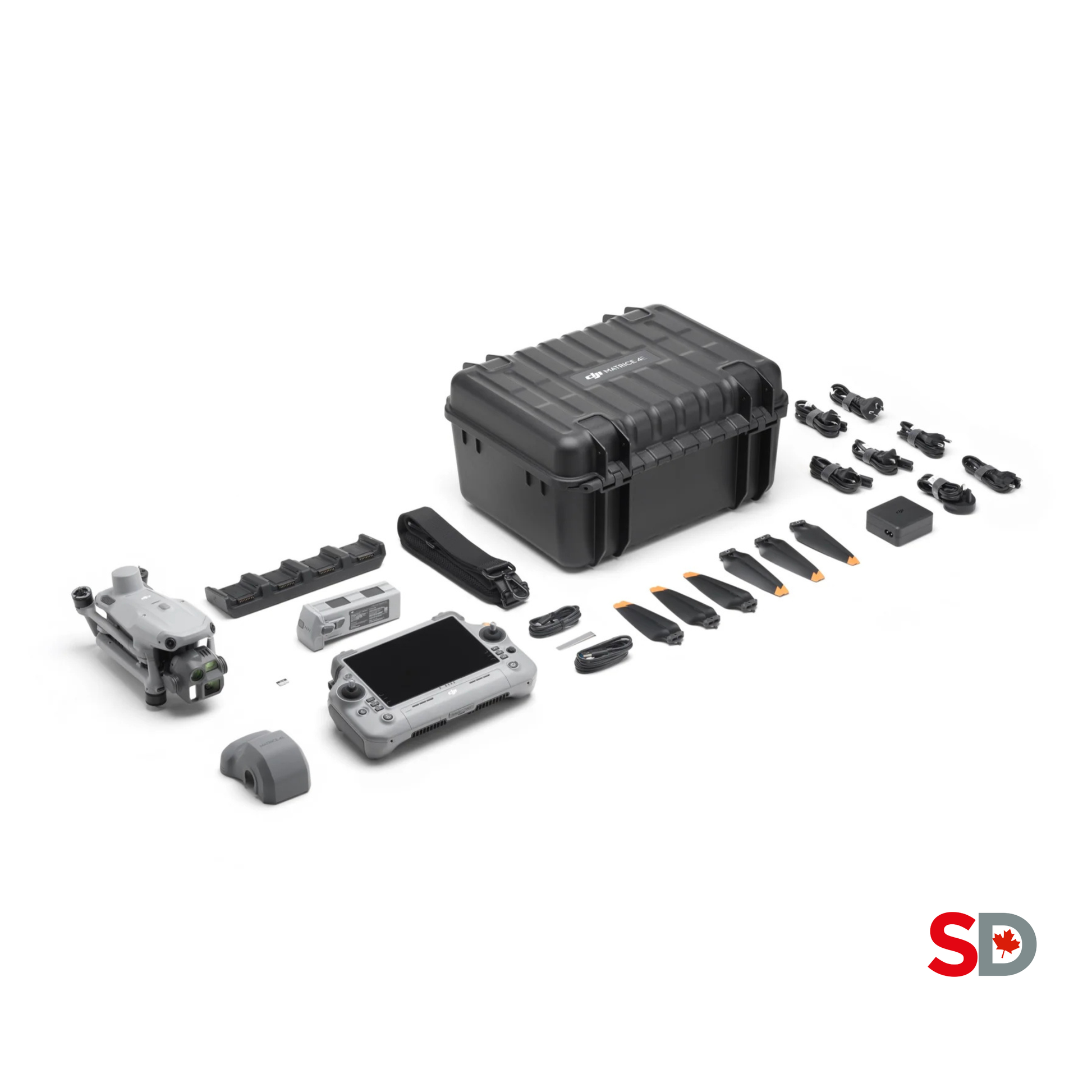
Matrice 4E
Portable RGB mapping for exposed surfaces, repeat surveys and stockpile workflows.


Matrice 400 + L3
High-output LiDAR for complex terrain, vegetation, corridors and premium point clouds.
Use Matrice 4E for routine surfaces. Use L3 when geometry or ground recovery changes the job.
Matrice 4E is the practical default for exposed stockpiles, open pits, quarry faces, progress mapping and recurring volume work. Matrice 400 with Zenmuse L3 earns its premium when vegetation, long corridors, complex highwalls, difficult texture, large-area production or LiDAR-specific deliverables make photogrammetry less reliable or more labour-intensive.
Portable photogrammetry for frequent mine and quarry mapping.
- Exposed stockpiles and aggregate yards.
- Routine pit, bench and haul-road updates.
- Orthomosaics, textured meshes and visible progress records.
- Small crews moving between multiple sites.
- Lower capital and mobilization burden.
LiDAR production for difficult surfaces and larger programs.
- Vegetated or partially obscured terrain.
- Complex highwalls, corridors and reclamation surfaces.
- Dense classified point-cloud deliverables.
- Large sites where range and coverage improve production.
- Organizations with recurring LiDAR demand and processing capability.
Build a tiered acquisition program instead of forcing one sensor onto every site.
- Use Matrice 4E for routine monthly or weekly updates.
- Deploy L3 for seasonal terrain, vegetation or highwall campaigns.
- Keep one coordinate, control and QA system across both.
- Define which deliverable is authoritative for each task.
- Compare total production cost, not only hardware price.
The flight should end in an operational decision—not a folder of images.
A geospatial program creates value when survey, production, geology, operations, finance and management receive the right output at the right interval. Define the accepted surface, coordinate reference and QA threshold before collection.
Stockpile volume register
Individual pile boundaries, base surfaces, cut or fill volume, material ID, capture date and confidence notes.
Pit and bench model
Current geometry for planning, progress review, crest and toe interpretation, access and operational context.
Highwall point cloud
Dense spatial data for geotechnical review, change detection and specialist analysis by the responsible professional.
Haul-road surface
Profiles, cross-sections, grade review, drainage context, berm visibility and maintenance prioritization.
Orthomosaic and inspection map
Georeferenced visual evidence for infrastructure, stockyards, processing areas, water management and change review.
Reclamation terrain model
Surface evolution, drainage, vegetation context, earthwork quantities and documented progress against the approved plan.
Two very different production models.
Matrice 4E integrates the mapping camera into a compact aircraft. Matrice 400 is a heavy-duty enterprise platform, while Zenmuse L3 supplies the LiDAR, dual RGB cameras and position-orientation system. The second option is a system investment, not a simple camera upgrade.
DJI Matrice 4E
A 1,219 g aircraft with a 20 MP 4/3 wide camera, mechanical shutter, 0.5-second minimum image interval, RTK and up to 49 minutes of controlled-test flight time. DJI positions it for surveying, construction and mining.
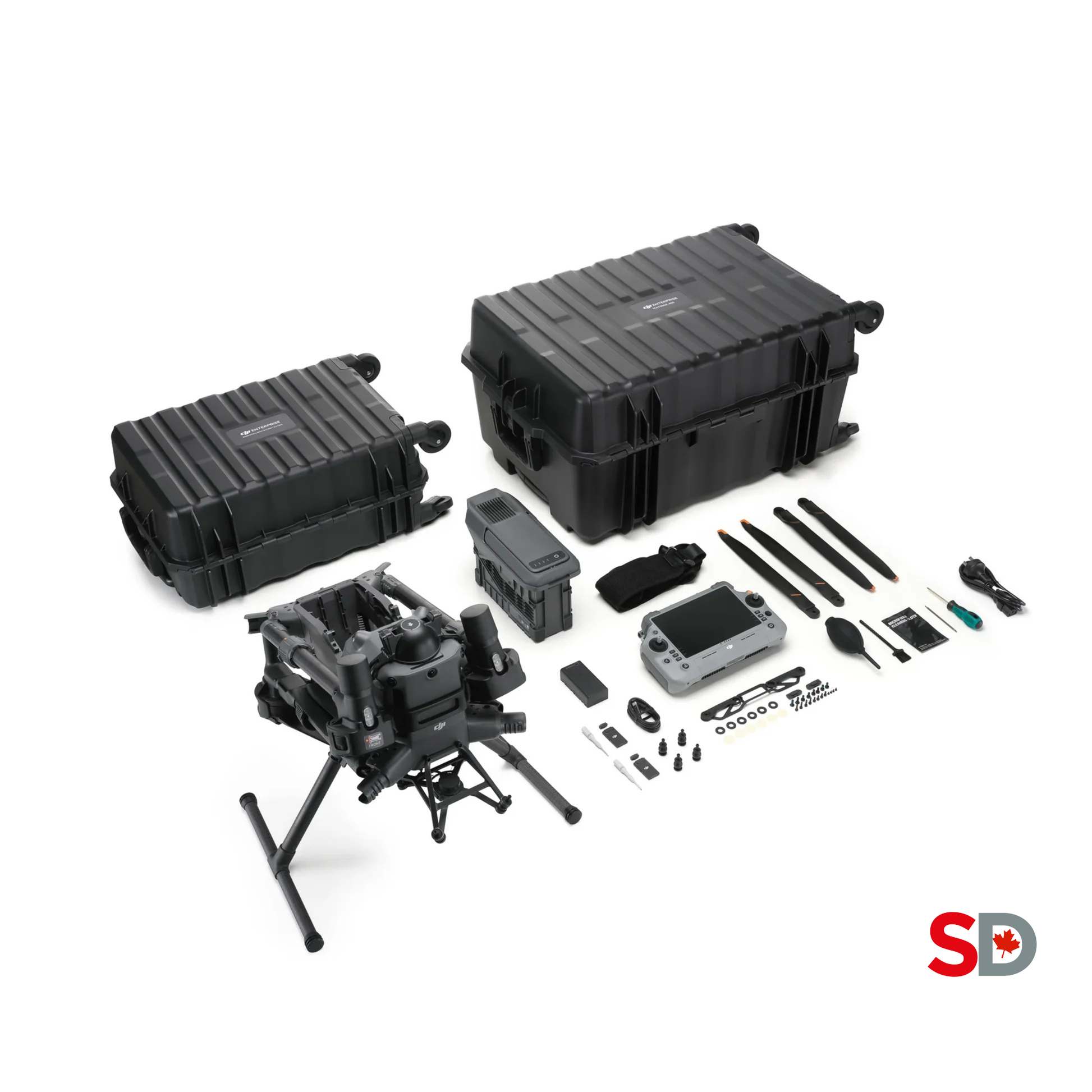
DJI Matrice 400
A 15.8 kg maximum-takeoff-weight platform with up to 59 minutes of controlled-test flight time, IP55 protection, a published 6 kg maximum payload and real-time terrain-following support. Zenmuse L3 requires its dedicated single-gimbal connector.
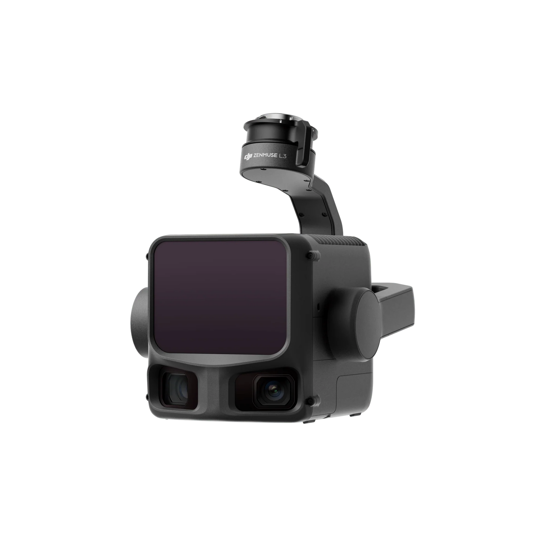
DJI Zenmuse L3
A 1.60 kg payload with 1535 nm LiDAR, pulse settings from 100 to 2,000 kHz, up to 16 returns in supported modes, dual 100 MP RGB mapping cameras, a 107-degree combined horizontal field of view and an integrated POS workflow.
Compare what changes the mine-site result.
The most important difference is measurement method. Matrice 4E relies on visible feature matching across overlapping images. L3 records laser ranges and can colourize the resulting point cloud with its RGB cameras.
| Decision factor | Matrice 4E | Matrice 400 + Zenmuse L3 | Mining implication |
|---|---|---|---|
| Measurement method | RGB photogrammetry from overlapping images | 1535 nm LiDAR plus dual RGB mapping cameras | Photogrammetry is image-dependent; LiDAR directly measures range returns. |
| Primary mapping camera | 20 MP 4/3 CMOS wide camera, 24 mm equivalent, f/2.8-f/11 | Two 100 MP or 25 MP 4/3 RGB mapping cameras, 28 mm equivalent | Both can produce visual mapping outputs; L3 combines RGB with LiDAR acquisition. |
| Shutter and interval | Mechanical shutter up to 1/2000 s; 0.5 s minimum JPEG interval | Mechanical shutter up to 1/2000 s; 0.5 s at 25 MP or 1 s at 100 MP JPEG | Fast capture supports efficient flight lines, subject to lighting and mission settings. |
| Aircraft takeoff weight | 1,219 g standard takeoff weight | Matrice 400 maximum takeoff weight: 15.8 kg | Matrice 4E is easier to carry and launch; M400 requires larger transport, staging and crew planning. |
| Published flight time | Up to 49 minutes without wind using standard propellers | Up to 59 minutes forward flight under DJI test conditions | Reserve, payload, wind, cold, altitude, route and battery health reduce usable mission time. |
| Environmental protection | No standard ingress-protection level | Matrice 400 IP55; L3 IP54 | The larger system has published protection, but safe weather limits and maintenance still apply. |
| Operating temperature | -10°C to 40°C | Matrice 400 and L3: -20°C to 50°C | L3 platform has a wider published range; Canadian cold still affects batteries and field procedures. |
| Terrain and vegetation | Best on visible, textured and exposed surfaces | Multiple returns can recover some lower vegetation and ground through canopy gaps | LiDAR has an advantage where image matching or ground visibility is limited. |
| L3 pulse and returns | Not applicable | 100, 350, 1,000 or 2,000 kHz; up to 16 returns at supported rates | Settings trade range, density and return count; they must be selected from the deliverable. |
| Published L3 system accuracy | No universal final-model accuracy; validate each workflow | At 120 m: 3 cm vertical and 4 cm horizontal RMSE under DJI test conditions | Manufacturer values are capability references, not substitutes for independent checkpoints. |
| RTK positioning | RTK fix specification: 1 cm + 1 ppm horizontal; 1.5 cm + 1 ppm vertical | L3 POS RTK fix specification: 1.0 cm + 1 ppm horizontal; 1.5 cm + 1 ppm vertical | Positioning specifications do not equal final surface accuracy. |
| Primary outputs | Orthomosaic, textured mesh, dense image point cloud, DSM and volumes | LiDAR point cloud, classified ground, DTM, DEM, RGB outputs and combined deliverables | Choose from the client's accepted format and downstream mine-planning system. |
| Best operational fit | Frequent portable mapping and exposed stockpile work | Large, complex, vegetated or LiDAR-specific production | Utilization determines return on investment. |
| Public SpeedyDrone reference | CAD 6,229 checked July 21, 2026 | M400 full package CAD 14,099 plus L3 CAD 20,225 | Final systems require batteries, connector, RTK, software, training and support planning. |
The sensor should match the surface—not the marketing claim.
Quarry faces, crushed aggregate, dark rock, wet surfaces, vegetation, snow, water, dust and steep geometry challenge sensors in different ways. Evaluate the hardest part of the site, not only the clean demonstration area.
Excellent visual detail on exposed, textured surfaces.
- Strong orthomosaics and textured 3D models.
- Efficient recurring stockpile and progress mapping.
- Low mobilization burden for multi-site crews.
- Needs overlap, sharp images and visible feature matching.
- Can struggle with water, uniform snow, glare, dust and occlusion.
Direct ranges for geometry and partial vegetation penetration.
- Multiple returns support ground-recovery workflows.
- Less dependent on visible texture than photogrammetry.
- Useful for highwalls, corridors and complex terrain.
- Requires pulse, scan, overlap and density planning.
- Classification and point-cloud QA require specialized skill.
Use RGB for communication and LiDAR for difficult geometry.
- Maintain a routine Matrice 4E update cycle.
- Schedule L3 campaigns for leaf-off terrain or annual baselines.
- Use one control network and coordinate standard.
- Keep sensor-specific QA and acceptance thresholds.
- Avoid mixing surfaces without documenting methodology.
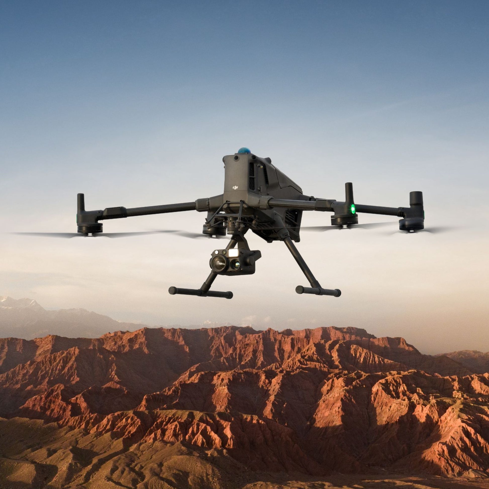
Endurance and terrain support for demanding sites.
Matrice 400 is built around a larger field operation: heavier cases, battery-station logistics, dedicated payload setup, larger launch space and a stronger need for documented crew procedures.

Penetration and daily coverage are condition-dependent.
DJI's productivity figures are controlled references. Canadian mine estimates must be recalculated for the 122 m routine altitude limit, terrain, VLOS, point density, overlap, weather and battery rotation.
Use the least complex system that reliably meets the acceptance standard.
The same operation may use Matrice 4E for weekly production maps and L3 for quarterly highwall, vegetation or reclamation campaigns. Standardize control and delivery even when sensors change.
Matrice 4E first.
Fast deployment, strong surface detail and efficient volume processing make photogrammetry the practical default for clean, visible piles.
Best first choice: M4EConsider L3.
Multiple LiDAR returns can improve lower-surface recovery, but pile limits and base surfaces still need human review.
Best fit: L3Match frequency and scale.
M4E fits frequent portable updates. L3 fits broader or more complex production when dense geometry and terrain coverage justify it.
M4E or L3Texture decides the sensor.
Use repeatable oblique M4E imagery on visible textured rock. Use L3 when range geometry, texture or vegetation weakens image matching.
L3 advantageMap the surface and operational context.
M4E can support routine road updates. L3 is stronger for longer corridors, complex terrain and ground-classification workflows.
Scale dependentModel visible terrain, not water depth.
Both systems can support surrounding terrain and drainage context. Neither directly maps submerged ground through opaque or reflective water.
Know the limitationSupport planning and records.
Drone surfaces can document pre- and post-blast geometry, but do not replace blast design, clearance, vibration monitoring or professional sign-off.
Operational supportL3 for ground; RGB for visible condition.
LiDAR can improve terrain recovery under partial cover, while RGB supports visible vegetation and progress communication.
Hybrid valuePut professional responsibility first.
Drone data supports measurement. It does not independently establish legal boundaries, certify geotechnical stability or replace the responsible surveyor or engineer.
Licensed oversightDesign around terrain, traffic, dust, blasts and the final surface.
A technically correct route can still be operationally unsafe or unusable. Integrate the drone crew with site dispatch, survey control, production scheduling, blasting, heavy-equipment movement and emergency procedures.
Define the accepted output.
Set the volume method, point density or GSD, surface type, coordinate system, vertical datum, file format and accuracy threshold.
Segment the site.
Separate stockyards, active pit, highwalls, plant, haul roads, water, reclamation and no-fly or restricted areas.
Coordinate site control.
Confirm dispatch contact, radio channel, blast schedule, loading zones, traffic, launch area, emergency process and stop-work authority.
Plan terrain and geometry.
Use terrain following where supported, account for pit depth and relief, protect line-of-sight and add oblique or cross-flight geometry where needed.
Set sensor parameters.
For RGB, set GSD, overlap, shutter and exposure. For L3, set altitude, speed, pulse rate, returns, scan mode, overlap and calibration.
Control the reference.
Verify RTK or PPK source, base coordinates, control marks, independent checkpoints, coordinate transformation and geoid model.
Inspect before leaving.
Review route completion, image sharpness, exposure, LiDAR coverage, RTK status, point-cloud gaps, control visibility and unexpected activity.
Process and validate.
Apply controlled settings, classify surfaces, compare checkpoints, document exclusions and publish the approved deliverable.
Do not copy a route from another mine and expect the same result.
Rock texture, relief, wall angle, vegetation, reflectivity, required density, weather and final model type change the mission. Test the workflow on representative terrain before committing to production quantities.
| Planning variable | Matrice 4E photogrammetry | Zenmuse L3 LiDAR | Quality-control question |
|---|---|---|---|
| Altitude | Set from target GSD, relief, obstacles and legal limit. | Set from point density, spot size, range, pulse mode and relief. | Does the entire surface meet the required detail at the highest and lowest terrain? |
| Speed | Keep shutter speed and image interval sufficient for sharp overlap. | Balance point spacing, route length, range and battery reserve. | Are motion, dust and wind degrading the data? |
| Overlap | Increase for steep terrain, walls, uniform rock and complex geometry. | Set for density, strip alignment and ground coverage; DJI benchmarks may use lower side overlap. | Are there gaps, weak edges or strip inconsistencies? |
| Camera or scan angle | Add oblique capture for faces, benches and vertical surfaces. | Select linear, star-shaped or non-repetitive scanning from the task. | Does the sensor actually see the surface without occlusion? |
| Lighting | Avoid severe glare, deep moving shadows and poor exposure. | LiDAR is less dependent on visual texture, but RGB colourization and range still depend on conditions. | Will the visible and measured surfaces be consistent enough for processing? |
| Vegetation | Image model normally represents the visible canopy surface. | Some returns may reach lower vegetation or ground through canopy gaps. | Is the deliverable canopy, terrain or both? |
| Snow and water | Uniform snow weakens texture; water is reflective and dynamic. | LiDAR measures the visible snow or water surface and may have weak or missing returns. | Is this the surface the client intends to measure? |
| Control | Use stable, visible marks and independent checkpoints. | Use exposed hard-surface checkpoints and verify strip alignment and classification. | Is the quality test independent from the adjustment process? |
Convert field data into surfaces the mine can audit and reuse.
DJI Terra supports visible-light reconstruction and DJI LiDAR processing. Final mining workflows may continue in mine-planning, CAD, GIS, point-cloud, geotechnical or inventory systems. Preserve raw data and document every transformation.
Mission planning and acquisition.
Build area, linear, terrain-following and payload-specific routes; record mission settings and field status.
Corrections, base and rover workflows.
Support RTK or PPK positioning and collect control or checkpoints when the project method allows.
RGB and LiDAR reconstruction.
Process 2D maps, 3D models, point clouds, terrain products and quality information using controlled settings.
Operational production.
Create surfaces, contours, profiles, volumes, designs, reconciliations and reports in the accepted downstream environment.
Preserve the evidence chain.
Retain raw observations, images, LiDAR files, base data, control, processing reports, versions and approved exports.
Deliver context without losing control.
Use permissioned web or desktop viewers for measurements, annotations and review while protecting sensitive site data.

LiDAR, RGB and POS data must remain synchronized.
Use supported storage, calibration, RTK or PPK and Terra workflows, then validate the result against independent checkpoints.

Long detection range does not remove density and accuracy planning.
Reflectivity, incidence angle, atmosphere, pulse rate, surface size and flight geometry affect usable range and point distribution.
A volume is only as defensible as its boundary, base and reference.
Centimetre positioning claims do not define a final stockpile volume or pit surface. The QA plan must test reference, geometry, completeness, classification, pile delineation and the accepted calculation method.
Document every reference.
Record horizontal CRS, vertical datum, geoid, units, site localization and any transformation into mine coordinates.
Do not initialize from an unknown point.
Verify the RTK or PPK source, antenna setup, observation quality, correction age and base coordinate provenance.
Test rather than assume.
Keep checkpoints separate from control and distribute them across elevation, surface type and project extent.
Define what belongs to the pile.
Review toes, merged piles, retaining structures, vegetation, equipment, conveyors and material spill areas.
The hidden surface changes the answer.
Use an accepted ground model, prior empty-pad survey, design surface or documented interpolation—not an arbitrary flat plane.
Review ground and non-ground labels.
Automatic classes can mislabel benches, berms, conveyors, vegetation and steep faces. Inspect before surface generation.
Hold the method steady.
Use controlled routes, dates, processing settings, naming and reporting so production changes are not confused with method changes.
State limitations and exclusions.
Report checkpoints, residuals, gaps, water, snow, vegetation, shadows, dust, manual edits and surfaces that should not be used.
Both systems are small drones, but the mission category still changes.
Matrice 4E and the published Matrice 400 configuration fall within Transport Canada's small-drone category. Registration, pilot certification, airspace, distance from people, VLOS or EVLOS, altitude and aircraft safety assurance must be resolved for the actual operation.
| Canadian issue | Planning requirement | Mining and quarry implication |
|---|---|---|
| Weight category | Small drones are at least 250 g but not more than 25 kg. | M4E and M400 require registration and the applicable pilot certificate. |
| Basic operation | Every Basic condition must be met, including uncontrolled airspace and distance from uninvolved people. | A remote quarry may qualify, but site workers, roads, aerodromes and airspace must still be assessed. |
| Advanced operation | Required for controlled airspace or applicable closer-to-people privileges, with the correct certificate, aircraft declaration and permissions. | Verify the current RPAS Safety Assurance Declaration for the exact aircraft and privilege. |
| VLOS and pit geometry | The pilot must maintain the visual relationship required by the operation category. | Highwalls, benches and deep pits can obstruct the aircraft; repositioning or visual observers may be necessary. |
| EVLOS | Advanced privileges may support eligible extended visual line-of-sight operations under current limits and conditions. | Useful for corridors or large sites only when the operation satisfies the certificate, observer, airspace and distance rules. |
| Lower-risk BVLOS | Level 1 Complex operations require the applicable pilot certificate, RPOC, aircraft eligibility and operating conditions. | Do not assume a large remote mine automatically qualifies for BVLOS. |
| Altitude | Routine categories are generally limited to 122 m or 400 ft AGL. | L3 benchmarks at 300 m or higher require a different Canadian authorization pathway. |
| Special operations | An SFOC-RPAS is required when flying beyond Basic, Advanced or Level 1 Complex rules, including above 122 m. | Build approval time, fees and operating conditions into the production estimate. |
| Site rules | Aviation compliance does not replace workplace, trespass, privacy, blasting or site-safety obligations. | Integrate the RPAS procedure with the mine's approved management system. |
Matrice 4E is a mapping purchase. L3 is a production-system investment.
Public SpeedyDrone references were checked July 21, 2026. Final quotes should confirm stock, Care coverage, connector, batteries, charging, RTK, software, training, tax, freight and the accepted processing workflow.
Portable mapping entry point.
- Integrated 20 MP 4/3 mapping camera.
- Mechanical shutter and RTK support.
- Lower transport and field-crew burden.
- Add batteries, charging, RTK, software, control and training.
- Strong fit for recurring exposed-surface mapping.
Enterprise aircraft foundation.
- Public package lists aircraft, RC Plus 2 Enterprise Enhanced, Care Plus, BS100 and one TB100 battery.
- Zenmuse L3 is not included.
- Confirm the dedicated L3 gimbal connector.
- Plan additional TB100 batteries for production rotation.
- Larger cases, transport and launch area required.
Premium LiDAR payload.
- Matrice 400 only.
- Dedicated single-gimbal connector required.
- Budget D-RTK 3 and DJI Terra.
- Plan point-cloud workstations, storage and classification.
- Best justified by recurring LiDAR production.
| System item | Public reference checked July 21, 2026 | Ownership impact |
|---|---|---|
| Matrice 4E | CA$6,229 | Core portable photogrammetry platform; confirm battery count and package contents. |
| Matrice 400 SP Plus Full Package | CA$14,099 | Includes one TB100 and BS100 in the public listing; production fleets normally require more battery capacity. |
| Zenmuse L3 | CA$20,225 | Payload only; dedicated connector required. |
| M400 full package + L3 | CA$34,324 before connector and additions | Core platform and payload arithmetic only, not a complete deployed system. |
| TB100 battery | CA$1,945 each; three-pack CA$5,835 | Battery rotation, temperature management and charging throughput affect daily production. |
| D-RTK 3 Multifunctional Station | CA$2,205 | Supports base, correction and rover workflows; pole and tripod may be separate. |
| DJI Terra Standard | CA$2,325 perpetual public reference | Confirm that the selected edition supports the required reconstruction and LiDAR workflow. |
| DJI Terra Flagship | CA$4,645 perpetual public reference | Advanced processing option; verify current features and licence terms. |
| Training and workflow commissioning | Quote based | Mission templates, control, QA, software and site procedures determine whether the equipment produces useful data. |
Buy the system that changes production economics—not the one with the longest specification sheet.
Matrice 4E wins when frequency, portability and visual surface mapping create the value. Matrice 400 with L3 wins when LiDAR-specific capability, terrain, vegetation, stand-off, density or project scale materially changes the accepted result.
Start with Matrice 4E.
Build a repeatable stockpile, orthomosaic and progress workflow before investing in LiDAR.
Recommended: M4EPrioritize mobilization speed.
M4E can move between sites quickly. Add L3 as a shared specialist asset when demand is established.
M4E + specialist L3Evaluate a tiered fleet.
Use M4E for frequent operational updates and L3 for broader terrain, highwall, corridor or vegetation campaigns.
Hybrid fleetLiDAR can change the usable ground model.
Test L3 on representative vegetation and seasonality before committing to density and accuracy targets.
Recommended: L3 testDemonstrate or subcontract first.
Process sample data, rent or partner on initial projects before carrying the full platform cost.
Assessment firstChoose with the responsible professional.
Control, evidence, acceptance, validation and legal responsibility should drive sensor and software selection.
Professional oversightProve one representative site before scaling.
Week 1: define deliverables, control, site procedures and acceptance.
Week 2: collect a Matrice 4E photogrammetry baseline.
Week 3: collect L3 sample data on the difficult terrain.
Week 4: compare accuracy, completeness, field time, processing time and cost per accepted output.
Matrice 4E and Zenmuse L3 questions answered.
What is the main difference between Matrice 4E and Matrice 400 with Zenmuse L3 for mining?
Matrice 4E is a compact photogrammetry platform built around a 20 MP 4/3 camera, mechanical shutter, RTK and rapid image capture. Matrice 400 with Zenmuse L3 is a larger LiDAR system that directly measures laser returns while also collecting RGB imagery. Matrice 4E is usually the more efficient choice for routine exposed-surface mapping, while the L3 system is better suited to vegetation, complex highwalls, large corridors and projects that require dense LiDAR point clouds.
Which system is better for stockpile volume measurement?
For exposed, well-textured stockpiles, Matrice 4E photogrammetry is often the practical first choice because it is portable, fast to deploy and produces detailed surface models. Matrice 400 with L3 becomes more valuable when stockpiles have difficult texture, partial vegetation, complex occlusion, broad site coverage or a wider LiDAR production requirement. Both workflows require clear pile boundaries, a defensible base surface and independent quality checks.
When is Zenmuse L3 worth the additional investment?
L3 is easier to justify when a mining team repeatedly maps vegetated ground, steep or complex pit geometry, long haul-road or corridor networks, reclamation terrain, highwalls or large sites where LiDAR density and penetration reduce field or processing risk. It is not automatically the better purchase for every quarry. Annual project volume, accepted deliverables, crew capability and utilization should support the larger platform.
Can Zenmuse L3 see through vegetation?
L3 does not see through solid vegetation. Some laser pulses pass through gaps in leaves and branches and return from lower vegetation or the ground. Ground-return completeness depends on canopy density, season, scan mode, pulse rate, altitude, overlap, flight direction, surface reflectivity and processing. Leaf-off conditions may improve ground recovery in many Canadian environments.
Can Matrice 4E produce survey-grade mining data?
Matrice 4E can support high-accuracy mapping when the mission, RTK or PPK source, coordinate reference, control, checkpoints and processing are designed correctly. The aircraft's RTK specification is not a guarantee of final model accuracy. The accepted standard must be validated with independent checkpoints and the professional responsible for the final survey or engineering deliverable.
Which platform is better for pit walls and highwalls?
Matrice 4E can create detailed highwall models with well-planned oblique image capture and adequate visible texture. L3 directly measures range and can be more robust where geometry, lighting, texture, vegetation or stand-off distance make image matching difficult. Neither system removes occlusion, line-of-sight, geotechnical interpretation or site-safety requirements.
Can a drone fly during loading, hauling or blasting operations?
The drone mission must be coordinated with the mine or quarry's site-control procedures. Establish an approved launch zone, radio or dispatch contact, traffic separation, blast schedule, exclusion areas and an immediate abort process. Do not treat the drone flight as independent from active equipment, blast clearance or site emergency rules.
What Canadian drone certificate is required for these systems?
Both Matrice 4E and Matrice 400 are small drones when operated at no more than 25 kg. At minimum, the pilot needs the certificate applicable to the operation and the aircraft must be registered and marked. Basic operations require every Basic condition to be met. Controlled airspace, closer-to-people operations and other Advanced privileges require the applicable Advanced certificate, aircraft declaration and permissions.
Is Matrice 400 a medium drone in Canada?
No, not in its published configuration. Transport Canada defines a small drone as weighing at least 250 g but not more than 25 kg. DJI publishes a Matrice 400 maximum takeoff weight of 15.8 kg, so it remains in the small-drone weight category. The actual operation still depends on configuration, airspace, distance from people and the privileges being used.
Can the L3 300 metre productivity benchmark be used for a normal Canadian quarry mission?
Not automatically. Routine Basic, Advanced and Level 1 Complex operations are generally limited to 122 m or 400 ft above ground level. Operations above 122 m require an SFOC-RPAS. Canadian production estimates should be recalculated for legal altitude, pit geometry, line-of-sight, airspace, point density, overlap, weather, battery logistics and control requirements.
What software and deliverables are used for mining and quarry mapping?
DJI Pilot 2 is used for mission planning and acquisition, while DJI Terra can process visible-light imagery and L3 LiDAR. Common outputs include orthomosaics, textured 3D models, point clouds, DSMs, DTMs, contours, stockpile volumes, cut-and-fill surfaces, haul-road profiles, highwall models and QA reports. CAD, GIS, mine-planning or specialist point-cloud software may be required for final production.
How much do the two mining mapping systems cost in Canada?
Public SpeedyDrone prices checked July 21, 2026 listed Matrice 4E at CAD 6,229, the Matrice 400 SP Plus Full Package at CAD 14,099 and Zenmuse L3 at CAD 20,225. The Matrice 400 package and L3 therefore total CAD 34,324 before the L3 connector, additional batteries, D-RTK 3, DJI Terra, training, tax and other deployment costs. Prices, stock, care plans and package contents can change.
Verify specifications, rules, declarations and package contents.
Send the site, terrain, output and annual mapping volume.
Include the province, mine or quarry type, project area, pit depth and relief, vegetation, stockpile count, required outputs, accepted accuracy, coordinate system, survey-control method, capture frequency, existing software, pilot category and preferred deployment timeline. SpeedyDrone can prepare a Matrice 4E or Matrice 400 with Zenmuse L3 assessment, Canadian quote, demonstration, financing review, training pathway and workflow plan.


