


Construction Progress Monitoring with Drones: From Weekly Flights to Shareable 3D Models
A drone can photograph an entire jobsite in one visit, but a useful progress program depends on what happens every week: repeat the mission, hold the coordinate system, validate the data, process consistent outputs, compare against prior dates and publish a version that project teams can actually open and understand.
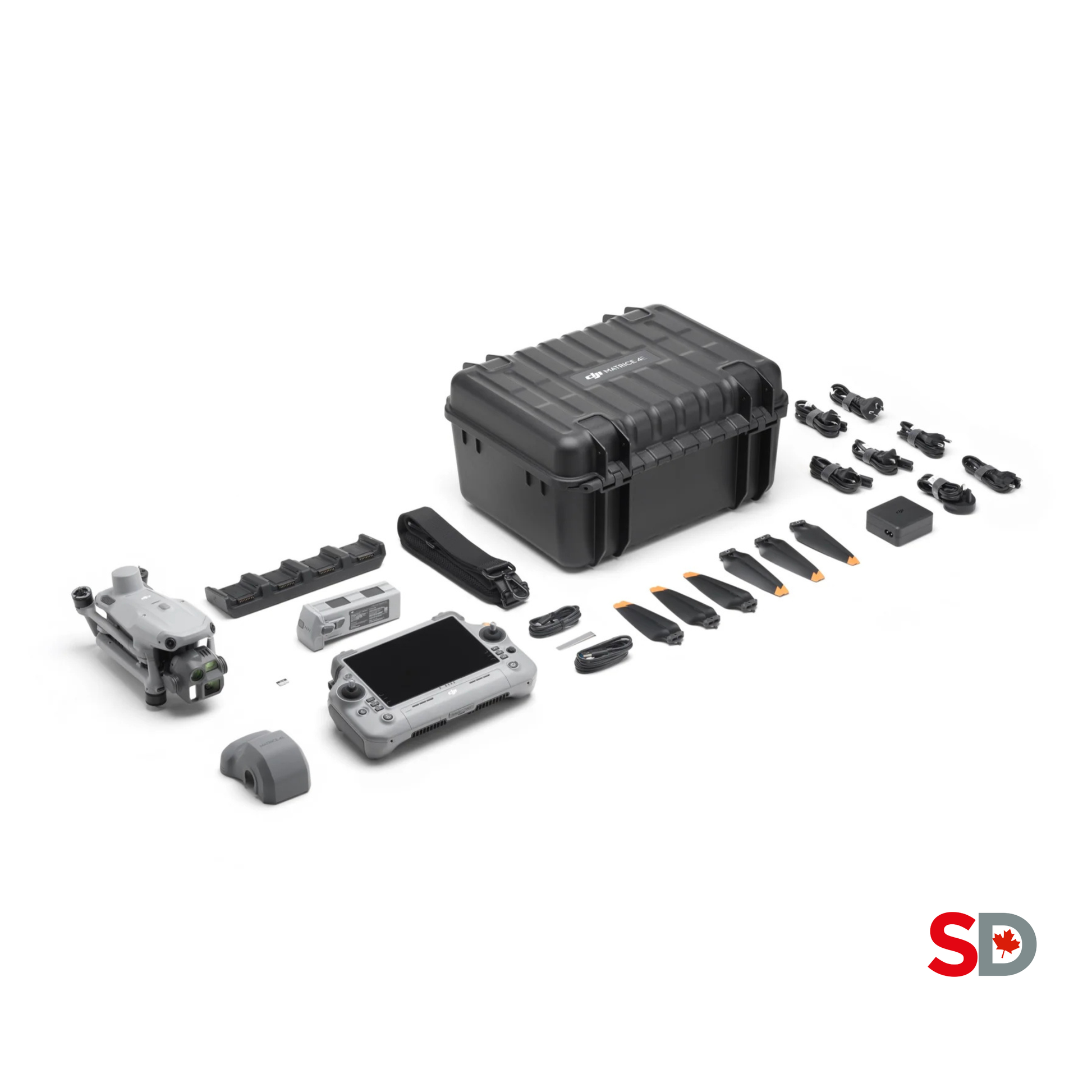 Repeatable capture · RTK · 2D + 3D
The value is not the flight. It is the repeatable evidence.
A strong weekly program uses the same site boundary, altitude, overlap, camera orientation, coordinate reference, checkpoints, naming system and delivery schedule. Each flight becomes a comparable layer instead of a disconnected set of attractive images. Start with the decisions the project team needs to make, then choose the model detail and software.
Fly the same portable RTK mapping mission every week.
- Use a mechanical-shutter mapping drone.
- Capture a nadir map and selected oblique views.
- Validate RTK, image coverage and checkpoints.
- Publish an orthomosaic, model and issue summary.
- Archive every capture under one timeline.
Share a controlled viewer, not a folder of raw photographs.
- Give owners a visual timeline and key milestones.
- Give site teams measurable maps and annotations.
- Give consultants exports compatible with CAD, GIS or BIM.
- Control permissions, retention and external sharing.
- Document assumptions and accuracy limits.
Automate only after the manual workflow is stable.
- Prove the route and processing method first.
- Confirm permanent power, network and site security.
- Define remote supervision and weather rules.
- Integrate DJI Dock 3 and FlightHub 2 where utilization supports it.
- Keep an exception and escalation procedure.
One flight can support several views of the same project.
Do not process every possible output simply because the software can. Select the smallest set that supports schedule review, site coordination, quantities, client reporting, issue documentation and long-term records.
Current orthomosaic
A georeferenced top-down map for logistics, access, staging, surface conditions, installed work and annotation.
Shareable 3D model
A navigable site model for remote review, context, progress communication and visual comparison from multiple angles.
Point cloud
A dense spatial dataset for measurement, surface analysis, design coordination and downstream CAD, GIS or BIM use.
DSM or elevation surface
A surface model for terrain change, drainage observations, earthwork review and selected cut-and-fill workflows.
Issue and milestone views
Annotated screenshots or links that direct attention to access conflicts, sequencing, stored materials or completed areas.
Weekly progress brief
A concise package that states the capture date, conditions, completed areas, visible changes, limitations and next actions.
Capture, validate, compare, publish and preserve.
The operating system should be documented before the first production flight. The route is only one component; responsibilities, site coordination, quality checks, processing settings, distribution and archive rules matter just as much.
Define the decisions.
Identify who needs the data, which questions must be answered, the required outputs, expected turnaround and acceptable accuracy.
Create the baseline.
Set the site boundary, coordinate system, vertical reference, control, checkpoints, route, camera settings and file structure.
Coordinate the site.
Confirm crane activity, lifts, blasting, concrete operations, people, temporary obstacles, access, airspace and the launch area.
Repeat the capture.
Use the approved route and settings. Add only the supplemental oblique, facade, video or detail captures required that week.
Validate in the field.
Check mission completion, RTK status, exposure, blur, image count, coverage gaps, control visibility and unexpected site changes.
Process consistently.
Keep the same coordinate settings, software version controls, reconstruction quality and output conventions unless changes are documented.
Compare and annotate.
Review against prior dates, milestones, drawings or models. Record visible changes, exceptions, uncertainties and assigned follow-up.
Publish and archive.
Distribute the approved viewer or report, preserve raw data and outputs, apply access controls and log the final delivery.
Keep the comparison variables under control.
A model can look different because the site changed—or because the capture changed. Standardizing the variables below makes weekly comparisons more defensible and reduces false conclusions caused by lighting, geometry or processing drift.
| Variable | Weekly standard | Why it matters | When change is acceptable |
|---|---|---|---|
| Site boundary | Use one master boundary with documented exclusion zones. | Keeps coverage and output extent comparable. | Expand for a new phase, then retain the revised version number. |
| Altitude and GSD | Use the same planned altitude and target ground sampling distance. | Controls image scale, detail and processing load. | Adjust for cranes, structures, airspace or a newly defined accuracy need. |
| Overlap | Maintain approved front and side overlap. | Supports reliable feature matching and model completeness. | Increase for complex geometry, taller structures or low-texture surfaces. |
| Camera orientation | Repeat the nadir mission and the same planned oblique angles. | Reduces geometry changes between weekly models. | Add targeted angles for newly exposed facades or structures. |
| Coordinate reference | Keep the horizontal system, vertical datum, geoid, units and transformation fixed. | Prevents apparent movement caused by reference changes. | Only under a documented project-wide revision. |
| Control and checkpoints | Protect stable marks and reoccupy independent checkpoints. | Tests whether weekly outputs align to the accepted reference. | Replace disturbed points through a documented survey-control process. |
| Lighting and weather | Prefer consistent daylight, low glare, manageable wind and dry optics. | Reduces shadows, blur, reflections and colour differences. | Fly only when the operational and information need justifies the difference. |
| Processing settings | Use a controlled template and document software versions. | Keeps reconstruction quality and outputs comparable. | Change after testing, then reprocess earlier dates if direct comparison is required. |
| Naming and timestamps | Use ISO dates, site codes, flight IDs and version numbers. | Prevents confusion between raw data, drafts and approved deliverables. | Revise the convention once, document it and migrate the archive. |
Use aerial mapping, oblique imagery and ground documentation together.
Aerial imagery is excellent for site-wide context, earthwork, roofs and exposed structure. It cannot see through opaque surfaces or reliably document interiors, trenches after backfill, in-wall services after closure or details hidden by equipment.
The repeatable top-down record.
- Primary source for orthomosaics and surface models.
- Useful for logistics, grading, stockpiles and installed work.
- Mechanical shutter reduces rolling-shutter distortion during mapping.
- Flight lines should account for cranes, structures and changing elevation.
- Uniform snow, water, glare and low-texture surfaces can reduce reconstruction quality.
Geometry for vertical and complex surfaces.
- Improves building edges, facades and vertical context.
- Supports a more complete 3D model than nadir-only imagery.
- Requires safe stand-off from cranes, structures, wires and people.
- Use repeatable angles and planned paths where possible.
- Do not treat visual completeness as structural inspection certification.
Capture what the aircraft cannot see.
- Interiors, below-grade areas and enclosed conditions.
- MEP, rebar, embeds and utilities before cover-up.
- Fixed-vantage photos for direct before-and-after comparison.
- Close-range details needed for punch lists or coordination.
- Link to drawings, locations and dates under the same document-control system.
Portable weekly capture or an automated site system?
Matrice 4E is the current portable default for many new DJI construction-mapping programs. Mavic 3 Enterprise remains a capable compact mapping platform where available. DJI Dock 3 with Matrice 4D changes the operating model from scheduled site visits to remotely managed recurrent capture.
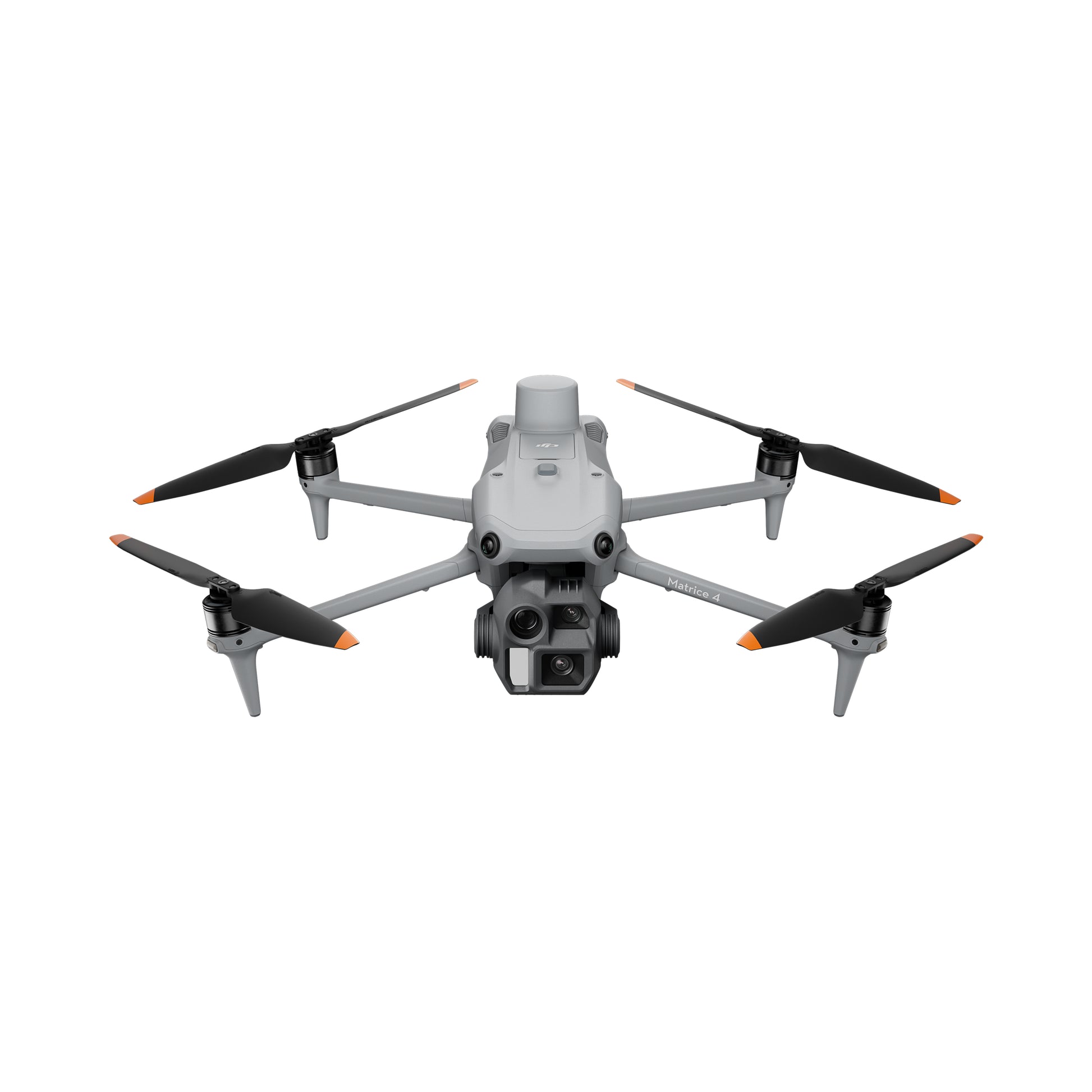
DJI Matrice 4E
Designed for portable surveying and mapping with a 20 MP 4/3 wide camera, mechanical shutter, RTK capability and a published 0.5-second minimum photo interval.
- Strong fit for weekly multi-site capture.
- Published maximum flight time up to 49 minutes in controlled conditions.
- Compact enough for a single field team.
- No published weather-protection rating; follow environmental limits.

DJI Mavic 3 Enterprise
A proven compact mapping aircraft with a 20 MP 4/3 camera, mechanical shutter, 0.7-second interval shooting and an optional RTK module.
- Useful for established fleets and smaller programs.
- Published maximum flight time up to 45 minutes in controlled conditions.
- RTK module and package contents must be confirmed.
- SpeedyDrone page showed sold out when checked; availability requires confirmation.

DJI Dock 3 + Matrice 4D
A fixed or vehicle-mountable dock workflow for scheduled remote missions, recurrent capture and FlightHub 2 operations.
- Best for high-frequency or difficult-to-access sites.
- Matrice 4D uses a 20 MP 4/3 wide camera with mechanical shutter.
- Requires site engineering, power, connectivity, security and operating procedures.
- Dock body pricing is not the complete deployed-system cost.
| Decision factor | Matrice 4E | Mavic 3 Enterprise | Dock 3 + Matrice 4D |
|---|---|---|---|
| Operating model | Portable pilot-led missions across one or many sites | Portable pilot-led missions using an established compact platform | Scheduled remote missions from a dedicated site system |
| Primary mapping camera | 20 MP 4/3 CMOS wide camera with mechanical shutter | 20 MP 4/3 CMOS wide camera with mechanical shutter | 20 MP 4/3 CMOS wide camera with mechanical shutter |
| Published photo interval | Minimum 0.5 seconds | Minimum 0.7 seconds | Minimum 0.5 seconds |
| Positioning | Integrated enterprise RTK workflow | Optional RTK module | Integrated dock and aircraft RTK workflow |
| Weather resilience | No published IP rating | No published IP rating | Dock and aircraft have published ingress-protection ratings, subject to operating limits |
| Best fit | New weekly construction programs and mobile teams Recommended default | Existing fleets, smaller budgets or lighter utilization Confirm availability | High-frequency monitoring with permanent infrastructure System project |
RTK improves the workflow, but validation makes it trustworthy.
RTK can reduce positional drift and the amount of ground control needed for some workflows. It does not eliminate the need to define the project reference, protect stable points, check correction quality and test the output against independent checkpoints.

Base, relay and rover functions in one platform.
D-RTK 3 can support corrections, communications and control-point workflows. Final positioning quality still depends on setup, satellites, interference, reference coordinates and field practice.

Start with a known and documented reference.
A convenient point is not automatically a defensible base position. Record how the coordinates were established, antenna setup, correction source, timestamps and quality indicators.
Prove that each weekly model belongs in the timeline.
- Document coordinate system, vertical datum, geoid, units and transformation.
- Record RTK FIX status and correction source.
- Use stable independent checkpoints appropriate to the required accuracy.
- Review horizontal and vertical residuals, not only software labels.
- Inspect image sharpness, overlap, holes, edge distortion and model noise.
- Issue a short QA note with exclusions and limitations.
“Centimetre-level” is not a universal project result.
- Manufacturer figures come from stated test conditions.
- Absolute accuracy and relative model consistency are different questions.
- Checkpoints must be independent of the adjustment they are testing.
- Vegetation, moving equipment, shadows and reflective surfaces affect reconstruction.
- Drone data does not replace a licensed cadastral survey or engineering certification.
- State the tested result for the actual project, not only the hardware specification.
Separate reconstruction from collaboration.
The software that creates a high-quality model may not be the best interface for every superintendent, owner, consultant or subcontractor. Design the stack around processing control, web viewing, permissions, annotations, timeline comparison, exports and integration.
Local reconstruction and geospatial production.
- Process visible-light imagery into 2D and 3D deliverables.
- Generate orthomosaics, point clouds, meshes and elevation products.
- Keep project coordinate and reconstruction settings under controlled templates.
- Export results for downstream analysis or sharing.
- Plan adequate Windows workstation, RAM, GPU and storage capacity.
Operations, automation and cloud collaboration.
- Manage routes, aircraft, docks and remote operations.
- Schedule routine collection with compatible dock systems.
- Process and compare site outputs in supported workflows.
- Support sharing and integration with broader construction systems.
- Confirm current licence, storage, data-governance and feature requirements.
Browser-based progress monitoring and sharing.
- Cloud processing for orthomosaics, 3D meshes, point clouds and elevation models.
- Timeline views and 2D or 3D comparisons over time.
- Measurements, annotations and shareable project links.
- Design overlays and selected CAD, BIM or platform integrations.
- Evaluate hosting, pricing, data residency and access controls for the organization.
Unified aerial, ground and project documentation.
- Consistent automated aerial capture supports repeatable comparisons.
- Ground and 360 documentation can fill interior and close-range gaps.
- Maps, models, drawings and issue workflows can be linked in one environment.
- Useful when field collaboration matters more than local reconstruction control.
- Select based on existing Procore, Autodesk, BIM, GIS and document-control systems.
| Workflow need | Preferred capability | Questions to ask before buying |
|---|---|---|
| Controlled local processing | Desktop reconstruction with repeatable templates and export control | What output formats, coordinate systems, workstation resources and licence terms are required? |
| Remote flight operations | Fleet, route, dock, alert and mission management | Who supervises flights, responds to exceptions and controls route changes? |
| Owner and consultant sharing | Browser viewer, permissions, annotations and audit trail | Can external users open the project without specialist software, and can access be revoked? |
| Timeline comparison | Historical layers, split view, overlays and measured change | Are models aligned to the same reference, and are comparison methods documented? |
| BIM or CAD integration | IFC, DXF, point-cloud, raster and API workflows | Which system is the source of truth, and who approves design-versus-as-built interpretation? |
| Enterprise governance | SSO, roles, retention, regional storage, backups and integrations | Where is data stored, who can download it, and how long is each project retained? |
Package the same capture differently for each role.
A superintendent may need annotated site conditions. An owner may need a simple visual timeline. A survey or VDC team may need georeferenced exports and QA documentation. One universal report usually serves none of them well.
Visible progress and milestone confidence.
Provide a current overview, key changes, milestone images, major risks, unresolved items and a link to the approved viewer.
Executive progress briefSchedule, coordination and evidence.
Use weekly comparison, annotations, access routes, staging, installed quantities and assigned follow-up items.
Annotated map + timelineWhat is happening on the site now.
Deliver a fast current map, logistics view, crane and material zones, surface conditions and selected oblique imagery.
Field coordination packageDesign-versus-current context.
Provide aligned point clouds, models, raster surfaces, design overlays and documented coordinate transformations.
Model-ready exportsMeasured data with QA evidence.
Include control method, checkpoints, residuals, coordinate system, tested accuracy, exclusions and the appropriate professional responsibility.
Geospatial QA packageApproved visuals without exposing sensitive data.
Create a separate reviewed set that excludes security details, neighbouring properties, people, proprietary drawings and uncontrolled claims.
Approved media exportA construction fence is not an aviation authorization.
Construction sites often combine workers, contractors, public edges, cranes, temporary obstacles and controlled urban airspace. Classify the actual operation before every flight and coordinate it with the site safety system.
| Planning issue | Canadian requirement or control | Construction implication |
|---|---|---|
| Basic operations | Small drone, VLOS, uncontrolled airspace, more than 30 m horizontally from any person, and applicable aerodrome distances. | Many active urban sites will not meet every Basic condition. |
| Advanced operations | May support controlled airspace and closer-to-people operations with the appropriate certificate, aircraft declaration and permissions. | Verify the exact operation, pilot privileges, aircraft eligibility and air traffic authorization. |
| People on site | Do not assume every worker is involved in the drone operation. | Create exclusion zones, brief the required personnel and schedule around high-density work where practical. |
| Controlled airspace | Requires the applicable Advanced privileges and permission from the air traffic control authority. | Build authorization lead time into the weekly schedule, especially in Toronto and other urban areas. |
| Site survey | Review airspace, NOTAMs, obstacles, weather, radio environment, launch and emergency areas. | Cranes, hoists, temporary towers and structures change weekly and must be reflected in the route. |
| Maximum altitude | Routine categories remain at or below 122 m AGL unless an applicable special authorization is obtained. | Plan GSD and model coverage within the legal altitude and site geometry. |
| Site safety system | Coordinate with the constructor, owner, superintendent and applicable safety procedures. | Use sign-in, radio protocol, launch control, spotters where needed, stop-work triggers and incident reporting. |
| Emergency response | Prepare lost-link, fly-away, battery, weather, person-entry and aircraft-emergency procedures. | Everyone responsible for the operation should know who can stop the flight and how the site will respond. |
A useful visual record can also expose people, property and project information.
Build privacy and information governance into the program before sharing links. The model may show workers, neighbouring properties, access controls, security layouts, materials, proprietary designs and commercially sensitive progress.
Define the purpose.
State what is being collected, why it is necessary, who is responsible and which uses are prohibited.
Minimize exposure.
Choose routes, timing and framing that reduce unnecessary capture of people and neighbouring private areas.
Control every link.
Use named users, roles, expiration, revocation, audit logs and download restrictions where the platform supports them.
Preserve what matters.
Keep an approved record schedule for raw data, models, reports and issue evidence, then securely dispose of expired copies.
Budget for the operating system, not only the aircraft.
Public SpeedyDrone prices below were checked July 21, 2026 before tax. Confirm care plan, batteries, charging, RTK, software, computer, storage, training, airspace work, insurance, labour, travel and availability in the final quote.
DJI Matrice 4E
- Current public aircraft listing.
- Mechanical-shutter mapping camera and RTK workflow.
- Confirm batteries, care, charger and full field package.
- Strong starting point for a new weekly multi-site program.
- Software and control equipment are separate.
Mavic 3 Enterprise
- Public SP Basic one-year option when checked.
- Page displayed sold out; confirm current availability.
- Optional RTK module may be required.
- Useful for established fleets or lighter utilization.
- Compare total package, not only aircraft price.
DJI Dock 3 body
- Public dock listing, not a complete deployed project.
- Matrice 4D or 4TD aircraft must be confirmed.
- FlightHub 2, installation and site engineering are separate.
- Include power, network, security, permits and maintenance.
- Best justified by high capture frequency and utilization.
| Additional item | Public reference checked July 21, 2026 | Why it matters |
|---|---|---|
| D-RTK 3 Multifunctional Station | CA$2,205 | Base, relay and rover workflows for positioning, communication and control support |
| DJI Terra Standard | CA$2,325 for one year; CA$6,629 permanent option | Local visible-light reconstruction and professional mapping workflow; confirm exact features |
| DJI Terra Flagship | CA$4,645 for one year; CA$13,278 permanent option | Advanced reconstruction option; confirm current licence capabilities and project fit |
| Processing workstation | Project-specific | Large image sets and 3D reconstruction require appropriate Windows hardware, RAM, GPU and fast storage |
| Cloud collaboration platform | Subscription and usage dependent | Viewer access, processing, storage, timeline, integrations and governance can drive annual cost |
| Training and SOP development | Scope dependent | Pilot skills, site coordination, mapping, QA, processing, sharing and emergency procedures determine reliability |
| Weekly operating labour | Site, travel and delivery dependent | Include planning, authorization, site time, processing, review, reporting and archive—not only flight minutes |
Prove the workflow on one site before scaling the fleet.
A controlled pilot reveals whether the site, team, software and outputs work together. Use four weekly cycles to measure turnaround, reflight rate, stakeholder usage, quality, labour and the decisions supported.
Baseline and governance
Confirm users, outputs, reference systems, airspace, route, control, privacy, storage, naming and approval responsibilities.
Repeat and compare
Fly the same route, process with the same template and test whether the team can identify meaningful change.
Integrate and improve
Add annotations, plan or BIM overlays, stakeholder-specific reports and a formal QA summary.
Decide the operating model
Measure value, bottlenecks and utilization, then choose portable internal operations, a service provider or dock automation.
| Pilot KPI | What to measure | Scale signal |
|---|---|---|
| Capture success | Completed missions, reflights, missing areas and weather cancellations | Repeatable route with a low preventable reflight rate |
| Turnaround time | Flight completion to approved viewer or report | Delivery meets the project meeting and decision cycle |
| Quality | Checkpoint results, alignment, holes, blur, noise and exclusions | Outputs consistently meet the defined use—not vague “high accuracy” |
| Adoption | Viewer opens, annotations, downloads, meeting use and assigned actions | Multiple roles use the data without the drone team translating every screen |
| Decision value | Issues identified, site visits avoided, quantities reviewed and disputes clarified | Documented benefits exceed the full recurring cost |
| Governance | Access, approval, retention, versioning and incident controls | The process can be audited and repeated by trained personnel |
Choose the program by frequency, geography and decision value.
The best construction drone system is not the one that produces the largest model. It is the one that reliably produces the right evidence before the next decision, with the accuracy, access controls and operating cost the organization can sustain.
Start with a portable Matrice 4E workflow.
A trained internal team or service provider can rotate across sites and standardize capture, Terra processing and cloud delivery.
Portable weekly programImprove process before replacing hardware.
Standardize routes, RTK, control, QA and sharing first. Upgrade when image interval, platform age, availability or operating efficiency justifies it.
Workflow optimizationEvaluate Dock 3 as an infrastructure project.
Model the full system: aircraft, dock, site engineering, network, FlightHub 2, remote supervision, maintenance, permissions and exception response.
Automation assessmentPut professional QA and responsibility first.
Work with the qualified survey or engineering professional responsible for control, accuracy, interpretation and accepted deliverables.
Geospatial assuranceKeep the package simple and visual.
A current orthomosaic, selected oblique views, milestone comparisons and a controlled web viewer may create more value than a heavy model every week.
Executive visibilityPilot before buying the complete stack.
Use a demonstration, rental, service engagement or four-week pilot to validate stakeholder use, processing, software and recurring economics.
Assessment firstWeekly flights, 3D models and Canadian operations answered.
How often should a construction site be flown?
Weekly capture is a practical default for many active projects because it aligns with common coordination and reporting cycles. Daily or event-based capture may be justified for rapid earthwork, critical lifts, concrete placement, major milestones or dispute documentation. The correct frequency depends on how quickly the site changes and whether the resulting information can influence a decision before the next capture.
What should a weekly construction drone deliver?
A useful minimum package is a current orthomosaic, selected oblique images, a shareable viewer or 3D model, a comparison against the previous approved date, annotations for important changes and a short QA or limitations note. Survey, civil or VDC teams may also need point clouds, elevation surfaces, CAD or GIS exports and control documentation.
Why must the flight route stay the same every week?
Repeating the route, altitude, overlap and camera geometry reduces variation caused by the capture itself. This makes it easier to distinguish real construction change from differences in image scale, angle, coverage or reconstruction. The route can change when the site changes, but the change should be planned, versioned and documented.
Is DJI Matrice 4E suitable for construction progress monitoring?
Yes. Matrice 4E is designed for portable surveying and mapping and uses a 20 MP 4/3 wide camera with a mechanical shutter, RTK capability and a published 0.5-second minimum photo interval. It is a strong fit for recurring orthomosaic and 3D reconstruction missions across one or multiple construction sites, subject to flight planning, Canadian rules and project QA.
Can Mavic 3 Enterprise still be used for weekly construction mapping?
Yes. Mavic 3 Enterprise remains a capable compact mapping aircraft with a 20 MP 4/3 camera, mechanical shutter and optional RTK module. It can be a practical choice for established fleets or lighter programs. Current stock, care options, RTK accessories and long-term platform support should be confirmed before standardizing a new fleet.
When does DJI Dock 3 make sense for a construction site?
Dock 3 becomes more attractive when capture frequency, travel, site access, response time or remote management justify permanent infrastructure. The business case must include the Matrice 4D or 4TD aircraft, FlightHub 2, site engineering, power, connectivity, security, installation, operating approvals, maintenance and remote exception response—not only the dock body.
Does RTK eliminate the need for ground control points?
Not universally. RTK can reduce control requirements in suitable workflows, but the project still needs a defined coordinate system, reliable correction source and independent quality checks. Ground control or checkpoints may remain necessary depending on the required absolute accuracy, client specification, site conditions, professional responsibility and the need to verify weekly alignment.
Can drone models be used to calculate stockpile volumes and earthwork?
Drone-derived surfaces can support stockpile and earthwork calculations when the visible surface is captured adequately and the control, coordinate system, base surface, processing and validation are appropriate. Results should be reviewed against the project specification and by the professional responsible for the quantity or payment decision. Hidden material, water, vegetation and inaccessible surfaces can affect results.
Can a 3D drone model replace a BIM model or legal survey?
No. A drone model is an observed reality-capture dataset. A BIM model represents designed or managed building information, while a legal survey and other regulated deliverables require the appropriate licensed professional and evidence. Drone outputs can be compared with BIM, CAD or survey data, but they do not automatically replace those sources of authority.
What software can share construction drone models?
DJI Terra can process visible-light imagery into 2D and 3D outputs. DJI FlightHub 2 can support cloud operations, dock workflows, route management, processing and collaboration. Platforms such as PIX4Dcloud and DroneDeploy provide browser-based progress monitoring, measurements, annotations, timeline comparison and sharing. Select the stack based on processing control, viewer usability, integrations, security, storage and cost.
Can I fly a drone over workers on a Canadian construction site?
Do not assume that site access or a construction fence allows flight over people. Under Transport Canada rules, the operation category, pilot certificate, aircraft safety declaration, distance from people, controlled airspace and permissions all matter. Plan workers as uninvolved unless they are properly part of the operation under the applicable rules, use exclusion zones and coordinate with site safety leadership.
What causes poor construction 3D models?
Common causes include insufficient overlap, blurred images, changing exposure, reflective or uniform surfaces, water, snow, moving equipment, heavy shadows, poor oblique coverage, tall structures, inaccurate reference data, unstable checkpoints, incorrect coordinate settings and inconsistent processing. Field validation before leaving the site is the lowest-cost way to prevent many failures.
How much does a construction drone monitoring system cost in Canada?
Public SpeedyDrone prices checked July 21, 2026 listed Matrice 4E at CAD 6,229, Mavic 3 Enterprise from CAD 4,799 with the page showing sold out, DJI Dock 3 body at CAD 21,509, D-RTK 3 at CAD 2,205, DJI Terra Standard from CAD 2,325 for one year and DJI Terra Flagship from CAD 4,645 for one year. A complete program also requires batteries, charging, computing, storage, cloud software, training, insurance, labour, travel and operating procedures.
Verify current specifications, rules, software and package contents.
Build a weekly capture program your project team will actually use.
Send the province, site location, project area, construction phase, desired flight frequency, airspace, accuracy need, current survey control, required outputs, BIM or project platform, number of users and preferred delivery cycle. SpeedyDrone can prepare a Matrice 4E, Mavic 3 Enterprise or Dock 3 workflow assessment, Canadian quote, software plan, training pathway, financing review or Toronto demonstration.


