


Mavic 3M • Mapping geometry
Real-time vision or a reviewed DSM?
Choose a terrain source that fits the site, then check the height reference that your images will actually use.

DJI Mavic 3M supports two terrain-follow mapping approaches: Real-Time Follow uses onboard vision and needs no DSM, while DSM Follow uses imported terrain data to generate an altitude-varying route. Real-Time Follow is an option when light, surface texture and terrain are suitable. A recent, checked DSM is worth considering when you already have reliable elevation data or need to document the same planning reference across repeat missions.
Both approaches aim to keep the aircraft’s relative height more consistent over changing terrain. That helps control image scale and ground sampling distance, or GSD. The decision still depends on what the reference represents: bare ground, visible crop or tree canopy. A terrain-follow setting alone does not establish obstacle clearance, positional accuracy or comparable multispectral results.
This guide focuses on that acquisition decision for sloped fields and orchards. It explains the documented DJI Pilot 2 paths, the limits of vision and imported data, and how to plan RGB and multispectral sampling separately. The M3M smart-farming workflow guide covers the broader path from imagery to field decisions.
Technical documentation and public store pages checked September 30, 2026. DJI’s currently linked M3M User Manual is v1.8. Calculations and diagrams below are planning examples, not SpeedyDrone flight tests or selected mission settings.
Why terrain follow matters on a sloped field
A level flight path does not maintain the same distance from a rising or falling field. Ground near a hilltop is closer to the camera; a lower part of the block is farther away. A fixed height relative to the takeoff point can therefore produce different local aircraft-to-ground distances within one mission. The launch reference and the ground beneath each photograph are different things.
For a given camera and approximately nadir view, nominal GSD increases with height above the imaged surface. If that distance changes from 80m to 120m, the calculated pixel spacing increases by 50%. The numbers are illustrative, but the relationship explains why an apparently consistent flight setting can produce variable sampling over a rolling field.
Terrain Follow adjusts the flight height to follow the terrain reference. DJI links this to maintaining consistent GSD in areas with large elevation differences. In practice, you should describe it as a way to improve acquisition geometry, then verify the result. Surface slope, camera angle, model error and canopy height can still change the projected footprint of individual pixels and photographs.
Real-Time Follow vs DSM: what changes?
The two modes differ primarily in where the height information comes from. Real-Time Follow observes the scene during flight. DSM Follow plans altitude changes from a supplied raster. Having a file is useful only when its coordinate system, coverage and surface representation are appropriate for the mission.
On smaller screens, scroll the table horizontally to compare both modes.
| Decision point | Real-Time Follow | DSM Follow |
|---|---|---|
| Terrain input | Onboard vision during flight | Imported elevation/surface raster |
| DSM required? | No | Yes for the imported-data path |
| Main dependency | Suitable light, texture and terrain within documented visual limits | Recognized file, correct coordinates, coverage and credible current heights |
| Planning advantage | No prior DSM preparation | A recordable model and route-height planning reference |
| Main review question | Can vision reliably observe the relevant surface here? | What surface and date do these elevations represent? |
| Water, wires or towers | Explicit DJI limitations apply; do not rely on this mode around them | The file does not establish obstacle clearance or make the location safe |
| Repeat seasonal work | Scene and visual conditions can change | Record model/version; revalidate after terrain or canopy changes |
For an open rolling field with suitable visual conditions and no prepared model, Real-Time Follow is a reasonable mode to evaluate. For a recurring project with a trustworthy terrain model, DSM Follow gives the team a source it can inspect and record. This is our planning framework based on DJI’s documented dependencies; it is not a manufacturer rule that one mode always wins in a particular crop.
If both the visual environment and the available DSM are unsuitable, reconsider the mission rather than forcing a choice. An imported model does not solve rain, poor visibility or an unsafe obstacle layout. A visually clear scene does not validate an outdated height model.
What do the 30–200m range and 150m display mean?
The Mavic 3M v1.8 User Manual, pages 83–84, describes a 30–200m long-distance detection range for the vision system used by Real-Time Follow. It also describes a terrain-trend display approximately 150m ahead of the aircraft. These figures explain terrain sensing and the displayed profile; they do not guarantee that a small obstacle will be detected at that distance.
DJI recommends suitable visual conditions and terrain slope below 75°, while separately stating that Real-Time Follow cannot work in locations featuring cliffs, steep slopes, power lines and towers. A slope measurement alone therefore cannot qualify a site. Shape, abrupt changes, obstacle geometry, texture and light all matter.
The same manual warns about low light, rain, snow, fog, water and waves. It also identifies reflective or transparent surfaces, repetitive or absent texture, moving objects and drastic lighting changes as vision problems. An irrigation pond, thin wire crossing or shaded row is a reason to review or exclude part of the route, not evidence that automatic following will handle it. Follow the aircraft’s operating limits and maintain the ability to interrupt the task.
How to import a DSM in DJI Pilot 2
DJI’s current M3M FAQ describes the DSM import path through the flight-path library, creation of a mapping mission, Terrain Follow and DSM file selection from internal storage or the controller’s SD card. The v1.8 manual also tells users to select AGL altitude mode to enable Terrain Follow. Labels can vary with the installed Pilot 2 build and mission type; check the actual controller rather than treating an older screenshot as a universal menu.
- Place the reviewed terrain file where the controller can access it.
- In Flight Path, choose Create Flight Path → Mapping Mission for Mavic 3M.
- Select AGL altitude mode as described in v1.8, then open Terrain Follow → DSM File Selection.
- Select the DSM from Internal Storage or the SD Card and confirm that the mapping boundary lies inside its extent.
- Review the generated altitude changes, takeoff/start transition, turns and completion plan before executing the task.
In v1.8, DJI specifies geographic coordinates rather than a projected coordinate system and recommends imported raster resolution no coarser than 10m. It also requires the mapping area to be within the file’s coverage. File recognition is one check; a recognized raster still needs credible elevations. A recommended cell-size limit is not a promise of sufficient detail for every terrace or orchard obstacle.
Our additional project review checks the data date, missing cells, horizontal alignment, elevation units and height reference. Compare recognizable terrain features with current site knowledge. If the model and expected heights disagree, resolve that discrepancy before flying. Do not guess a universal vertical offset or assume that a TIFF from another GIS project is ready for Pilot 2 without validation.
Plan RGB and multispectral GSD separately
Mavic 3M combines a 20MP RGB camera with four 5MP multispectral cameras. The different sensors and optics produce different spatial sampling at the same height. A sharp RGB orthophoto does not demonstrate the same pixel spacing in the multispectral layer used for crop variability or vegetation indices.
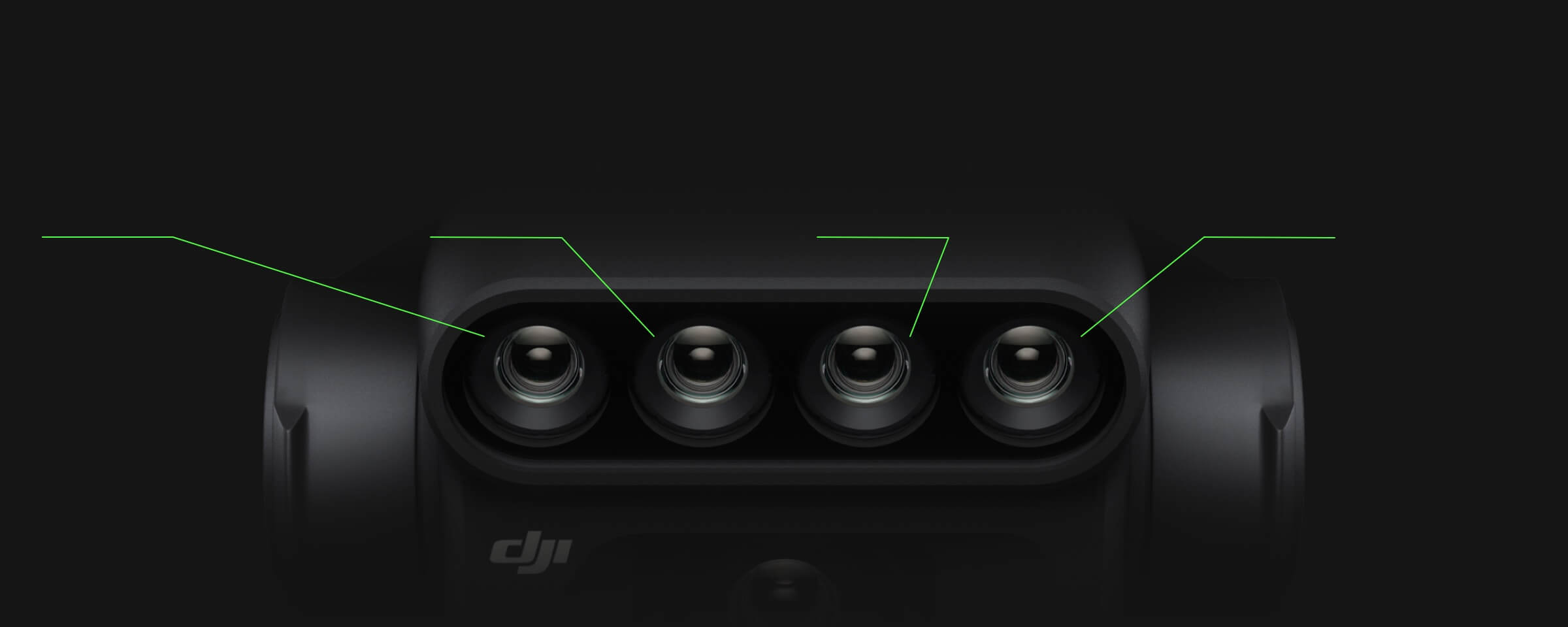
DJI’s M3M FAQ publishes the orthophoto relationships RGB GSD ≈ H ÷ 37.2 cm/pixel and multispectral GSD ≈ H ÷ 21.7 cm/pixel. For the following nominal nadir examples, H is height in metres above the imaged reference surface. A sloping surface or a canopy above the ground reference changes local geometry, so these calculations are starting points rather than a finished sampling assessment.
| Illustrative H | RGB | Multispectral |
|---|---|---|
| 60m | 1.61 cm/pixel | 2.76 cm/pixel |
| 80m | 2.15 cm/pixel | 3.69 cm/pixel |
| 100m | 2.69 cm/pixel | 4.61 cm/pixel |
If multispectral sampling drives the deliverable, start with that coefficient. A nominal 4cm/pixel target gives H ≈ 4 × 21.7 = 86.8m. You must then evaluate that candidate height against the reference surface, clearance, lawful operating envelope, overlap, speed and actual image quality. It is a calculation, not an instruction to fly every orchard at 86.8m.
Smaller pixels also do not guarantee smaller positional error, better crop diagnosis or an acceptable reconstruction. Motion blur, alignment, illumination and processing matter. Keep the GSD requirement separate from the required positioning checks and the agronomist’s interpretation of the resulting layers.
In an orchard, what surface does “terrain” represent?
An orchard combines ground elevation, tree height, canopy gaps, repeated rows, shade and occluded soil. A digital surface model can represent the visible upper surface, including vegetation. Bare-earth terrain data represents a different reference. The distinction affects both flight clearance planning and the camera-to-target distance used for sampling.
Our mapping analysis is straightforward: if a planned height is relative to bare ground, the camera will be closer to an elevated crown. If a model follows canopy tops, the flight profile may contain row/crown variations that differ from the underlying hillside. Identify what your data actually represents rather than treating DSM, bare-earth terrain and last season’s orchard model as interchangeable.
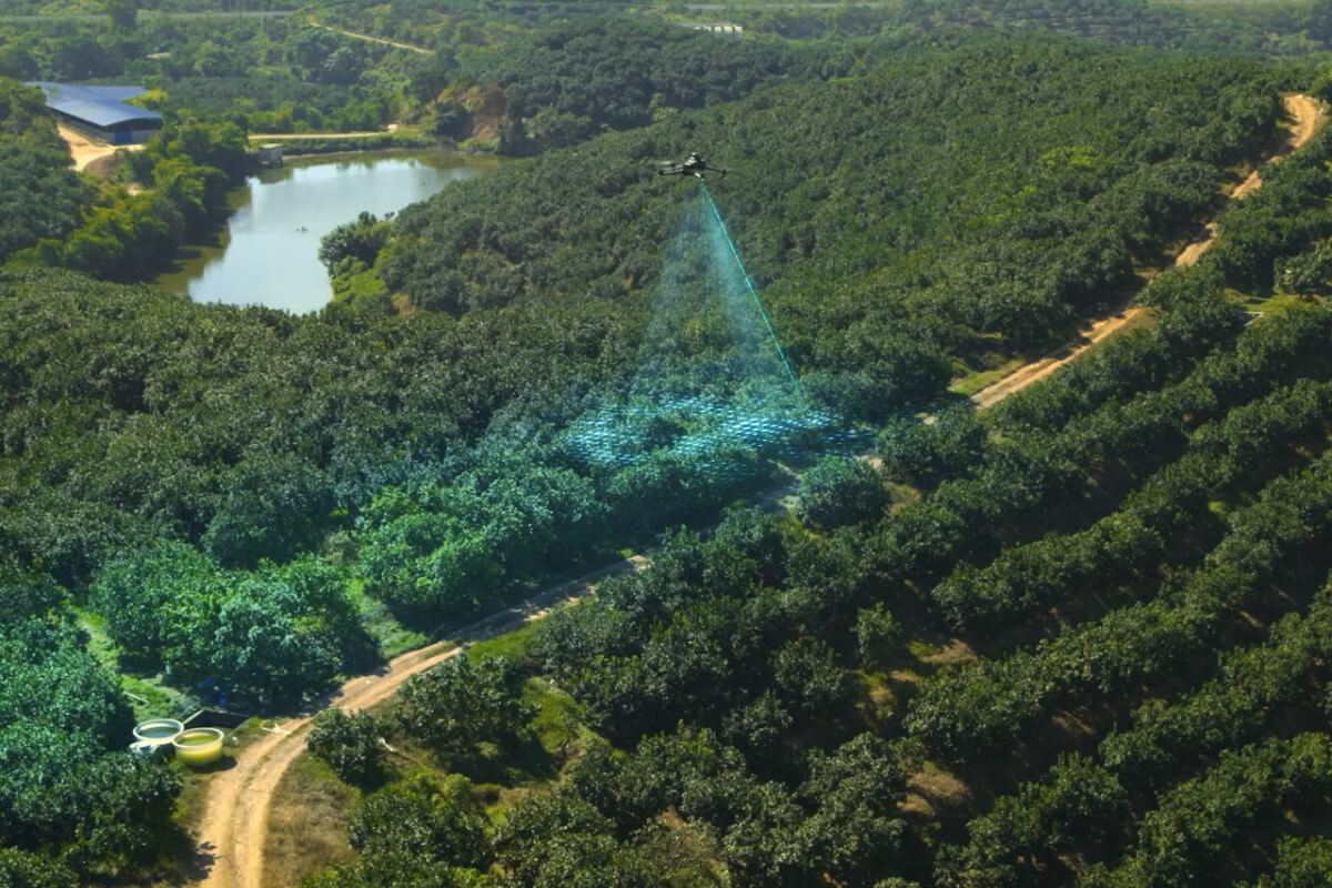
Real-Time Follow observes a visual scene that can include crowns, gaps and obscured ground. Do not assume that it produces a surveyed bare-earth profile through foliage. DSM Follow can use a recordable source, but an older model may miss tree growth, new structures or earthwork. Neither source is a live inventory of wires, poles, guy wires, workers or machinery.
Terrain-relative acquisition also leaves other orchard problems unresolved: canopy occlusion, matching repeated rows, tree movement and changing shadows. Keep a separate obstacle survey and image-quality review. The orchard mapping workflow guide covers the wider operational handoff.
Terrain follow, RTK and sunlight solve different problems
Terrain follow controls the relative-height part of acquisition geometry. RTK supports positioning, and M3M comes with an RTK module as standard. Check the required correction and positioning state for your project, but do not expect an RTK fix to make GSD constant over hills. Equally, a consistent relative height does not certify the final map’s positional accuracy.
For multispectral acquisition, DJI recommends good light and a sun altitude angle of at least 30°. The sunlight sensor records irradiance for compensation during reconstruction; keep it unobstructed. Large changes in cloud, shadows or crop movement still deserve review. A geometric setting cannot make differently illuminated observations automatically comparable.
For repeat seasonal work, record the mission boundary, terrain mode, DSM version and surface meaning, candidate height/GSD, overlap, speed, camera settings, RTK source and light conditions. This is our repeatability recommendation. If tree growth or earthwork changes the reference, document the change instead of silently reusing last season’s task.
A practical route and data review before the full block
Start with the deliverable: an RGB visual map, multispectral sampling or orchard reconstruction. Set the required sampling and validation criteria before choosing a terrain mode. Review the block boundary, terrain, obstacles and access, then decide whether available vision conditions or a checked model can support the planned acquisition.
Our recommended validation step is a representative small block that includes the relevant slope, canopy and lighting conditions. Review the route preview and takeoff/start/RTH assumptions first. During acquisition, monitor the task and be ready to interrupt it. Afterward, inspect sharpness, coverage, usable overlap and height/positioning records before extending the same plan across the whole site.
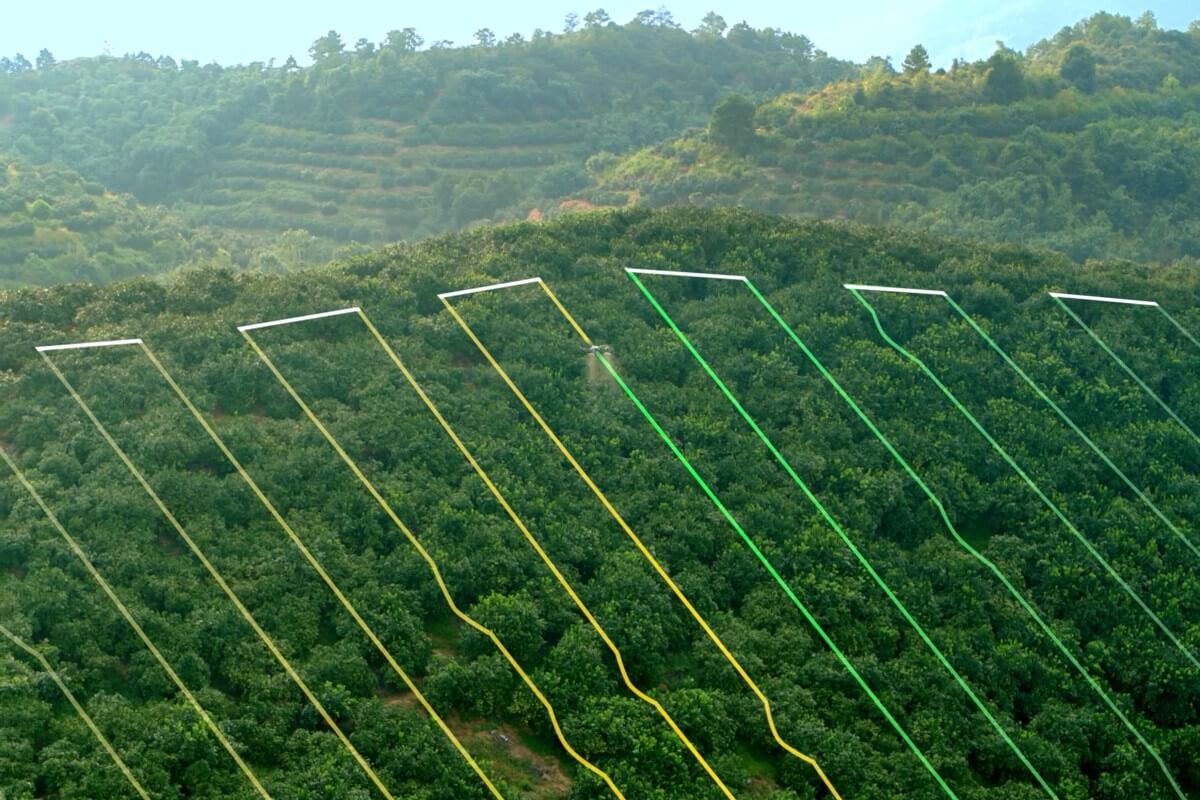
Continue into your selected reconstruction workflow only after checking the captured data. DJI documents a Terra route for preparing terrain files, and SmartFarm Web provides agriculture reconstruction and analysis workflows. Confirm the current build, licence, region and expected outputs. SpeedyDrone’s DJI Terra Standard listing provides software purchase options; verify the licence that fits your processing needs.
Preserve the source images, mission/model versions and review findings with the outputs. Vegetation-index patterns support scouting and analysis; they do not by themselves determine an agronomic treatment or approve an application route.
Build the M3M setup around the mapping requirement
The Mavic 3 Multispectral (M3M) at SpeedyDrone is the relevant aircraft for this RGB/multispectral workflow, with its camera array and standard RTK module. Select the aircraft configuration, positioning source and processing separately. Confirm the actual package and current order status; a terrain-follow function does not include every software licence, correction service or project-validation step.

Mavic 3M terrain-follow FAQ
Does Mavic 3M support terrain-follow mapping?
Yes. DJI documents Real-Time Follow and DSM Follow for Mavic 3M terrain-follow acquisition. They use different terrain inputs: onboard vision versus imported data. Check the supported controls in your installed Pilot 2 build and selected mission type. The feature helps maintain relative-height geometry; it does not approve a route, identify every obstacle or guarantee final mapping accuracy.
Does Real-Time Follow require a DSM?
No. Real-Time Follow obtains terrain information from the aircraft’s vision system. Its practical attraction is avoiding prior DSM preparation. That makes visual conditions part of the decision: lighting, texture, surface behaviour and terrain geometry must be suitable. If those conditions are poor, having no DSM is a missing planning resource rather than a reason to rely on vision outside its documented limits.
Can I import my own DSM into Pilot 2?
Yes. The M3M FAQ describes selecting a DSM from internal storage or an SD card within the mapping mission’s terrain-follow controls. The v1.8 manual calls for geographic rather than projected coordinates, complete area coverage and recommends cells no coarser than 10m. Confirm recognition on the actual controller, then review elevations, surface meaning, missing cells and current site changes before using the generated route.
What does the 30–200m Real-Time Follow range describe?
The v1.8 M3M manual identifies it as the vision system’s long-distance detection range for this function. The terrain-trend display is described separately at approximately 150m ahead. Neither figure should be treated as a guarantee of detecting small wires or providing obstacle clearance at that distance. Choose a lawful task height and review site hazards independently of the manufacturer’s sensing figures.
Is a slope below 75° enough to make Real-Time Follow suitable?
No. DJI’s slope recommendation also requires suitable light and visual surroundings. The same manual excludes locations featuring cliffs, steep slopes, power lines and towers, and lists other vision limitations. A slope angle alone leaves abrupt changes, texture, reflectivity, wires and route transitions unaddressed. Treat the number as one documented condition and review the complete site before choosing the mode.
Can I use terrain follow across an irrigation pond?
Do not rely on Real-Time Follow over large water areas or waves; DJI warns that vision may not measure distance to water reliably. A checked DSM can provide a terrain-planning input, but it does not establish safe sensing, clearance or operation over the pond. Review the boundary and route, and consider excluding or separately planning the water section rather than assuming a mode switch resolves every limitation.
How do I calculate RGB and multispectral GSD?
DJI’s orthophoto relationships are approximately H/37.2 cm/pixel for RGB and H/21.7 cm/pixel for multispectral imagery. With H in metres, a nominal 100m height gives about 2.69cm and 4.61cm per pixel respectively. Use the camera and reference surface relevant to the deliverable. These calculations describe sampling, while blur, slopes, reconstruction and positioning determine other aspects of data quality.
Does an orchard DSM represent ground or tree crowns?
Inspect the source. A surface model may include canopy tops, whereas bare-earth terrain data describes the underlying ground. Acquisition date and processing also matter. A ground-referenced route and a canopy-referenced route imply different distances to the visible trees. Do not assume a file name, successful import or vision-based following tells you which surface is being used or reveals soil hidden by foliage.
Does terrain follow replace RTK or sunlight compensation?
No. These features address different requirements. Terrain follow supports relative-height geometry; RTK supports positioning; irradiance records help compensate multispectral imagery during processing. For repeat work, record and review all three together with camera settings, overlap and environmental conditions. Good geometry does not make a poorly illuminated dataset comparable, and a fixed positioning solution does not keep image scale constant over changing terrain.
Which mode should I choose for repeat orchard surveys?
A recent, validated DSM can give the team a documented planning reference, especially when the same block is revisited. Recheck it after tree growth, new structures or earthwork. Real-Time Follow remains an option where visual conditions are suitable, but the observed scene changes with foliage and light. In either case, keep the mission/source versions and validate representative acquisition before comparing seasonal outputs.
Sources and scope
This guide uses the currently linked DJI M3M v1.8 manual, current model FAQ and specifications, official SmartFarm documentation and Transport Canada guidance. Field QA recommendations and diagrams are SpeedyDrone’s explanatory planning analysis. Official imagery depicts DJI promotional scenarios; no site-specific accuracy, detection or crop result is claimed.
Discuss your Mavic 3M mapping setup.
Tell SpeedyDrone whether you are mapping a rolling field or orchard, which output and sampling you need, whether a recent DSM is available, and how you plan to position and process the data. We can discuss the aircraft configuration and software options around those requirements.
Discuss my Mavic 3M setupExplore the Mavic 3 Multispectral collection for current equipment options.


