


Start with DJI Terra for a DJI reconstruction workflow, evaluate PIX4Dmatic for desktop geospatial production, and shortlist DroneDeploy when recurring capture must reach a wider project team. The right purchase depends on the exact licence, accepted outputs and people who will use them.
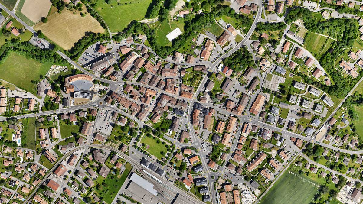
Several platforms can produce an attractive map. A useful comparison asks what happens next: can the survey technician validate it, can the designer open it in the required coordinate system, can the site manager compare dates, and can the organization retain its records after the subscription ends?
This resource turns those questions into a selection process: a shortlist, an output specification, a price reference, a representative trial and a handover checklist. Features and public prices were checked on October 6, 2026. Recommendations are workflow assessments; they are not results from a controlled processing-speed or accuracy benchmark.
01 A shortlist based on the work you must deliver
Use this matrix to choose what to test first. A recommendation becomes a purchasing decision only after the exact plan completes your sample project and the recipient accepts the result. Avoid buying a second platform to solve a problem that the current software can already solve with training or a different export.
DJI Terra vs PIX4Dmatic vs DroneDeploy: practical starting points
| Your main requirement | First evaluation | What must pass |
|---|---|---|
| DJI Zenmuse LiDAR reconstruction | DJI Terra | Exact sensor/version entitlement, trajectory processing, classified output and recipient import. |
| Local photo reconstruction | Terra and PIX4Dmatic Standard/Pro | Camera data, control, processing capacity, accepted raster/model exports and cleanup time. |
| Terrain and CAD production | PIX4Dmatic Analyst/Pro; compare Terra's required outputs | Ground classification, breaklines/vectors, surfaces, editing effort and the designer's actual file import. |
| Repeated site maps used by many people | DroneDeploy team offering | Dates, permissions, reviewer access, drawings, export rights and contract cost for the real team. |
| No internet on the processing machine | Specific offline Terra or PIX4Dmatic licence | Approved activation, hardware binding, offline operation and recovery after machine replacement. |
| Crop analysis or urgent incident mapping | Dedicated application/workflow review | Required sensor, index or turnaround. This general comparison does not establish specialist fit. |
On a small screen, swipe the table horizontally or focus it and use the arrow keys.
02 Write the output specification before the demo
Ask the receiving team what it needs to do with the data. “A 3D model” could mean a presentation, an inspection reference or an engineering surface. Those jobs require different geometry, metadata and review. A web link may satisfy an owner update while failing a designer who needs a surface file.
For a proposed topographic deliverable, name the required files, horizontal reference frame, projection, units, vertical datum, control method and acceptance criteria. State whether terrain must exclude vegetation, vehicles and structures. For progress reporting, specify capture dates, viewpoint consistency, drawing alignment, annotation ownership and who may access each project.
Also identify the authoritative record. If CAD is authoritative, the recipient should approve an imported CAD deliverable during the trial. If the portal is authoritative, test the portal as an invited reviewer. A processing operator's successful login does not prove that an external consultant can access the same history or export the same files.
A useful procurement sentence: “We need [files or portal functions] for [recipient and purpose], in [reference system], accepted by [named reviewer], within [turnaround], retained for [period].” Fill the blanks with the client before comparing licence prices.
Reconstruction and DJI data
03 DJI Terra: check the edition, then the whole processing path
Terra is a strong first evaluation when your acquisition workflow centres on DJI data and your team wants local reconstruction. It can fit a production office that processes captures, validates outputs and delivers files to another system. Its value should be measured through a completed project rather than the number of DJI products already owned.
DJI's current Terra feature list supports third-party camera imagery, while its LiDAR import is limited to DJI Zenmuse data. Standard includes photogrammetric reconstruction and terrain-related functions such as classification, contours, a grid of points and TIN generation. Flagship adds visible-light Gaussian Splatting and power-line reconstruction. Check the current matrix against the output you actually need.
This matters because “Terra for processing, Pix4D for terrain” is too simple. First attempt your required terrain workflow in the shortlisted Terra edition. Then compare the quality of editing, classification, export and downstream use with the alternative. A capability listed in both products may still take different amounts of skilled work.
What to prove during the Terra trial
Use the real image or sensor data, the intended workstation and the client reference system. Follow the project through reconstruction, control review, any classification or editing, and final export. Record both computer elapsed time and operator minutes. A fast reconstruction that needs substantial repair can lose its advantage before delivery.
For a LiDAR job, distinguish raw sensor reconstruction from importing an already reconstructed point cloud into another tool. Ask which installed software version and entitlement cover your exact sensor and outputs. A platform's ability to read LAS does not establish that it can reconstruct proprietary raw LiDAR observations.
For the workstation, use the current DJI system requirements and confirm the proposed Windows/NVIDIA configuration. Size RAM, GPU memory and free working storage for the production dataset. Keep source files, temporary processing space and retained deliverables in the capacity estimate. Minimum specifications are a starting condition, not a turnaround commitment.

DJI Terra Standard
Evaluate the required reconstruction and terrain outputs before paying for additional features.
View at SpeedyDrone →
DJI Terra Flagship
Check advanced Terra features and the quoted licence. Listing imagery shows DJI Modify; confirm any included application separately.
View at SpeedyDrone →Ask for edition, term, device count and online/offline authorization together on the quote. Product imagery does not establish bundled software rights. Browse the DJI Terra licence collection to compare current SpeedyDrone editions and terms. For a deeper licence discussion, use our Terra Standard vs Flagship guide alongside the current official feature list and written offer.
Desktop geospatial production
04 Pix4D is a product family. Specify PIX4Dmatic and its plan.
“Pix4D” on a procurement spreadsheet is incomplete. This comparison evaluates PIX4Dmatic for desktop production; a PIX4Dcloud licence is a separate cloud decision. Existing PIX4Dmapper deployments and specialist agriculture or rapid-mapping applications need their own requirements review. Do not assume a similarly named product includes the same workflow.
Under the current PIX4Dmatic plans, Standard targets reconstruction, Analyst targets terrain and CAD work, and Pro brings those workflows together. Choose by required steps rather than the lowest entry price. An extraction-focused plan is not an equivalent substitute for a complete orthomosaic-processing licence.
The 2026 unification of PIX4Dmatic and PIX4Dsurvey also matters to existing users. Legacy feature access, support and updates, migration timing and seat arrangements depend on the licence. Owning the former two applications does not establish that you will receive Pro with two simultaneous seats. Before renewal, ask for the destination plan, available features, concurrent access and treatment of existing projects in writing.
Test the production task, not only reconstruction
Give the operator a representative surface: slopes, structures, vegetation edges and the features the client needs extracted. Inspect which points are classified as ground, how boundaries and breaklines are edited, and how much checking is required before exporting. Keep a log of manual corrections. That log is more useful for staffing than an attractive demonstration scene.
PIX4Dmatic's documented outputs include point clouds, GeoTIFFs, CAD vector formats and a PDF quality report, subject to the relevant workflow and licence. Have the designer reopen the actual export. Verify layer names, elevation, units and required geometry instead of accepting “CAD-ready” as a finished specification.
Hardware choice also changes the evaluation. Pix4D currently supports Windows and Apple silicon macOS, but its hardware guidance distinguishes CUDA acceleration and Gaussian Splatting support: macOS does not have the same feature/performance path. Run the trial on the machine you intend to keep, and list any missing feature before you price the deployment.
Capture, access and project history
05 DroneDeploy: buy the workflow the project team will use
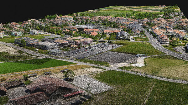
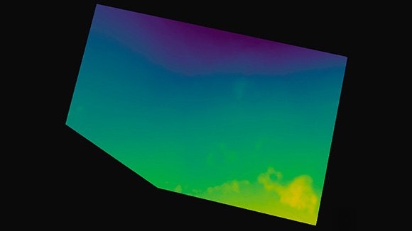
DroneDeploy deserves a close look when regular captures must support decisions across field, project-management and owner teams. The evaluation should include a second capture date, a reviewer and an administrator. A one-time map processed by one operator leaves much of the platform's potential value untested.
Separate individual pilot subscriptions from team contracts. The current Flight & Analysis plan has a single administrator, a stated per-map image limit and no ground-capture processing. Aerial, Aerial Pro and Unified offers use custom quotes. “DroneDeploy subscription” therefore does not establish multi-user access, 360 documentation or every advanced measurement function.
The single-user feature guide differentiates overlays, exports, cut/fill, thermal and extraction tools by plan. GCP access also has a documented individual per-map option; it is not accurate to say every controlled map always requires an enterprise contract. Get the exact rights and charges for your workload.
Make the reviewer part of the demo
Ask a site manager to find the latest accepted capture, compare it with the previous date, locate an annotation and identify the related drawing revision. Ask an external reviewer to do the same with their intended permissions. Measure whether they can complete the task without the processing specialist explaining each screen.
Then test a correction. Can the team distinguish a revised measurement from the original, and can it identify which surface and capture date were used? Decide who closes issues, approves reports and controls project access. A shared workspace creates value when those responsibilities are clear.
For organizations already using construction or GIS systems, prove the intended exchange during the pilot. Confirm whether you need a file export, a linked record, an automatic synchronization or a supported integration. The word “integration” does not specify which data moves, how often it updates or what happens when permissions change.

Designed for this guide
Follow the output through four gates
Evaluate the complete path before choosing the licence.
-
01
Capture
Aircraft, payload, controller and app
-
02
Process
Actual input files, metadata and licence
-
03
Validate
Reference system and independent checks
-
04
Use
Recipient import, access and accepted output
06 Pass four compatibility checks before procurement
- Capture: confirm aircraft, payload, controller, mobile operating system and application version. DroneDeploy's hardware list separates flight support from processing support. Uploading images successfully does not prove automated flight control.
- Processing: use the original files and necessary positioning metadata. State whether the input is imagery, raw LiDAR or a processed point cloud. A generic file-format match is insufficient when calibration, trajectory or sensor-specific reconstruction is required.
- Export: verify the exact licence can produce the needed files, resolution, reference system and metadata. Test the destination software and version. File creation and successful engineering use are separate outcomes.
- Authorization: confirm online activation, offline rights, device binding and concurrent use. Have IT approve the deployment and recovery method before a machine is isolated from the network.
In particular, desktop processing does not automatically mean a standard licence can run indefinitely without internet. PIX4Dmatic offline use requires a dedicated licence; its offline OTC licences are version-locked and hardware-bound, and offline trials are unavailable. Terra also distinguishes authorization modes and online functions. Test the purchased offline configuration, not an online trial with the network temporarily disconnected.
For remote sites, time the complete transfer from memory card to accepted output. Slow upload can dominate a cloud workflow; insufficient local storage can dominate a desktop workflow. Keep an approved fallback for a connection outage, a failed processing job and an unavailable operator. These are operating requirements to test, not reasons to assume one model is always better.
07 Acceptance starts with the deliverable, reference system and independent checks
Software does not make every dataset suitable for every measurement. Before comparing results, define the required area, surface, resolution and accuracy with the responsible reviewer. Separate visual completeness, positional accuracy and fitness for the proposed task; a result may pass one and fail another.
Keep the Canadian reference system explicit
Natural Resources Canada describes NAD83(CSRS) and CGVD2013 within Canada's reference systems. Your project still needs the exact frame realization, epoch where applicable, projection or local grid, vertical datum, geoid or transformation and units. An existing municipal or engineering project may have its own approved reference requirements.
Check input coordinates, processing settings and exported coordinates separately. Ask whether heights are ellipsoidal or referenced to the specified vertical datum. A horizontal EPSG choice alone does not resolve every height transformation. Open the output alongside agreed reference data and investigate any systematic offset before accepting it.
Control constrains; checkpoints test
Ground control used to adjust a reconstruction is not independent evidence of the resulting accuracy. Set aside independently surveyed checkpoints, with a distribution suited to the site and project specification. Agree their measurement method and uncertainty with the reviewer. Report horizontal and vertical residuals, bias and the required aggregate statistics, together with point count and any excluded points.
Use RTK or PPK status as part of the evidence, not the final acceptance statement. Check correction/base information and image positioning quality. Review blur, overlap, missing coverage, water, reflective surfaces, vegetation and moving equipment. Snow can change the surface being mapped; processing cannot recover ground that was never observed.
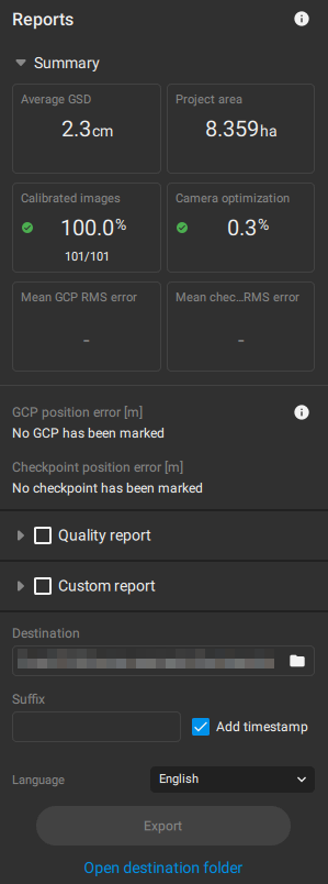
Pix4D's quality-report documentation separates control and checkpoint information. Its illustrative report below has green indicators for some processing checks while no GCP or checkpoint has been marked. That is a useful reminder: successful calibration does not establish independent positional verification or compliance with your client's acceptance criteria.
Read the evidence
Processing success is one check.
This official report illustration shows a result that calibrated, but it supplies no marked control/checkpoint evidence. In your project, retain the detailed report and the independent validation record.
Ask the reviewer to inspect the statistics, reference system, coverage and excluded areas before accepting a measurement deliverable. Use project-specific criteria rather than a universal “survey-grade” label.
Suggested checks to adapt to the client specification
| Deliverable | Inspect | Prove outside the processor |
|---|---|---|
| Orthomosaic | Coverage, seams, distortion, resolution, reference system and date. | Open the full-resolution georeferenced file in the recipient's GIS and check agreed reference locations. |
| Point cloud | Coverage, noise, classification, units and height reference. | Import the agreed LAS/LAZ format and verify classes, coordinates and independent check residuals. |
| DSM or DTM | Included surface, ground evidence, gaps, edits and interpolation. | Inspect critical profiles and compare elevations. A DSM includes elevated surfaces; a DTM requires a defensible terrain selection. |
| CAD vectors or surface | Required features, elevations, layers, boundaries and topology. | Have the designer use the delivered files in the actual project, without rebuilding undocumented transformations. |
| Volume or cut/fill | Boundary, base/design surface, capture date and exclusions. | Approve the calculation method and inputs; repeat the calculation or reconcile it against the agreed reference. |
| Shared project record | Dates, permissions, drawing revisions and annotation ownership. | Have the intended reviewer find, compare, comment on and retain the required record. |
Swipe horizontally to read the complete acceptance checklist.
08 Compare the cost of an accepted project
The snapshot below is a reference for asking for a quote, not an equivalent-package ranking. Prices use different currencies and licence scopes. Confirm taxes, billing term, device/seat rights, support, upgrades and any add-ons against the current written offer before purchase.
Public price references checked October 6, 2026
| Offer | Reference price | Scope to confirm |
|---|---|---|
| Terra Standard / SpeedyDrone | CAD 2,634 one year CAD 7,519 permanent |
Selected variant, authorization mode, device count and update/support terms. |
| Terra Flagship / SpeedyDrone | CAD 5,265 one year CAD 15,056 permanent |
Required advanced features and any separately licensed application. |
| PIX4Dmatic / official plans | USD 2,290 Analyst USD 3,990 Standard USD 4,990 Pro / year |
Annual billing, taxes excluded; reconstruction versus terrain/CAD scope and seats. |
| DroneDeploy / official plans | USD 4,188 Flight & Analysis / year Advanced and team offerings: quote |
Individual versus team rights, image limits, exports, ground capture and fair use. |
Swipe horizontally to read licence scope beside each price.
Price sources: the current Terra Standard and Flagship listings, Pix4D plans and DroneDeploy plans. Do not convert USD references with an undated exchange rate or treat a visible order option as a delivery-date promise.
Build a three-year estimate in CAD using the organization's purchasing assumptions. Include licence commitments, support/updates, workstations, working storage, backups, upload connectivity, cloud access, training and operator time. Include a contingency for reprocessing and re-exporting after a recipient rejects a file. State assumptions so the next renewal review can update them.
Then calculate cost per accepted project = allocated software and infrastructure cost + operator/review effort + required external work. Track elapsed turnaround separately. A desktop machine can run overnight while a cloud job waits for upload; neither clock alone measures staff effort or client value.
Do not assume a perpetual licence includes every future update, that a cloud plan includes every stakeholder, or that two overlapping subscriptions reduce work. Keep the smallest stack that delivers the required result reliably, and add a tool only when the pilot demonstrates a specific missing capability or a worthwhile reduction in effort.
09 Run a two-pass trial with one representative project
Agree the trial scope with the vendor before starting a trial clock. Use data you are authorized to upload and process. Select a manageable common dataset to compare the shared photo workflow; evaluate native LiDAR reconstruction separately when another platform cannot ingest the same raw input. Different starting inputs make a speed comparison misleading.
DJI's current Terra trial lasts one month, is limited to 500 photos and 8 GB of LiDAR data, runs on one computer and needs internet. These restrictions can exclude a full production dataset or an offline requirement. An evaluation subset can prove some functions, but a successful small trial does not prove capacity at project scale.
Pass one: prove fit
- Freeze the specification. Save the input-file list, control/checkpoint records, accepted reference system, required outputs, review criteria and destination software. Record the operator, software version and licence used.
- Complete the required workflow. Import, configure, reconstruct, inspect, edit and export. Use settings appropriate to the deliverable; identical menu choices across products need not be technically equivalent. Record any vendor assistance.
- Keep a repair log. Note failed imports, gaps, manual classification, reprocessing, drawing alignment and file conversions. Time hands-on work separately from unattended processing. Retain warnings instead of silently resetting the project.
- Have the recipient test the result. A CAD/GIS reviewer checks the export; a project reviewer checks access and history. Save specific acceptance or rejection reasons and the correction required.
Pass two: prove repeatability
Repeat the workflow with a second representative capture or another operator following the written procedure. For a progress platform, compare two dates and test access as a reviewer. For technical production, repeat the agreed validation and export steps. Assess whether the result depends on one experienced operator improvising undocumented fixes.
Now test the likely constraint: a larger dataset under an agreed evaluation arrangement, the intended offline configuration, several waiting projects or a corrected deliverable. Record what was actually tested. Keep an unresolved full-scale test as a condition of purchase rather than extrapolating from the small sample.
Trial decision: accept only when required outputs, reference system, independent verification, recipient use, turnaround and licence rights pass. Score ease of use and cost after those mandatory checks. A weighted score must not average away a failed requirement.
Use the same review sheet for every candidate: dataset, version, licence, machine/network, operator minutes, elapsed time, edits, validation result, recipient result, exported archive and unresolved conditions. Record “not tested” honestly. Keep vendor demonstration results separate from your own measured result; they answer different questions.
Designed for this guide
Capture record
Keep the originals
Images or sensor files
Positioning metadata
Control and checkpoint records
Production record
Keep the decisions
Version and settings
Edits and exclusions
Validation and approval
Recipient package
Keep the usable output
Accepted exports
Reference-system notes
Rights, history and access
10 Data control includes access, retention and leaving the platform
Start with the organization's actual policy and client contract. Identify what may be collected, uploaded, shared and retained. Ask for hosting and backup locations, subprocessors, support access, identity controls, audit records, deletion behaviour and the process for retrieving data at contract end. “Cloud” does not prove a specific residency arrangement; “local” does not prove that backups and support transfers stay in an approved environment.
Assign an owner for accounts, project permissions and the retained archive. Test an external reviewer invitation with the intended rights. Then revoke it and confirm access ends. Avoid sharing an operator account as a substitute for an approved team-access arrangement. Include onboarding and offboarding in the written workflow.
Export a complete sample archive while the plan is active
DroneDeploy's export documentation assigns formats to different subscription levels. It also identifies its OBJ output as model-local rather than georeferenced, and places source-image ZIP and RCP exports under enterprise access. Verify the exact entitlement and reference-system behaviour instead of assuming all data can leave in any chosen format.
Its single-user guidance says cancellation leaves basic viewing temporarily while export and advanced tools are disabled. Finish exports before the paid entitlement ends; do not rely on a viewing grace period to retrieve deliverables. Confirm the applicable retention and recovery terms through the contract and current billing guidance.
The same archive discipline helps a desktop team. Keep the original inputs, required project files, accepted neutral-format exports, processing/version notes, control/checkpoint evidence and approval record. Have someone reopen the archive from its backup location. A copied folder is not a proven recovery method until its required files and dependencies can be found and used.
11 Use a hybrid stack only when each handoff has a purpose
A single platform is not compulsory. A hybrid workflow can fit an organization with both technical deliverables and repeated stakeholder reporting. Define the authoritative dataset, the owner of each step and the acceptance test at every handoff. Otherwise, multiple systems can preserve different versions of the same job.
DJI reconstruction followed by terrain/CAD work
A proposed workflow might reconstruct DJI sensor data in Terra, export a validated point cloud, and use a separately licensed production tool for required editing or extraction. Prove the actual import and licence rights first. Compare the extra handoff with completing the same task in Terra; the second tool should solve a documented gap or save enough effort to justify its cost.
Technical files plus a shared project workspace
An engineering team may deliver accepted files while a project-management team maintains a recurring visual record. Clarify which exports or overlays the shared platform can accept. Do not assume another processor's project folder can become a native cloud project. Label technical deliverables, progress references and revised outputs so reviewers know what they are using.
For a smaller contractor, one trained operator and a suitable portal may meet the whole reporting requirement. For a geospatial production office, local software and export delivery may be sufficient. For sensitive infrastructure, approved data handling can eliminate a candidate before feature scoring. Choose around the actual recipient and constraint, and revisit the decision when either changes.
Crop analysis, thermal diagnostics, urgent incident response and legal boundary work also require specialist requirements outside this general comparison. A software licence does not establish flight authorization or professional authority. Bring the responsible specialist into the specification instead of extending a general mapping recommendation to every service.
Reusable project brief
12 Copy this specification into your demo or quote request
- Work and recipient
- Project type, province/site context, capture frequency, reviewing team and downstream software/version.
- Input and scale
- Aircraft/payload, image or sensor data, representative and largest expected dataset, original file formats and positioning records.
- Output and reference
- Required files/portal functions, resolution, horizontal frame/projection, units, vertical datum/geoid or local transformation.
- Acceptance and turnaround
- Reviewer, independent checks, agreed criteria, critical surfaces/features, correction process and delivery deadline.
- Deployment and access
- Workstation/network, online/offline requirement, operators, concurrent seats, internal and external reviewers, approved data environment.
- Licence and retention
- Exact product/plan, term/currency/tax, support/updates, limits/add-ons, archive requirements, export rights and contract-end retrieval.
- Evidence requested
- One completed sample, recipient-tested exports, validation record, hands-on/elapsed times and written unresolved conditions.
Keep the completed brief with the trial record and final quote. At renewal, compare changed workload, staffing, hardware, client requirements and licence terms against that original decision. This creates a useful operating resource instead of another feature-ranking document.
Mapping software questions Canadian teams ask
Which is the best mapping software for a Canadian drone team?
Use the required deliverable and recipient to shortlist. Terra is a sensible first evaluation for DJI reconstruction; PIX4Dmatic merits comparison for desktop geospatial production; DroneDeploy merits evaluation for shared recurring project records. Each recommendation is conditional on the exact plan. Give every candidate the same output specification and require a complete sample, independent verification where measurements matter, a recipient import/access test and a retained archive. The lowest price or most attractive demonstration does not resolve those requirements.
Can DJI Terra process third-party camera imagery?
DJI's current feature list includes third-party camera data, so describing Terra as strictly DJI-only is inaccurate. That support does not establish that every camera, metadata record or intended output will work. Test the actual files and control workflow. LiDAR is a separate question: the documented Terra import restriction is DJI Zenmuse LiDAR. Keep raw sensor reconstruction distinct from a downstream tool importing an already processed point cloud, and confirm the software version and licence for the complete job.
Which PIX4Dmatic plan should we compare?
Match the plan to your production steps: reconstruction, terrain/CAD work or both. Confirm each required output on the current plan matrix, then test it. Legacy PIX4Dmatic and PIX4Dsurvey owners should also obtain a written migration and seat explanation before renewal. Do not use an extraction-focused entry price as the price of a complete reconstruction-and-delivery workflow. Include any separately licensed cloud layer only if its actual processing or sharing rights are needed by your team.
Does RTK mean we can skip independent checkpoints?
RTK can improve image positioning, but it is not an independent test of the finished deliverable. Agree control and checkpoint strategy with the responsible reviewer, considering site geometry, measurement uncertainty, required surface and acceptance criteria. Keep validation points separate from points used to adjust the result. Retain residuals, relevant statistics and exclusions with the reference-system record. A small ground sampling distance, good positioning status or successful reconstruction should not replace the agreed result-verification method.
Can these applications operate without internet?
Separate field capture, local processing and licence authorization. Terra and PIX4Dmatic have specific offline licensing paths; a normal online licence or trial is not evidence that an isolated processing machine will remain authorized. Confirm activation, machine binding, version/update rights and recovery before deployment. DroneDeploy cloud processing and stakeholder access require an approved connectivity plan. Test the full purchased configuration in the intended environment, including how the team responds to an outage or failed machine.
Are cloud maps enough for a CAD or GIS deliverable?
A web map can be useful for review while a technical recipient still needs specified exports. Agree format, reference system, units, resolution, classification or geometry and relevant metadata. Confirm the subscription permits those exports. Have the recipient open a complete sample in the actual destination software and check its use in the project. Keep source and processing records alongside the accepted files. A share link or screenshot is sufficient only when it satisfies the agreed deliverable.
How should we compare software prices in Canada?
Put written offers in the same currency and comparison period using your purchasing assumptions. Match functional scope, operators and reviewers before adding workstation, storage, support, training and hands-on effort. Record taxes and exchange-rate assumptions rather than silently converting a public USD figure. Review the dated price table as a starting reference and confirm the current selected variant. Compare cost per accepted project and turnaround; a cheaper licence can be costly when it requires another application or extensive cleanup.
When does a hybrid software stack make sense?
Use two tools when each has a proven role: a specific reconstruction requirement, a justified production capability or a useful sharing layer. Test file/reference-system exchange and permissions before purchase. Name the authoritative dataset and owner at every step, and measure duplicated processing, storage and subscriptions. Retain the production and approval records so reviewers can identify which version was accepted. If one tool already delivers the required result efficiently, adding another may create more handoffs than value.
Keep the evidence beside the decision
Primary feature, plan, hardware and export sources are linked beside the claims above. Recheck those sources and the final quote before buying or renewing; a dated public comparison cannot establish future licence terms.
For related Canadian equipment and deployment planning, see SpeedyDrone's surveying and mapping solutions. This comparison owns the software-selection question; a hardware or flight-program decision needs its own brief.
Send your aircraft/payload, sample-data type and size, required outputs, reference system, province/site context, operators/reviewers and online/offline requirements. Include the client acceptance criteria and downstream software.
Use that brief to discuss DJI Terra licensing and the wider mapping setup with SpeedyDrone Canada. Ask for the exact edition, authorization, device count, support and current offer in writing, and use the same specification when speaking with other software vendors.
Bring the project specification


