


Bridge inspection drones collect three different kinds of evidence: zoom images document visible surface conditions, thermal images screen temperature patterns, and LiDAR records three-dimensional geometry. Choose the sensor around the inspection question and the evidence the bridge owner needs.
A useful drone survey connects every finding to a component, preserves the source files and identifies areas that could not be inspected. It supports the responsible inspection and engineering team; it does not independently establish load capacity, confirm hidden deterioration or replace required hands-on testing.
This guide helps Canadian bridge owners and inspection teams scope a mission, select suitable equipment, check data quality and specify an actionable handoff. A visual documentation task may need only RGB imagery. Thermal screening or a controlled geometry survey belongs in the scope when it answers a separate, defined question.
Technical and regulatory sources checked October 6, 2026. Planning templates below should be adapted by the bridge owner and qualified professionals.

In this resource
1. Define the inspection question before the flight
Start with the decision the owner needs to make. “Inspect the bridge” is too broad to establish coverage, evidence quality or acceptance. A request to document visible coating loss on selected girders differs from thermal screening of a concrete deck or a survey supporting clearance assessment.
The responsible inspection lead should identify the applicable inspection framework, required components, known findings and areas requiring close access or specialized testing. The flight team then determines which evidence can be collected safely. Where a drone cannot provide the required view or measurement, record the gap and agree on another access method.
A mission brief the whole team can use
- Asset and purpose: bridge identifier, location, inspection type and the decision this collection supports.
- Coverage: spans, component identifiers, sides and faces; exclusions and priority locations from previous reports.
- Evidence: required images, radiometric files or spatial outputs, plus how their quality will be assessed.
- Site constraints: traffic, pedestrians, rail or marine activity, airspace, access permission and recovery locations.
- Responsibility: flight lead, inspection lead, data processor, reviewer and owner who accepts the deliverables.
Agree on a small trial collection before committing to the entire bridge. Have the intended reviewer inspect representative images or a sample model. An early acceptance check can reveal unreadable details, incompatible files or missing component identifiers while the capture plan can still be changed.
From an inspection question to a reviewable record
- 01ScopeName the component, question and required evidence.
- 02Check accessConfirm permissions, safe capture positions and recovery.
- 03Collect + checkReview sample quality and log incomplete coverage.
- 04Review + actLink findings to sources and assign follow-up.
2. Match each sensor to the evidence it can provide
Zoom, thermal and LiDAR are complementary tools. Buying all three does not make an inspection complete. Specify what each sensor is expected to establish, which conditions support that result and which questions remain outside its capability.
| Evidence type | Useful question | Expected output | Boundary |
|---|---|---|---|
| Zoom / RGB | What visible surface condition should the inspector examine? | Located context and detail photographs. | Visibility depends on pixels, focus, light and viewing angle; concealed surfaces remain unknown. |
| Radiometric thermal | Where does the surface show a temperature pattern worth investigating? | Original radiometric images, visible pairs and capture conditions. | A thermal anomaly has more than one possible cause. It is not a confirmed structural diagnosis. |
| LiDAR | What geometry and spatial context can be measured within the validated survey? | Registered point cloud, reference system and accuracy evidence. | Occlusion and positioning affect coverage; density does not establish measurement accuracy. |
| RGB photogrammetry | How can the visible structure be represented and navigated in 3D? | Textured model or suitable image-based mapping outputs. | Texture, lighting, image overlap and reconstruction gaps affect the model. |
On smaller screens, scroll within the table to read all columns.
For a recurring corrosion-photo record, a controlled RGB workflow may be the sensible starting point. For a geometry baseline, survey planning and processing become central. Add thermal when the owner has a defined screening question and an interpretation method. These are selection examples, not universal recommendations for every bridge.
A hybrid record can place a detail photo or thermal observation in a spatial model. That relationship is useful only when the location is reliable and the original evidence remains accessible. A visually convincing model should never obscure weak capture conditions or missing inspection faces.
3. Build a coverage register by component and face
Coverage should follow the owner’s component inventory. A single orbit around the bridge does not show all girder faces, bearings or hidden connections. Divide the asset into reviewable locations and track whether the required evidence was captured, needs another pass or requires another method.
| Component | Potential drone evidence | Check or record |
|---|---|---|
| Deck and joints | Visible cracks, spalls, joint condition, drainage and a scoped thermal survey. | Traffic restrictions, surface state, shade and areas obscured by vehicles or debris. |
| Soffit and girders | Surface condition, coating loss, visible connections and contextual geometry. | Each required face; darkness, occlusion and whether detail is actually resolved. |
| Bearings and seats | Located views of accessible hardware, debris and visible condition. | Hidden contact faces and locations requiring close access or testing. |
| Piers and abutments | Visible cracking, exposed material and above-water geometry. | Wet surfaces, reflections, vegetation and the boundary of submerged areas. |
| Cables and hangers | Visible surface or attachment details from suitable angles. | Obstructed faces and the limits of imagery for concealed or internal deterioration. |
| Approaches and banks | Surface/terrain context and exposed erosion features. | Water level, survey extent and locations needing underwater investigation. |
Planning examples; use the owner’s actual inventory and inspection requirements. Scroll to read every column.
Use explicit coverage states such as captured and reviewable, captured but inadequate, not visible and follow-up required. Avoid interpreting a blank field as “no defect.” Record why a location was missed and who will resolve it.
For water-related concerns, distinguish exposed erosion from submerged scour. Images and aerial geometry can document visible banks and foundations, but they do not establish the unseen riverbed or submerged footing condition. Specify an appropriate underwater investigation separately when the inspection question requires it.
4. Capture zoom imagery that survives engineering review
Zoom is useful when it provides a clear view from a suitable capture position. The practical quality test is whether the intended feature is resolved in the original image. Magnification alone does not establish that a crack can be measured or that a connection has been adequately inspected.
DJI specifies 34× hybrid optical zoom and a maximum zoom of 400× for the H30 Series. Treat extreme magnification as an aid to locating a feature, then check the actual evidence for sharpness, detail and scale. Do not derive a minimum detectable crack width from the zoom number.
Build a linked image sequence: an overview identifies the bridge and span, a component view identifies the member or connection, and a detail view shows the observation. Keep stable identifiers across these views. A tightly cropped defect photograph without context can become difficult to locate during review or a later return visit.
Check the files before leaving the site
Review representative originals at full resolution. Check focus, motion blur, clipping, glare and whether shadow hides the relevant surface. Confirm that the agreed location and scale information are present. If dimensional measurement is needed, have the responsible professional define an appropriate calibrated method; a laser range readout alone does not validate crack-width measurement.
Capture another angle where it adds evidence rather than more near-duplicates. A second view may clarify whether an apparent line is a shadow or visible surface feature. Preserve originals alongside annotated review copies so that markings, cropping and compression do not replace the underlying record.
Use prior routes and viewpoints as references for repeat collection. Check them against the current site before reuse: traffic, temporary works, vegetation and access can change. Similar framing aids comparison but does not itself prove that a physical defect has changed.
5. Treat thermal anomalies as screening evidence
Thermal inspection records surface radiation and temperature patterns. Under suitable conditions, those patterns can help direct follow-up for concrete deterioration. The interpretation depends on the heating or cooling history, surface state and inspection method; a coloured patch is not sufficient evidence of delamination.
FHWA’s infrared thermography guidance explains that passive thermal contrast depends on favourable environmental conditions. Water, debris and other surface changes can complicate interpretation, and the technique does not provide flaw depth. This is technical background, not a Canadian inspection approval or a guarantee for a particular drone.
Have the qualified reviewer define the collection window and acceptance conditions for the asset. Record weather, solar exposure, shade, recent precipitation, surface condition and capture time. Do not assume that a method suitable for a sun-exposed deck transfers unchanged to a shaded soffit.
A thermal finding needs two checks
Was the collection interpretable?
Retain radiometric originals, settings, visible image pairs and the environmental record. Identify surfaces and conditions outside the agreed method.
What corroborates the observation?
Compare context and visible evidence. Record alternative explanations and the follow-up selected by the qualified inspection team.
The Zenmuse H30T records 1280×1024 thermal photos and supports R-JPEG files for analysis with DJI Thermal Analysis Tool 3. Preserve these files rather than handing over palette screenshots alone. A screenshot can illustrate a report but cannot substitute for the original radiometric data and settings.
Separate concrete screening from inspections of bridge lighting, cabinets or movable equipment. These have different target conditions and may require electrical or mechanical expertise. The review record should identify what was inspected, who interpreted it, what remains uncertain and whether another method is needed.
6. Validate LiDAR geometry before comparing change
LiDAR is useful for a spatial baseline, visible structural geometry, approaches and terrain context. It can support clearance or repeat-survey questions when the collection and accuracy assessment are appropriate to the required measurement. It is not a substitute for detail imagery of small surface defects.
Close access has a sensor limit. DJI lists a 10 m minimum effective detection distance for Zenmuse L3. Check whether a feasible scan position can cover the target within the sensor’s effective range. This value is a measurement specification, not a safe flight separation or permission to operate.
A near-surface photograph and a LiDAR scan may need different routes. Scan angles, returns, trajectory quality and occlusion must be considered together. Decks and girders can hide surfaces from the scanner; a dense point cloud of the visible side does not establish coverage of the reverse face.
Published accuracy is not a deformation threshold
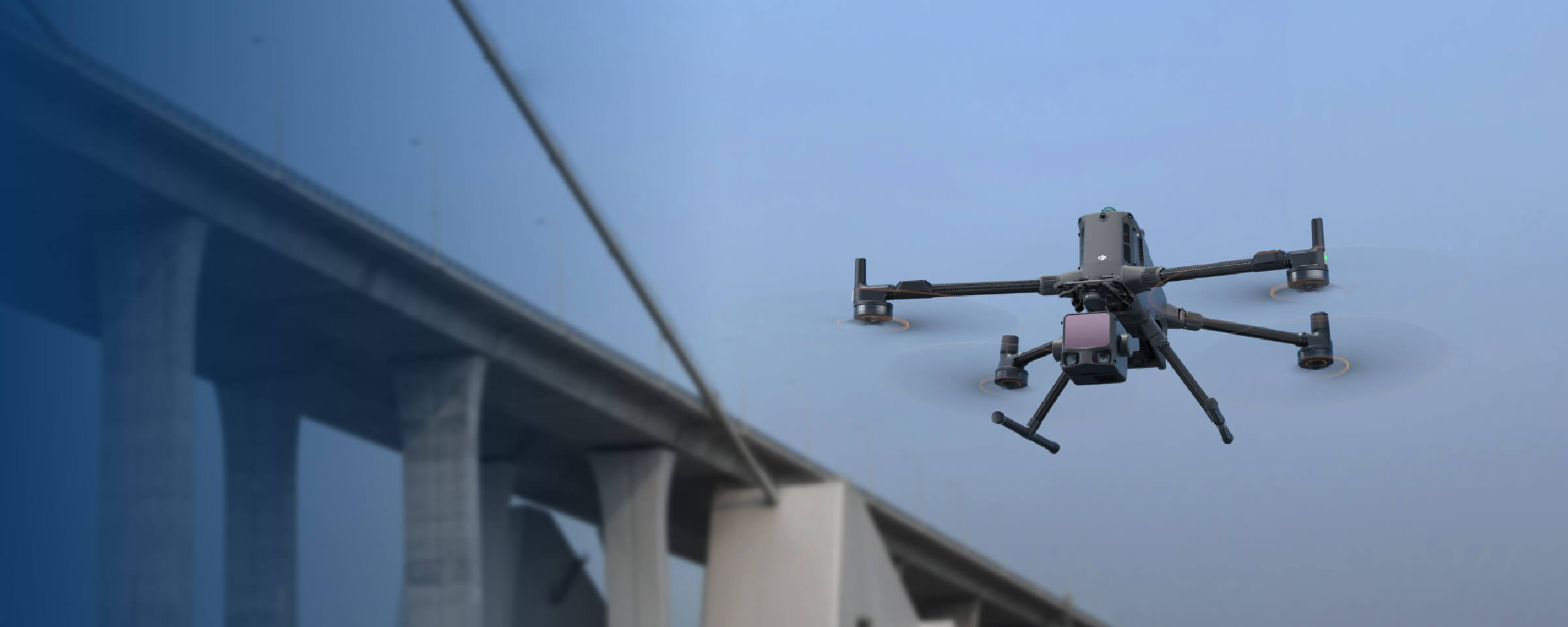
DJI reports L3 system accuracy of 3 cm vertical and 4 cm horizontal RMSE at 120 m under specified laboratory conditions. The published test includes defined flight geometry, calibrated positioning, checkpoints and processing. It does not establish the accuracy of a GNSS-obstructed bridge survey or the smallest change a repeat inspection can detect.
Agree on coordinate and vertical reference systems, control, independent checks, registration and processing documentation before collection. For repeat surveys, assess the uncertainty of both datasets and their alignment before calling a difference physical movement. A colour difference map can show registration error as well as actual change.
Preserve unmodified source data and distinguish it from classified clouds, cleaned models and presentation exports. DJI lists Terra export formats including LAS and LAZ for L3 point clouds. Confirm that the owner’s software can open the chosen format with its required coordinates and metadata; test a sample import before final delivery.
Keep holes, low-confidence areas and exclusions visible in the record. A cleaned mesh can help navigation and communication, but cosmetic completeness must not become false evidence of a measured surface. If the required accuracy or coverage cannot be demonstrated, state the limitation and refer the question to an appropriate survey method.
7. Plan under-bridge access around recovery and visibility
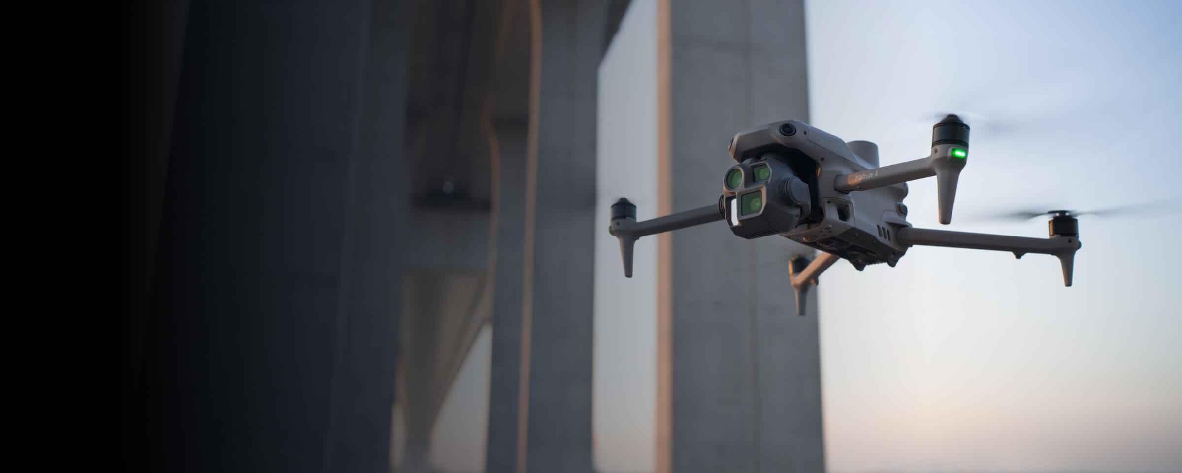
Under-bridge inspection changes the operating environment. The structure can obstruct satellite reception, sight lines and command links. Close members, dark surfaces, water and changing wind complicate access. Onboard sensing may assist the pilot, but it does not establish that every opening is navigable or every thin obstacle will be detected.
Define how the aircraft will enter, leave and recover before attempting the collection. Check the aircraft manual, installed payload, positioning modes and actual control settings. A generic return-to-home path that rises toward a deck may be unsuitable beneath a structure; recovery behaviour must be assessed for the specific operation.
A site-specific go / no-go discussion
- Positioning and link: identify where reception or visibility may degrade and how the crew will monitor and respond.
- Clearance: assess the entire aircraft and payload envelope, not only the camera’s view.
- Recovery: identify usable landing/recovery areas and the response to lost link, positioning degradation or unexpected traffic.
- People and access: confirm the protected operating area and the required road, rail, pedestrian or marine coordination.
- Coverage fallback: name the surfaces needing another platform, ground viewpoint or approved access method if flight is unsuitable.
The inspection lead and flight lead should agree on stopping conditions, including loss of reliable control, inadequate clearance or an operating area that can no longer be maintained. The exact criteria belong in the site plan and applicable procedures; this guide does not prescribe a universal wind, GNSS or distance threshold.
Log an inaccessible bearing or soffit face as a coverage gap. Do not continue simply to complete a route or buy a smaller aircraft on the assumption that it resolves the operating problem. Sometimes another access method is the more appropriate way to obtain the required evidence.
8. Separate flight authority from inspection requirements
Canadian aviation requirements and the bridge owner’s inspection requirements answer different questions. The flight team must establish a lawful operation for the actual aircraft, site and people involved. The responsible inspection team determines whether the resulting evidence meets the asset’s inspection requirements.
Flight category, airspace and people
Transport Canada’s Advanced guidance includes small-drone sheltered and extended visual line-of-sight (EVLOS) operations. These have specific conditions; being beneath a bridge is not, by itself, an exemption from visual-line-of-sight or people-separation requirements.
For sheltered operations, the current guidance specifies no more than 30 m above the structure, within 61 m horizontally of it, within 3.7 km of the pilot and control station, and at least 30 m horizontally from uninvolved people. The pilot and control station must be at the designated launch/recovery site during those activities. Check the applicable aircraft declaration and controlled-airspace requirements as well.
EVLOS applies to small drones in uncontrolled airspace with a qualified visual observer, at least Basic-certified, the required 30 m separation from people and the stated 3.7 km distance limits. Read the complete Transport Canada Advanced operating conditions for the planned mission.
Do not treat Advanced certification as general BVLOS authority. Level 1 Complex operations have separate pilot, aircraft and operating conditions, including an RPAS Operator Certificate (RPOC). Operations outside prescribed categories may require an SFOC-RPAS. Establish the correct pathway before promising access or an unattended mission.
Owner access and provincial inspection frameworks
Flight authority does not provide property access, traffic control, rail protection or marine coordination. Confirm the owner’s permissions and restrictions separately. A public bridge can involve several stakeholders even when the take-off point is accessible.
In Ontario, O. Reg. 104/97 requires at least one inspection in every second calendar year under a professional engineer’s direction and in accordance with OSIM, subject to the regulation’s provisions. This is not a national schedule or a rule that drone imagery alone satisfies the inspection. Alberta’s bridge-management system has its own inspection processes. Identify the applicable owner and jurisdiction before defining the drone-supported scope.
9. Specify a handoff the owner can accept and reuse
The deliverable should connect observations, original evidence, coverage and next actions. A video montage or navigable model may help communicate the work, but neither is a sufficient substitute for a traceable inspection record. Agree on the deliverable structure and acceptance checks before the field visit.
A practical finding record
Use the owner’s required format where one exists. A proposed starting record includes: bridge and component ID; span, side and face; observation; context and detail file references; capture date; reviewer; interpretation limits; required follow-up; and acceptance status. Keep an observation such as “visible coating loss in image set” distinct from its engineering significance.
Use stable identifiers across the register, image filenames and model annotations. For example, an explicitly illustrative identifier such as BR-01 / Span-02 / Girder-03 / East face can link an image set to a coverage entry. It is an organizational example, not a real bridge finding or a mandated naming convention.
| Package | Include | Acceptance question |
|---|---|---|
| Scope + coverage | Mission brief, component register, exclusions, inadequate views and follow-up owner. | Can the reviewer distinguish inspected, unresolved and inaccessible locations? |
| RGB evidence | Originals, located context/detail pairs and separate annotated copies. | Can the feature be read and located without relying on a compressed report image? |
| Thermal evidence | Radiometric originals, visible pairs, settings, environmental record and interpretation. | Are the collection conditions and uncertainty clear? |
| Spatial evidence | Source/processed datasets, reference systems, control, checks, registration and coverage limits. | Is the geometry fit for the stated measurement and usable in the owner’s software? |
| Review + archive | Findings, reviewer/acceptance status, processing versions, actions and storage/access arrangements. | Can a future team reconstruct what was observed, changed and accepted? |
Designed as a starting checklist for this guide. Adapt it to the contract and professional review requirements.
Assign someone to check file completeness, identifiers and readability separately from interpretation. Retain processing settings and software versions where they affect reproducibility. Record which dataset was accepted and preserve a clear relationship to subsequent corrected or reprocessed versions.
Agree on ownership, retention, access permissions and export rights before using a cloud platform. Sensitive infrastructure data may have owner-specific restrictions. The Canadian enterprise drone data-security checklist provides a separate procurement discussion for those requirements.
10. Choose the system after the scope is accepted
A Matrice 400 workflow can support H30T visual/thermal collection and L3 geometry collection, but these are different evidence tasks. Ask for a configuration matched to the approved mission rather than assuming every payload is required or that a package includes the full inspection workflow.
For visible-condition documentation with thermal screening, assess the H30T’s capture and analysis workflow. For a geometry baseline, assess L3 range, positioning, processing and quality verification. When both are needed, plan how their outputs will be associated and reviewed; do not assume both payloads must be used simultaneously.
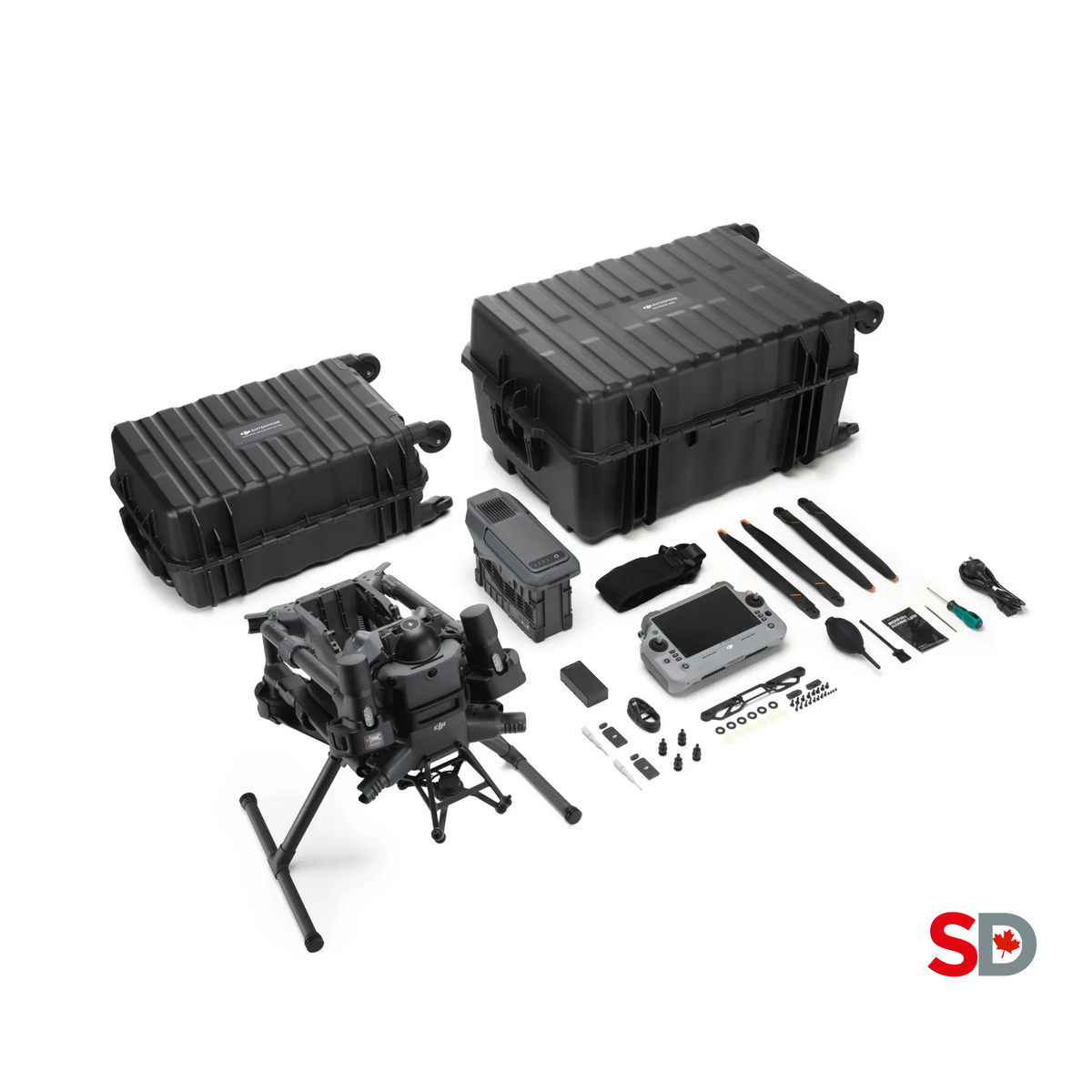
Matrice 400 SP Plus Full Package
Aircraft platform for the verified H30T and L3 workflows. Confirm the required payload, connector, charging and software configuration in the quotation.
View at SpeedyDrone →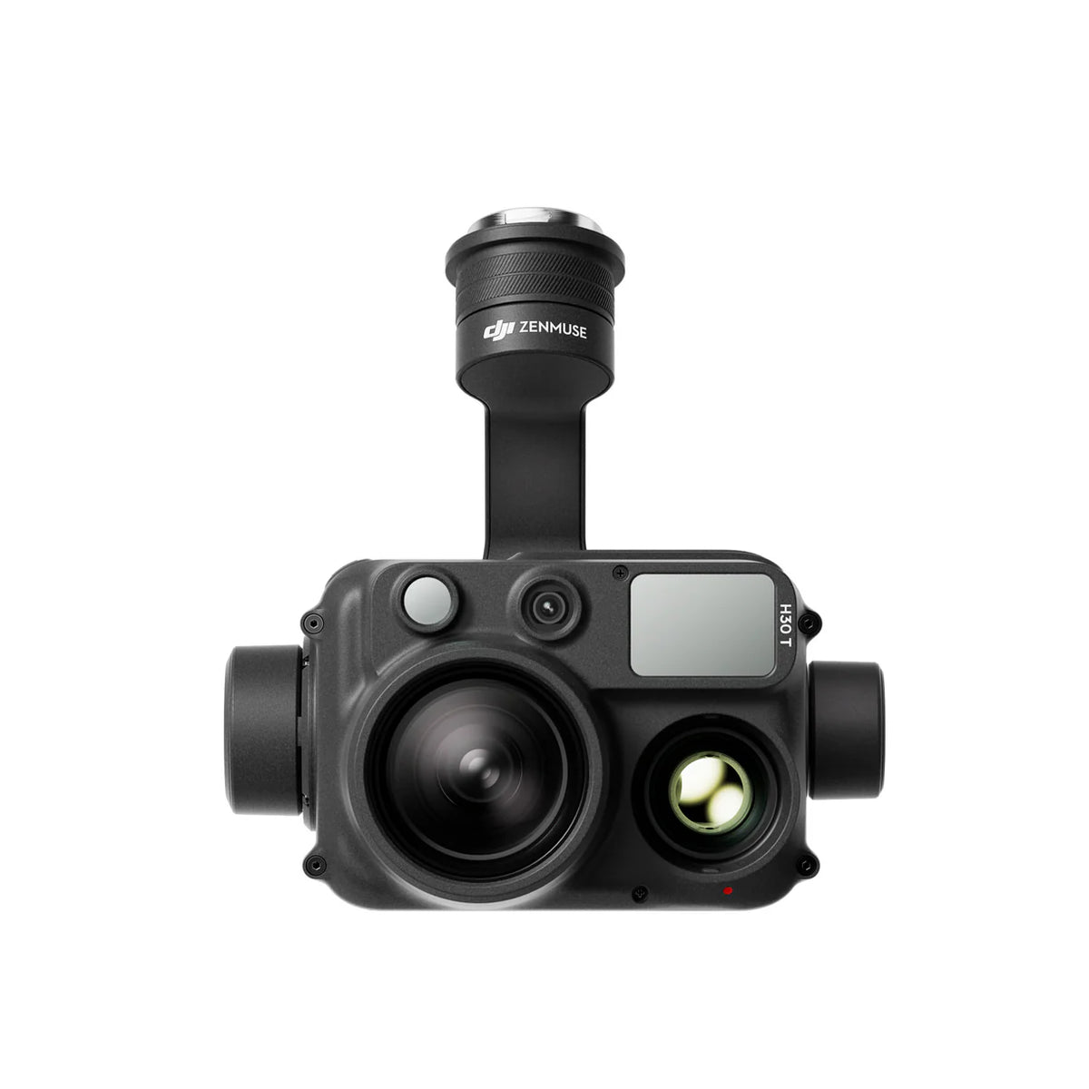
Zenmuse H30T
Zoom and radiometric thermal evidence in one payload. Check that the quote specifies H30T when thermal capture is required, rather than the non-thermal H30.
View at SpeedyDrone →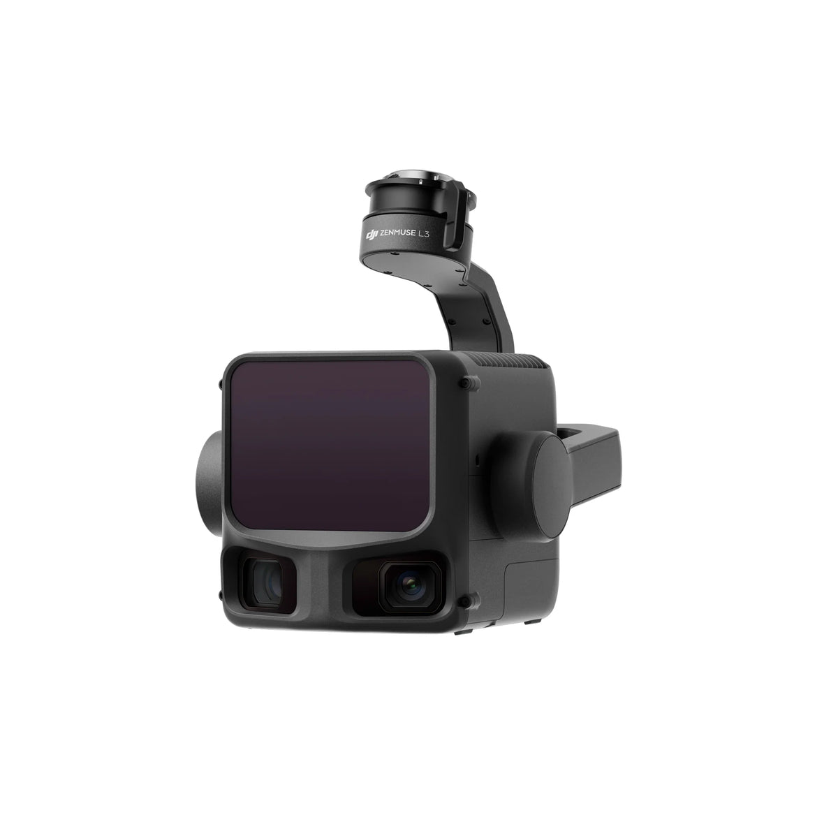
Zenmuse L3
LiDAR geometry collection on Matrice 400 with the required L3 single gimbal connector. Validate usable range, coverage and accuracy against the project.
View at SpeedyDrone →Budget for accepted evidence
Compare the cost of a complete, accepted dataset: aircraft and payloads, batteries and charging, positioning/control, software, processing hardware, storage, maintenance, crew, permissions, traffic/access arrangements and professional review. Include recollection and alternative access for unresolved components. A hardware price alone cannot establish the cost of completing the inspection.
Confirm the processing edition and licence terms for the required data. DJI Terra processes L3 data, while radiometric thermal review uses a separate analysis workflow. The DJI Terra Flagship listing provides a current procurement path; confirm the selected licence term and whether its online or offline option fits the owner’s environment. Software purchase or model cleanup does not establish engineering acceptance.
A useful pilot has an owner-defined acceptance test: collect representative components, open the files in the owner’s environment, evaluate coverage and quality, and record the actual time needed for processing and review. Use that result when deciding whether to bring the capability in-house or commission a scoped service. The complete Canadian drone-program budget guide supports the broader ownership discussion.
Bridge inspection drone FAQ
Can a drone replace a required bridge inspection?
Drone collection can contribute evidence to an inspection, but the responsible owner and qualified professionals determine whether the method meets the required scope. Some components may need close access, sounding, testing or another investigation. Define those requirements before collection, and deliver a coverage register so inaccessible or inadequate views remain visible. A drone report should not present absence of a visible defect as proof of structural safety.
Do we need zoom, thermal and LiDAR for every bridge?
No. Start with the decision and required evidence. A repeat photographic record may need only suitable RGB imagery. Thermal belongs in a defined screening workflow with interpretable conditions and qualified review. LiDAR belongs where spatial geometry or a controlled baseline is required. Select additional sensors because they answer another question, and account for their processing and review costs.
Can zoom imagery measure a small crack?
A crack may be visible without being reliably measurable. Pixel coverage, focus, motion, viewing geometry and calibration matter. Agree on the required measurement method with the responsible professional and verify representative originals before completing the mission. The H30 Series’ advertised zoom does not establish a minimum crack width that can be resolved or a measurement tolerance for a particular bridge.
Does a thermal anomaly confirm concrete delamination?
No. Temperature contrast may support screening under suitable conditions, but surface state and environmental history can create other explanations. Preserve the radiometric original, visible pair and capture conditions. The qualified inspection team should interpret the observation and select corroboration where needed. Passive infrared thermography does not independently establish flaw depth or justify a structural conclusion from a palette screenshot.
Can Zenmuse L3 scan very close to a girder?
DJI lists a 10 m minimum effective detection distance for L3. Assess the proposed scanning geometry against that limit and the required coverage. A location accessible for a close photograph may not provide a suitable LiDAR scan. The sensor specification is distinct from safe operating separation; flight feasibility, permissions and recovery still require their own assessment.
Can repeated point clouds prove that a bridge moved?
A repeat survey can support change analysis when its uncertainty and registration are appropriate to the question. Compare reference systems, control, independent checks, processing and alignment across both epochs. A difference map alone cannot separate physical movement from measurement or registration error. Have the responsible survey or engineering professional establish the method and the significance of any reported change.
Can aerial LiDAR inspect underwater scour?
The aerial bridge workflow described here does not establish submerged footing or riverbed geometry. It can document exposed banks and above-water features. When submerged scour is part of the inspection question, specify suitable underwater methods and qualified interpretation separately. Do not present an apparently complete aerial model as evidence that the underwater portion has been examined.
Is under-bridge flight automatically a sheltered operation?
No. Sheltered operation is a defined Canadian operating pathway with aircraft, location, separation and other conditions. Assess the actual mission against the current Transport Canada requirements and the applicable airspace/declaration. Also assess control, positioning and recovery beneath the structure. An aircraft that technically fits through an opening does not, by that fact, have legal authority or a safe recovery plan.
What should we require beyond a 3D model?
Require the scope and coverage record, located original evidence, relevant thermal or spatial metadata, documented quality checks, review status and follow-up actions. Preserve source and processed datasets separately. Test that the owner can open the files and relate a model annotation to its evidence. A presentation model is helpful for navigation, but its appearance does not prove measurement accuracy or complete inspection coverage.
What should we send when requesting a system quotation?
Send the bridge type and owner, target components, inspection questions, known access constraints, required deliverable formats, review/acceptance method and procurement timeline. Identify who will fly, process and interpret the data. That information helps define hardware and software needs and exposes tasks that may require a different access method or external professional support. Request exact package inclusions and current terms before committing.
Sources and further reading
Manufacturer documentation supports equipment capabilities. Government sources support the operating and inspection context. The checklists in this guide are editorial planning aids.
- DJI Enterprise bridge-inspection solution — manufacturer workflow context and promotional imagery.
- DJI Zenmuse H30 Series specifications and analysis tools and downloads.
- DJI Zenmuse L3 specifications — effective range, compatibility, accuracy test conditions and formats.
- FHWA infrared thermography guidance — technical background and limitations.
- Transport Canada Advanced operations, Level 1 Complex operations and special operations.
- Ontario Regulation 104/97: Standards for Bridges and Alberta bridge-management and inspection resources.
General planning information. Follow the bridge owner’s current requirements and the direction of qualified inspection, engineering, survey and aviation professionals.
Bring your inspection scope to the system discussion
Send the bridge type, target components, access constraints and required evidence. Discuss the Matrice 400, H30T or L3 configuration that fits the collection task, with engineering review and acceptance responsibilities identified separately.


