


FlightHub 2 · Field reference
From a live view
to a shared location.
DJI Dock 3 3D drawing: what laser lines and areas add, how map annotations fit, and what still needs verification.

Dock 3 utility setting from the SpeedyDrone product gallery. Illustrative product imagery, not a SpeedyDrone field test.
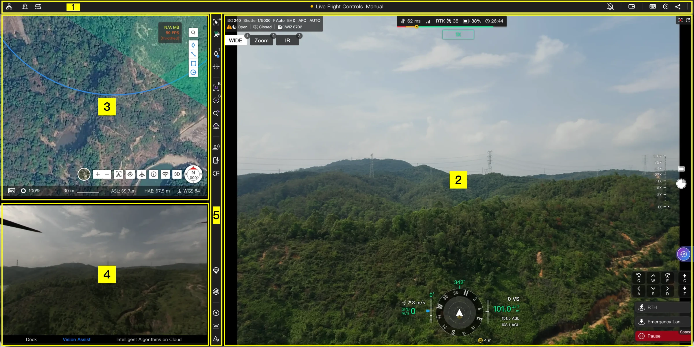
DJI Dock 3 now supports creating 3D lines and areas through laser pointing in FlightHub 2’s Virtual Cockpit. DJI’s English public release notes list the addition under September 23, 2026, and confirm that completed drawings can be viewed in map annotations.
The practical question is no longer just “Where is that target?” It is “Which stretch or zone are we discussing?” A point can identify a pole; a line or area can describe an observed extent. That could make a remote inspection handoff clearer than a screenshot with a circle drawn on it.
There are important limits. DJI’s announcement does not provide a complete button-by-button procedure, a survey accuracy specification or an unconditional promise that every new drawing will appear in Dock 3’s AR view. This guide separates the confirmed feature from a suggested team workflow and the checks still needed on your installation.
What actually changed?
The new capability concerns where geometry is created: a remote Dock 3 operator can use laser pointing inside the Virtual Cockpit to draw a line or area. It is more specific than “FlightHub 2 has annotations,” which was already true.
The timeline matters. DJI’s July 30, 2026 entry had already described creating spatial lines and surfaces on the map, with map and cockpit AR viewing. The September 23 entry adds the Dock 3 laser-based creation path. These are related developments, but they are not the same release or identical compatibility claims.
The same July entry contains Change Detection Pro improvements. Those should not be presented as part of the September drawing launch, or as proof that a hand-drawn area automatically becomes a change-detection task or report. See the official FlightHub 2 public release notes for the dated feature record.
Pin Drop, Ranging and 3D Drawing are different tools
Start with the information you need to hand over. If the next person only needs one location, a point may be enough. If you need a target reading, ranging answers a different question. The new drawing workflow is for describing spatial extent.
On a phone, scroll the comparison horizontally.
| Tool | Documented output | Practical distinction |
|---|---|---|
| Laser Pin Drop | A point annotation at the screen-centre target. | Mark a single location, such as an asset needing attention. |
| Laser Ranging | Target latitude/longitude, altitude and distance to the aircraft. | Read target information; this is not a line or area drawing by itself. |
| 3D Drawing | Laser-based 3D lines and areas, viewable in map annotations. | Describe an observed extent for review and handoff. |
The first two descriptions come from DJI’s current cockpit manual; the third comes from the newer release entry. Avoid treating a familiar pin icon as proof that your account already exposes the new drawing tool. Check the actual connected device and interface before building it into an operating procedure.
A practical workflow: create, review, hand over
Think of the drawing as the beginning of a team record, not the finished inspection result. A useful handoff needs three things: the intended target, a spatial object that represents it sensibly, and enough context for another person to interpret it.
The sequence below is a proposed working method, not DJI’s exact click sequence. The public announcement does not specify the new tool’s icon, vertex controls or finish command. Those details should be documented from the deployed interface during a controlled acceptance test.
- 1. CreateIdentify the visible target and use the available laser drawing workflow to represent its extent.
- 2. ReviewInspect the resulting map annotation against the intended scene before relying on it.
- 3. Hand overGive the receiving team the location, observation time, interpretation and review status.
As an internal convention, use a description such as “Corridor B—observed vegetation zone—review required,” rather than an unexplained shape. Include a time reference in your inspection record: a boundary observed yesterday may not describe today’s conditions. These are recommended record-keeping practices, not confirmed fields in the new drawing dialog.
Have the receiving person reopen the annotation in the intended project and explain what they understand it to mean. That simple check can reveal a wrong asset, an ambiguous extent or a permissions problem before the object becomes part of a maintenance decision.
When to use a line—and when to use an area
A spatial line is useful when the observation follows a length: a section of road edge, an asset segment or a visible boundary that needs closer inspection. Its value is the relationship between the observation and a location, rather than a mark that exists only in one image.
An area is a better communication choice when you mean a zone: an apparent roof-damage region, a material-storage area or an observed patch of vegetation. Keep the language tied to what was actually visible. “Observed area of interest” is more defensible than “complete damage boundary” when part of the scene is hidden.
Neither drawing should silently imply that every part of a structure or surface was observed. Review occluded edges, ambiguous targets and the intended height context. The feature name alone does not establish automatic surface reconstruction, volume calculation or a validated area-measurement method.
Map annotations are confirmed; the AR round-trip needs checking
The September release entry confirms the map-annotation destination. AR is less clear for this exact new workflow. DJI’s broader documentation describes projecting spatial annotations into a cockpit view, but the current manual also retains an older restriction on line/area synchronization from Pilot 2.
There is a second inconsistency: the same manual’s feature table marks AR projection unsupported for the Dock 3 Matrice 4D/4TD entries, despite its general AR section. We therefore cannot responsibly turn the platform-wide description into a guarantee for newly laser-drawn Dock 3 objects.
What to rely on today: the new laser drawing capability and map viewing are documented. Treat reappearance of that same object in a specific Dock 3 cockpit AR view as an acceptance-test item until the documentation or a verified deployment resolves the discrepancy.
This does not establish that the feature is broken. It establishes that the public documents do not yet provide one consistent compatibility answer. Check the current Virtual Cockpit manual alongside the release notes, rather than choosing whichever statement sounds most favourable.
For pilot-side overlays rather than remote geometry creation, see our Matrice 400 Smart AR Projection guide. Similar terminology does not make the aircraft, interface or supported workflow interchangeable.
Three useful applications—without overstating the result
The following are proposed applications, not reported customer deployments or measured performance claims. In each case, the benefit is a clearer observation handoff; a qualified person still decides what action to take.
Utility inspection: an observed vegetation zone
A remote operator notices vegetation that warrants review near a corridor. A line might describe the affected stretch; an area might identify the visible patch. The maintenance team receives spatial context instead of having to infer the location solely from a cropped image.
Do not label this a clearance-compliance measurement or proof of contact with conductors. Record which asset and view the observation concerns, retain supporting imagery through the approved inspection process, and send uncertain extent information for review.
Construction: a location for a follow-up task
A site coordinator could use an observed area to communicate a blocked access route or a material-storage zone. The drawing tells the next reviewer where to look; it does not determine whether the construction matches the design or who owns the corrective work.
FlightHub 2 also documents loading calibrated design files. That is a separate context layer, not automatic validation of laser-drawn geometry. Verify alignment and access permissions before comparing a field observation with a design. A drawing should not become a payment quantity or an as-built deliverable without the required validation.
Emergency response: an observation with a time limit
For an observed flood edge or road hazard, a spatial object may help communicate the visible extent. Label it with the observation time and a review status in the team’s incident record. Make clear whether the operator saw the full boundary or only one accessible side.
A drone annotation is not, by itself, an official exclusion zone, an incident-command decision or a safe approach route. The responsible team must interpret and approve its use. Where conditions are changing, a precise-looking outline can become misleading quickly.
Laser-defined does not mean survey-grade
No accuracy claim for the complete new drawing workflow is established by the short release announcement. Do not borrow a laser-rangefinder specification and present it as the accuracy of an entire line, surface or shared map object.
For an operational handoff, the question is whether the receiving team can identify the correct location and understand the uncertainty. For a survey or engineering deliverable, the question is whether the complete method meets its required accuracy, reference-system and validation criteria. These are different acceptance standards.
Before adding the feature to your SOP, run a controlled test on a clearly identifiable, appropriate target within your approved operating arrangements. SpeedyDrone recommends recording:
- Configuration: aircraft, dock, software/firmware versions, cloud deployment and account permissions used.
- Creation: whether line and area tools appear, what the interface actually requires, and whether the intended object is retained.
- Map review: whether the geometry corresponds to the intended asset and whether any height or extent looks implausible.
- Team access: whether another authorized project member can find and interpret the result.
- AR, if required: whether that exact object appears in the intended cockpit, rather than merely confirming an AR settings panel exists.
- Fallback: how to preserve the observation and request review if drawing, connectivity or object access fails.
Record unresolved results as unresolved. If map handoff works but AR does not, you may still have a useful map-based process; you do not have a verified AR process. Keep drawing annotations separate from flight-route instructions and continue using the organization’s approved flight and site-safety procedures.

Check the deployment, not just the feature name
The relevant system starts with DJI Dock 3 and a compatible Matrice 4D-series aircraft. SpeedyDrone’s Matrice 4D and Matrice 4TD listings provide aircraft purchase paths; their controller-bundle descriptions should not be mistaken for the contents of every Dock configuration.
Confirm the exact hardware, FlightHub deployment, software access and acceptance requirements before ordering around this feature. The public-cloud release note alone does not establish On-Premises parity, a minimum firmware combination or inclusion in every plan.
For the wider operating model, our FlightHub 2 multi-site operations guide covers the platform context. This article stays focused on turning a remote observation into a reviewed spatial annotation.
Frequently asked questions
Can I follow this as a click-by-click setup tutorial?
No. It is a feature and workflow reference. The source announcement does not describe the new drawing controls in enough detail to reproduce a reliable click sequence. Use the deployed interface and current DJI instructions to document the actual steps; this guide supplies the questions and acceptance checks that help you evaluate the result.
Does this confirm the same feature for Dock 2?
No. The new release entry names Dock 3. A point-marking capability on another dock does not establish support for the same laser-based line/area workflow. If an existing installation is being assessed, verify its exact device compatibility rather than generalizing from the FlightHub 2 platform name.
Can I guarantee that a new line will show in AR?
Not from the currently conflicting documentation alone. Confirming a saved map annotation and confirming its AR display are separate tests. If AR is essential to a purchase or operating procedure, make the exact aircraft, software configuration and object round-trip part of the acceptance criteria.
Does creating an area create a flight route?
Do not assume so. A spatial annotation describes an observation; a flight route directs an aircraft. This release entry does not establish automatic conversion between them. Review any route-generation feature under its own instructions and controls rather than treating an inspection outline as an approved mission.
Can a drawing be exported to GIS or a work-order system?
The cited drawing announcement does not specify an export format, schema or API endpoint for these new objects. If external integration is required, ask for a demonstrated transfer of the actual object type, including coordinates, height interpretation and any metadata you need. General platform integration capability is not enough evidence.
Which firmware version or FlightHub plan do I need?
A complete minimum-version and entitlement matrix is not provided in the cited drawing entry. Verify the available function on the intended account, deployment and hardware combination. Record that tested configuration, and recheck it when software, account permissions or deployment type changes.
What should a reviewer do with an uncertain boundary?
Treat it as an observation requiring clarification, not a precise instruction. Check the supporting view, time, intended asset and any hidden edges. If the geometry could be mistaken for a verified measurement or official perimeter, revise its description or hold it out of the decision process until the responsible person reviews it.
What if the team only needs one target location?
A point annotation may be the clearer choice. Use a line when a stretch matters and an area when a zone matters; more geometry is not automatically more useful. Choose the simplest representation that communicates the observation without suggesting precision or completeness that you have not established.
Sources and verification scope
Reviewed against DJI’s public release record, Virtual Cockpit manual, design-file documentation and Dock 3 system overview on September 26, 2026. This is a documentation-based guide, not a hands-on performance test. Public-cloud statements are not automatically transferable to On-Premises deployments. Recheck the live documentation before implementation.


