


Zenmuse L3 · Operator reference
Follow the line.
Know the limits.
Line-relative altitude, task-specific LiDAR settings and the human decisions behind corridor acquisition.
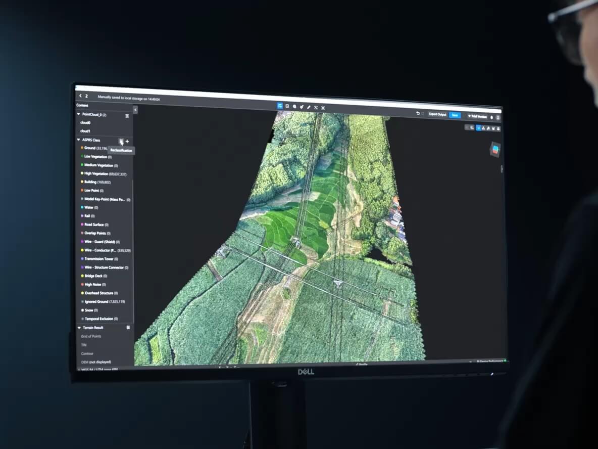
Zenmuse L3 Power Line Follow is a human-supervised data-acquisition mode for Matrice 400—not a complete autonomous power-line inspection.
For supported transmission and distribution lines of 10 kV and above, DJI recommends task heights of 50–80 m for transmission and 30–50 m for distribution, measured above the line’s highest point. The mode uses Non-Repetitive scanning and offers 100 or 350 kHz; DJI recommends 350 kHz for normal use.
The pilot positions the aircraft, checks recognition and chooses the line. The aircraft then follows it while recording point-cloud data. Processing, route planning, detailed inspection and evidence review are separate stages. This guide explains the settings and handoff points; it does not replace DJI’s manual, utility procedures or a site-specific flight plan.
What altitude should L3 use for Power Line Follow?
Start with the correct line classification. DJI’s supported ranges are wider than its recommended working ranges; they are not interchangeable recommendations.
| Task setting | Transmission line | Distribution line |
|---|---|---|
| Supported height range | 10–130 m | 10–50 m |
| DJI recommended height | 50–80 m | 30–50 m |
| Height reference | Highest point of the power line | Highest point of the power line |
Source: DJI L3 FAQ and user manual, Power Line Follow section. On small screens, scroll the table horizontally.
These figures are not simply height above takeoff or height above ground. A line-relative offset must be reconciled with the actual conductor, tower and terrain elevations along the route. It also does not establish safe electrical separation or permission to fly at that altitude.
How to read DJI’s altitude-and-speed recommendation
The manual recommends a task-height numerical value greater than twice the flight-speed numerical value, using metres and metres per second. At 15 m/s, that means more than 30 m. For transmission lines, the separate recommended 50–80 m range still applies; “more than 30” does not replace it.
This is an operating recommendation, not a dimensionally general physics formula or a regulatory rule. Select speed and height together, then check the route against the site’s obstacles, recognition conditions and authorised operating envelope.
Set up the aircraft before selecting a line
L3 is supported on Matrice 400. DJI specifies the dedicated L3 single gimbal connector connected to the aircraft’s underside E1 port, and warns that the wrong port can reduce mapping accuracy. If you are assembling a system, the Matrice 400 SP Plus Full Package is an aircraft-package option; do not assume the L3 payload is included.
Match aircraft, controller, payload and DJI Pilot 2 versions using the current release notes. The July 30, 2026 L3 release notes also specify DJI Terra 5.3.0 or later for reconstruction. A workflow documented for an earlier version is not enough to confirm the installed combination.
- Review flight limits and enable obstacle sensing. DJI recommends a maximum altitude above the highest obstacle and potential task altitude, and a disabled or maximum distance limit. Those are software recommendations: configure them only within the operation’s approved envelope. If the route and permitted limits conflict, revise the mission.
- Position for recognition. Fly diagonally above the tower and adjust the gimbal until the tower appears in the camera view. Power Line Follow does not start by independently searching an unknown corridor.
- Select Transmission or Distribution. An incorrect classification can impair recognition. Set task height, speed and LiDAR parameters for that line.
- Complete the prompted start sequence. Follow any enabled IMU-calibration procedure, inspect the recognised lines, select the correct one and start the task.
100 or 350 kHz? Use the settings for this mode
L3’s general specification lists four pulse rates: 100, 350, 1000 and 2000 kHz. That does not mean all four are available in Power Line Follow.
| Parameter | Power Line Follow guidance | Boundary |
|---|---|---|
| Pulse rate | 100 or 350 kHz | DJI recommends 350 kHz |
| Particularly tall towers | Consider 100 kHz and reduce speed | Do not change rate from headline range alone |
| Scanning mode | Non-Repetitive | Not a free choice among Linear, Star-Shaped and Non-Repetitive |
| RGB Coloring | Optional point-cloud colouring from RGB imagery | Adds visual context, not a stated LiDAR-accuracy improvement |
Why the maximum-range specification is not the selection rule
DJI’s general 10%-reflectivity specification lists 700 m at the centre and 500 m at the edge of the field of view at 350 kHz. At 100 kHz, it lists 950 m at the centre and 650 m at the edge. DJI separately states that maximum detection range is limited to 900 m by default; longer-range requirements should be discussed with DJI or an authorised dealer.
Those controlled target-detection figures are not line-follow heights or guaranteed wire-recognition distances. The general test uses a target larger than the laser spot, normal incidence, 100 klx illumination and 23 km visibility, with range defined at a 50% pulse-detection rate. A thin conductor is a different target.
The useful conclusion is modest: follow the mode-specific 350 kHz recommendation, use the documented 100 kHz/slower-speed option for particularly tall towers, and validate the actual mission. Do not invent a universal “best density” explanation that DJI has not established for your corridor.
RGB context and the wider scan
RGB Coloring can make towers, vegetation and surrounding surfaces easier to interpret in a coloured point cloud. It does not turn the colour image into a thermal inspection, nor does it prove a geometric accuracy improvement.
DJI identifies L3’s 80° × 80° Non-Repetitive field of view, smaller laser spot and longer detection range as improvements supporting line acquisition. These help explain the product’s role without making every crossing or vegetation condition suitable for automated following.
What does the 300 m wire-detection figure actually mean?
DJI publishes two wire benchmarks at 350 kHz and 100 klx. The material and diameter matter.
| Test wire | Published range | Metric |
|---|---|---|
| 21.6 mm steel-core aluminium stranded wire | 300 m | 4 points per metre on the fully scanned section |
| 18.4 mm black PVC-insulated wire | 100 m | Same point-density criterion |
The test conditions include 23 km atmospheric visibility, the centre of the LiDAR field of view perpendicular to the wire, Non-Repetitive scanning and flight along the wire at 15 m/s. The wire is clean and not aged.
A 300 m controlled detection benchmark is not a promise that every conductor will be recognised at 300 m. It is also not a recommended task altitude, obstacle-avoidance clearance or permissible separation from an energised line. Keep those decisions separate.
Which lines can it recognise—and when should you not use it?
DJI positions Power Line Follow for transmission and distribution lines rated 10 kV and above. It does not guarantee effective recognition of 400 V low-voltage lines, communications cables or broadcasting cables. A cable being visible in the camera image is not evidence that the automated task can follow it.
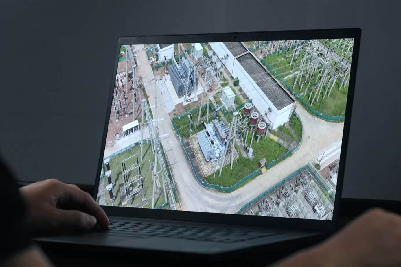
Recognition can degrade around insulated wires, nearby or obscuring canopy, dense lines at substation entrances and exits, and complex crossings between power lines and other cables. The manual also warns about interference from linear objects seen from above, including buildings, streetlights and billboards, as well as rain or fog.
DJI’s do-not-use boundary: do not use Power Line Follow where tree canopy is very close to the wires, or where black PVC-insulated wires run beneath tree canopy. These are not conditions to overcome by simply flying closer.
For dense or multiple crossing lines, DJI describes warnings and a transition to manual flight through the complex area. That is not an instruction to proceed regardless of risk. The pilot still needs a safe, authorised manual path; if none exists, stop or redesign that section.
Multiple lines, lost recognition and manual control
Several detected lines: hover and choose
When multiple power lines are detected, the aircraft hovers and waits for the operator to select the correct line before continuing. It does not always decide the intended route independently. Review the selected line and the onward path before resuming.
No detected line: the task ends
The manual lists failure to detect a power line as an automatic task-termination condition. Other termination conditions include RTH initiation, pressing the pause button, changing flight mode, losing the aircraft–controller connection, exceeding configured altitude or distance limits, and approaching restricted zones. If an obstacle is detected, the aircraft brakes and enters obstacle-avoidance mode.
These are different events, not one universal “hover until the pilot decides” behaviour. Review the aircraft’s current state and the reason the task ended before deciding whether to reposition, restart recognition, collect manually or abandon that segment.
Know the takeover sequence before flight. DJI states that the aircraft does not respond to ordinary control-stick inputs during this task. Press the pause button or change flight mode to exit the task before controlling the aircraft manually. Do not wait until a crossing to discover this distinction.
Monitor the FPV view and the operating area throughout the mission. Obstacle sensing assists the pilot; it is not proof that every wire has been detected or that a route is clear. Any retry involving altitude or gimbal changes needs a safe position and a reviewed plan, not an automatic descent toward the conductors.
Does Power Line Follow require IMU calibration?
DJI’s FAQ says a special additional IMU-calibration procedure is not required solely because the mission uses Power Line Follow; acceleration and deceleration around towers help with calibration. The manual also says to complete the calibration flight when IMU Calibration is enabled in the task.
Both instructions can be followed: do not invent an extra mandatory procedure, and do not skip a calibration workflow that Pilot 2 actually prompts you to complete.
Power Line AR, L3 acquisition and H30T inspection are different tools
Power Line AR highlights detected lines in the operator’s view. L3 Power Line Follow executes a line-following acquisition task after recognition and operator selection. For the sensing/display/mission distinction, use our Matrice 400 Smart AR guide.
L3 and H30T also answer different inspection questions. L3 supplies corridor geometry and RGB mapping context; H30T provides visible/zoom imagery and thermal information for component inspection. Neither output automatically establishes a defect diagnosis.

View Zenmuse L3 at SpeedyDrone

View H30T and confirm availability
| Question | L3 acquisition | H30T inspection |
|---|---|---|
| What data is central? | LiDAR point cloud and RGB mapping imagery | Visible/zoom imagery and thermal information |
| Where does it fit? | Corridor geometry and model preparation | Closer examination of components and thermal patterns |
| Does it measure thermal patterns? | No thermal sensor | Yes; interpretation still requires appropriate conditions and review |
| What follows acquisition? | Terra LiDAR processing and quality review | Review inspection media; not a substitute for L3 LiDAR reconstruction |
| What about automation? | Power Line Follow acquisition | Separate H30 Series automated inspection workflows exist; do not confuse them with L3 acquisition |
For the broader equipment decision, see the powerline and utility inspection workflow guide. Adding L3 does not remove the need for a suitable detailed-inspection payload or qualified interpretation.
The corridor workflow continues after the flight
DJI’s powerline solution separates L3 acquisition from model processing, route planning and subsequent inspection. Treat each stage as a handoff with its own evidence, rather than calling the initial flight a completed corridor inspection.
Separate field previews from processed evidence
The real-time point cloud helps assess coverage and situational context. DJI does not guarantee its accuracy. Pilot 2 also supports location, distance and area measurements in point-cloud playback after recording; do not treat those capabilities as a blanket promise of validated, in-flight survey measurements.
The March 31, 2026 release notes added a quality report for Power Line Follow tasks. Review it as task-acquisition feedback. It is not the same document as the report produced after Terra reconstruction.
For high-accuracy work, DJI directs users to offline Terra processing. That processing still needs project-appropriate checks. Our DJI Terra LiDAR Quality Report guide explains the next QA stage; a processed cloud is not automatically an accepted deliverable.
Keep the full data handoff intact
The L3 manual says to wait at least 60 seconds after image capture or point-cloud recording before powering off or removing storage cards. Preserve the complete timestamped capture folders and their associated positioning, IMU and calibration files—not just selected RGB images or a preview export.
In Terra, create a LiDAR point-cloud task, import the relevant folder, configure processing, then review both the result and its quality report. For output planning, see what L3 and Terra can deliver from a LiDAR flight.
SpeedyDrone lists DJI Terra Standard for software enquiries. However, DJI’s L3 FAQ describes L3 point-cloud processing and optimisation as free in Terra. Do not assume a paid licence is required just to process basic L3 data; confirm the licence needed for your additional deliverables and current software version.
Canadian flight permission is a separate check
Power Line Follow is a mission capability, not permission to fly BVLOS or exceed the operation’s altitude, airspace or site limits. Pilot qualifications, applicable operating category, airspace access and VLOS/BVLOS requirements apply independently of the software.
Check Transport Canada’s operation categories and pilot-certificate requirements, then assess your organisation’s BVLOS readiness where relevant. A higher software distance limit does not enlarge an authorised operating area.
Operator checklist: four decision points
Use this as a briefing aid alongside the current manual and your approved procedures—not as a complete flight or electrical-safety SOP.
Before the task
- Confirm voltage class, correct line type, tower heights, crossings and vegetation conditions.
- Check the connector, compatible firmware, storage and the planned acquisition/processing handoff.
- Set line-relative height and speed together; confirm 100/350 kHz selection and Non-Repetitive scanning.
- Enable obstacle sensing and reconcile maximum altitude/distance with the authorised route and contingency plan.
At the start
- Place the tower in view, complete any prompted calibration and verify recognition.
- Select the intended line, confirm heading and onward path, and check point-cloud recording.
During acquisition
- Monitor FPV, crossings, canopy, aircraft state and recording; do not equate displayed wires with guaranteed clearance.
- Expect operator selection when several lines are detected. Know the pause/mode-change sequence for manual control.
- If recognition fails or a termination condition occurs, reassess before restarting or changing the route.
After acquisition
- Review coverage, missing segments, the preview and available task-quality feedback.
- Observe the 60-second storage precaution and preserve complete capture folders.
- Process in Terra, review reconstruction quality, then plan any follow-up inspection and evidence analysis.
Build the acquisition and inspection plan together
Tell SpeedyDrone which line class, corridor conditions and deliverables you need. We can discuss the M400/L3 equipment configuration and how it fits alongside a detailed-inspection payload and processing software.
Discuss an L3 utility-mapping setupPower Line Follow FAQ
What altitude should Zenmuse L3 use?
DJI recommends 50–80 m for transmission and 30–50 m for distribution, relative to the highest point of the line. Those offsets are not ground-relative flight permissions or electrical-clearance guarantees.
Should I use 100 or 350 kHz?
DJI recommends 350 kHz. The manual suggests 100 kHz with reduced speed for particularly tall towers. Choose within the actual mission’s geometry and limits, not from maximum range alone.
Can this mode use 1000 or 2000 kHz?
L3 supports those rates generally, but the Power Line Follow section lists only 100 and 350 kHz. General payload capability is not the same as a task-mode option.
Which scanning mode does it use?
Power Line Follow uses Non-Repetitive scanning. The manual does not present Linear or Star-Shaped scanning as alternatives for this task.
Can it follow 400 V lines or communications cables?
DJI does not guarantee effective recognition of 400 V low-voltage lines, communications cables or broadcasting cables. The stated application is transmission and distribution lines of 10 kV and above.
What happens when several lines are detected?
The aircraft hovers and waits for the operator to select the correct line. Complex crossings may instead require a planned transition to manual flight; the system does not guarantee autonomous route selection.
How do I take manual control during a task?
The manual says ordinary stick inputs do not control the aircraft during the task. Press the pause button or change flight mode to exit, then use manual controls according to the aircraft state and your procedures.
Can vegetation interfere with recognition?
Yes. DJI advises against Power Line Follow where canopy is very close to wires or where black PVC-insulated wires run beneath canopy. Other insulation, dense lines and crossings can also impair recognition.
Do I need a special IMU-calibration flight?
Not solely because you are using Power Line Follow, according to DJI’s FAQ. However, if IMU Calibration is enabled in the task, complete the prompted calibration workflow described in the manual.
Is the real-time point cloud a survey-grade deliverable?
DJI does not guarantee real-time point-cloud accuracy. Use offline Terra processing for high-accuracy applications, then validate the processed result against the project’s requirements.
Technical references
This reference reflects the documents checked on September 28, 2026. Recheck current documentation before flight, especially after software updates.
- DJI Zenmuse L3 user manual — Power Line Follow, control handoff, data storage and Terra processing, pages 18–22.
- DJI Zenmuse L3 FAQ — supported lines, altitude ranges, recognition limits, IMU guidance and preview accuracy.
- DJI Zenmuse L3 specifications — pulse rates, range tests and wire-detection methodology.
- DJI Zenmuse L3 release notes — compatible software and Power Line Follow task-quality reporting.
- DJI powerline inspection solution — acquisition, modelling, inspection-route planning and analysis.


