


Agriculture · Data and equipment decisions
Keep using satellite imagery when it meets your monitoring scale, timing and quality requirements. Consider drone capture when a defined gapâsuch as small research plots, fine within-field detail or a specific observation windowâchanges a decision you need to make. Buy a drone only when repeated demand and a workable operating team justify ownership.
Data sources, Mavic 3M specifications, Canadian offer and operating guidance checked October 12, 2026.
For a grower association, agricultural research team or Living Lab, the first question is what information is missing. A sharper map has value when it improves sampling, separates trial units or arrives in time for a useful field visit. It has less value when the existing satellite record already supports the programmeâs decisions.
This satellite vs drone crop monitoring guide primarily compares free/open satellite data with an owned drone system. Commercial satellite imagery and contracted drone capture are additional options. Start with the data you have, document the unmet requirement, then compare ways to fill it. That avoids making an aircraft purchase the starting point for an observation programme.
In this guide
- Compare the actual options
- What open satellite data provides
- When satellite imagery is enough
- When drone capture adds value
- Small plots and mixed pixels
- Satellite, drone and ground checks
- Comparing NDVI across platforms
- Does Mavic 3M fit?
- Buy, outsource or stay satellite-first
- Fillable ownership-cost model
- Canadian operating requirements
- Procurement checklist
- Scope an equipment configuration
- FAQ
Define the comparison
01 Compare the actual options
âSatelliteâ is a platform category, not one specification. Sentinel-2, commercial optical products and radar observations have different characteristics. Likewise, drone detail depends on the sensor, flight plan and processing. Compare the specific data product you can obtain with the specific drone deliverable you need.
Use the table to identify a requirement, then test it with representative data. Coverage, useful timing and interpretation matter alongside spatial detail. Neither option removes the need for ground checks when the question concerns the cause of a crop response.
Scroll sideways on a phone to compare both acquisition options.
| Requirement | Open optical satellite data | Targeted drone capture |
|---|---|---|
| Coverage | Wide-area screening across many fields | Selected fields, plots or flagged areas |
| Detail | Specific to the mission, band and product | Specific to sensor, height, overlap and processing |
| Useful date | Acquisition plan and usable, quality-screened observations | Your chosen window, subject to weather, access and lawful operation |
| Weather | Optical observations affected by cloud and shadow | Wind, precipitation and illumination can prevent or degrade capture |
| Small plots | Evaluate pixels and boundaries against plot geometry | Potentially finer separation; still needs calibration and registration |
| Programme cost | No aircraft purchase; processing and staff still cost time and money | Equipment, personnel, processing, validation and ongoing readiness |
Radar can complement optical satellite monitoring, but it measures different properties and needs appropriate analysis. A commercial high-resolution optical product may also fill a spatial gap. Neither should be dismissed merely because an open optical dataset is insufficient.
Start with available information
02 What free satellite data can already provide
Copernicus makes Sentinel data available without a data purchase charge. Sentinel-2âs instrument samples 13 spectral bands: four at 10 m, six at 20 m and three at 60 m. Choose the bands and processing level required by your analysis; the instrumentâs total band count is not the contents of every processed product.
For example, Level-2A provides atmospherically corrected surface reflectance and excludes the cirrus band B10. Resampling a native 20 m band onto a 10 m grid does not create new 10 m spatial information. Check the acquisition date, cloud/shadow mask and usable coverage over your fields before treating an image as a scheduled observation.
Sources: Copernicus Sentinel-2 mission information and Sentinel-2 product documentation. A nominal revisit specification is not a guarantee of a cloud-free field observation.
AAFCâs Annual Crop Inventory is a different kind of resource
Agriculture and Agri-Food Canadaâs 2025 Annual Crop Inventory uses Landsat-8/9 and Sentinel-2 optical observations, RCM radar data and ground information to produce a 30 m annual crop-classification map. It provides useful regional context and a reference for locating crop types.
It is not a live scouting feed. A crop-classification label does not tell you whether a particular part of a field currently has a disease, nitrogen deficiency or water problem. Use the AAFC interactive inventory for its intended annual context, and obtain the observation and ground evidence required for a current agronomic question.
Year, data sources and final resolution verified against AAFCâs actual 2025 inventory service. Annual classification and in-season monitoring are different products.
A valid purchase decision
03 When satellite imagery is enough
A grower association screening many member fields may need regional trends and a shortlist of places to inspect. If the available imagery supports that scale and provides enough usable dates, buying a drone for every observation may add equipment management without changing the programmeâs decisions.
Test the archive against an actual season. Record which observations were usable over the fields, whether gaps crossed important crop stages, and whether flagged areas could be checked on the ground. Judge the data against the action it must support, rather than whether it looks less detailed than a drone image.
Staying satellite-first is reasonable when the analysis unit is large enough, timing is acceptable, access is manageable and staff can interpret the results. Put the next budget dollar into data handling or a targeted ground visit if that is the current bottleneck. A drone becomes a candidate after you can describe a requirement those measures do not solve.
Document the gap
04 When drone imagery adds value
Drone capture is worth evaluating when the question depends on finer spatial separation or a date that the available data cannot reliably supply. Examples include mapping the boundary of an irregular patch, relating an observation to individual trial plots or collecting repeated views around a planned research measurement.
Write the gap as a deliverable: âWe need separate measurements for these plots during this growth-stage window,â for example. Then specify the required resolution, positional checks, radiometric processing and turnaround. A contractorâs sample capture can establish whether those requirements are achievable before the team commits to ownership.
More pixels are not the same as more reliable conclusions. Rain, wind, changing illumination, access and processing delays still affect a drone programme. Ask how rejected imagery is handled and who interprets it. If the useful output is an inspection photograph rather than a calibrated multispectral measurement, consider whether a simpler capture method meets the job.
Match detail to the experimental unit
05 Satellite vs drone for small research plots
For field trials, compare the plot geometry with the relevant bandâs pixel footprint. A small or narrow treatment plot may share pixels with neighbouring treatments, soil or access lanes. Even a larger plot can lose usable interior area when boundary pixels must be excluded.
The illustration below uses hypothetical 4 m à 12 m plots and a 10 m grid. It explains a scale problem; it is not a measurement of a particular trial or a prediction of drone accuracy. The actual suitability test also needs pixel alignment, the bandâs native resolution and the registration uncertainty.
Designed for this guide · Illustrative geometry
A pixel can cross several trial boundaries
10 m reference grid over small plots
Boundary-crossing observations may combine treatments, crop and lanes.
Define the valid plot interior
Finer capture may support interior sampling if resolution and alignment are adequate.
Specify how plot polygons will be registered, which edge area will be excluded and how repeated captures will align. Confirm that enough valid interior data remains for the research question. High-detail images can help this process, but calibration and ground measurements remain essential.
Pixels within a plot are not automatically independent experimental replicates. The research team still owns the treatment design, replication and analysis. Use our agricultural research equipment guide for that broader equipment-selection context.
Use each layer for a clear job
06 Combine satellite, drone and ground checks
A hybrid programme can retain the regional record while concentrating drone work on selected questions. The satellite layer helps decide where to look; targeted capture refines the spatial observation; a field visit checks what may explain it. Qualified research or agronomic interpretation connects those observations to a decision.
Designed for this guide
One question carried through four layers
Keep a common field identifier, coordinate system, date record and question across the layers. Retain areas that did not appear abnormal as comparisons where appropriate. A programme that records only flagged locations can miss the evidence needed to interpret the signal.
A September 2026 ISPRS review of UAVâsatellite crop-monitoring synergies describes the value of multi-scale information and the challenges of combining it. That supports a complementary approach; it does not establish a ready-made model for your crop, location or drone.
Comparable maps need comparable measurements
07 Can you compare NDVI between platforms?
Do not treat two NDVI values as interchangeable simply because the index has the same name. The source bands, spectral responses, processing, observation geometry, date and spatial footprint can differ. A plot-level drone result and a coarser satellite pixel may also describe different mixtures of plants and background.
NASAâs Harmonized Landsat Sentinel-2 processing illustrates the effort involved: surface-reflectance processing, masks, viewing-geometry normalization, bandpass adjustment and common gridding. HLS addresses those satellite sensors; it is not a calibration recipe for Mavic 3M.
For a mixed-platform programme, agree the comparison method before capture. Record the product level, band choice, quality mask and valid field area. Align observations as closely as the study requires, and decide how the finer data will be aggregated to a common footprint. Ask for validation using the relevant crop stages and sites before transferring a numerical threshold from one platform to another.
DJI states that Mavic 3M photographs contain digital numbers rather than finished reflectance; its FAQ also identifies calibration metadata retained with the photographs. Preserve original files and metadata, and verify the chosen processing workflow. RTK positioning and radiometric quality solve different problems.
Choose hardware after defining the output
08 When is Mavic 3M a suitable candidate?
DJI Mavic 3 Multispectral combines a 20 MP RGB camera with four 5 MP multispectral cameras covering green, red, red edge and near infrared. It provides an RTK-equipped acquisition option when the requirement includes visual context and multispectral field observations.
Those capabilities are a reason to evaluate the system, not proof that it meets every study. Ask for a representative sample deliverable at the proposed capture settings. Check plot boundaries, missing areas, processed layers, metadata and your teamâs ability to use the output. More detailed acquisition is valuable only if that output survives the required quality checks.
Features checked October 12, 2026 against DJIâs Mavic 3M specifications. RGB and multispectral cameras have different specifications; a 20 MP RGB image does not make every multispectral layer 20 MP.
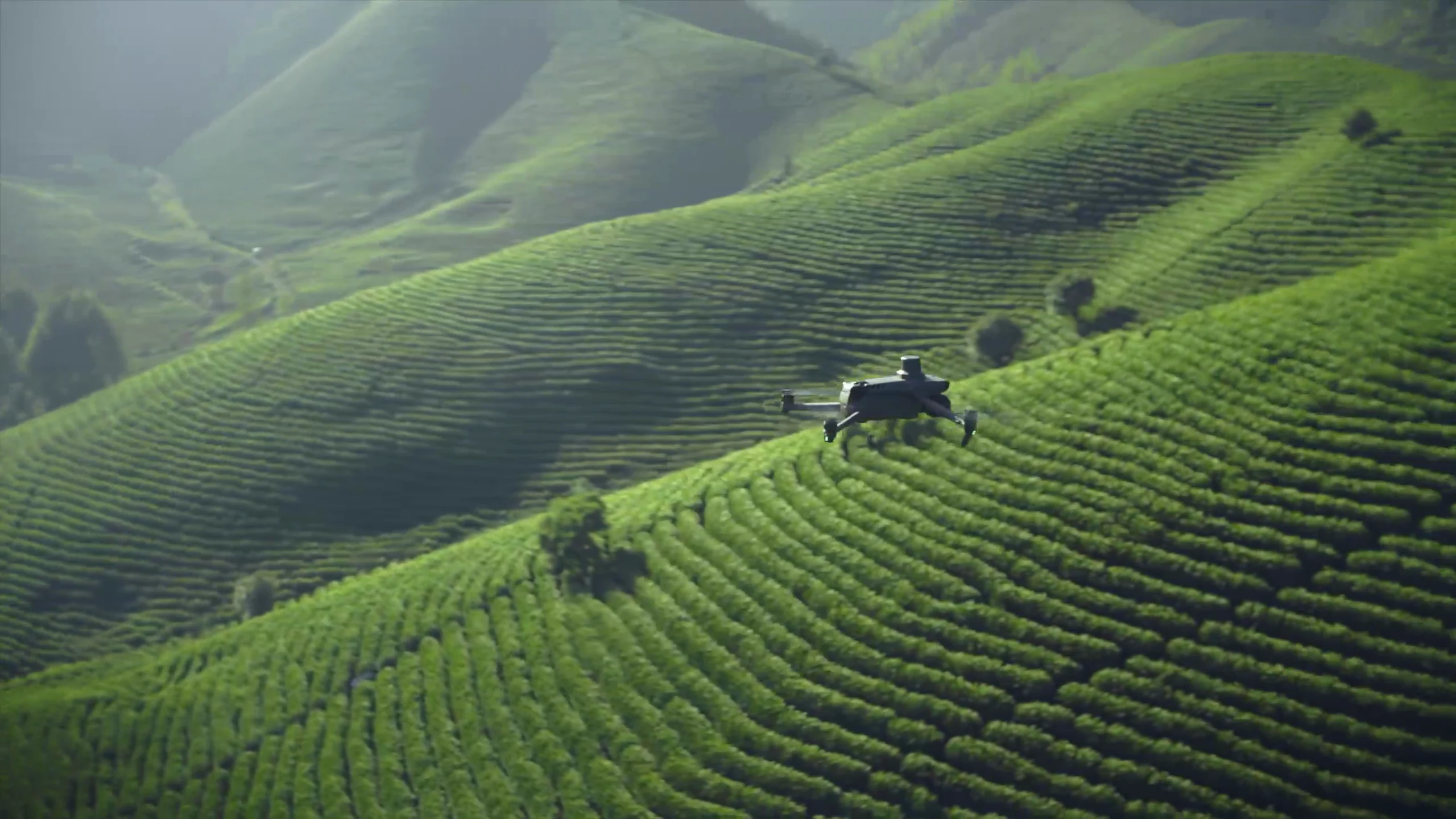

Current Canadian listing
Mavic 3 Multispectral (M3M)
View at SpeedyDrone âFrom C$6,033 CAD
Price checked October 12, 2026 for the listingâs SP Basic 1 Year option. Confirm the selected protection option, package contents and fulfillment timing in your quote. This listing price is not the total cost of an operational monitoring programme.
Source: DJI â manufacturer product image from the matching SpeedyDrone listing. Availability and delivery require current confirmation.
Four practical procurement paths
09 Buy, outsource or stay satellite-first?
Before comparing prices, hold the required output constant. A contracted capture quote, an internal teamâs estimate and a satellite subscription are not comparable if they deliver different dates, field coverage or processed products. Write acceptance conditions into each request.
Scroll sideways to review each option and its ownership implications.
| Option | Include in the estimate | Good reason to choose it |
|---|---|---|
| Open satellite | Processing, analysis, software or service charges, storage and validation | Existing data meets the scale and useful-date requirement |
| Commercial satellite | Licence, tasking or archive access, usable coverage, processing and permitted reuse | A specific data product fills the gap without local flight operations |
| Contracted drone | Capture, travel, scheduling, processing, repeat visits, delivery and data rights | Demand is occasional, or you need to validate the deliverable before buying |
| Owned drone | Complete kit, protection, batteries, software, training, operator time and ongoing readiness | Repeated accepted work, a capable team and a justified acquisition schedule |
Outsourcing transfers some operating workload, but the buyer still needs to specify the question and review the data. Establish who owns raw files and derived products, which metadata is retained, what triggers a repeat capture and whether the provider can meet the relevant growth-stage window.
Ownership adds control over scheduling, alongside responsibility for equipment, staff and quality. Include backup arrangements when a pilot is unavailable or equipment needs service. A low hardware price does not make a seasonal programme resilient.
A model you can fill with your own quotes
10 When does ownership make financial sense?
Use a field-date deliverable that passes your acceptance checks as the mission unit. A flight alone may produce unusable imagery; several flights may contribute to one accepted deliverable. Count the work you expect to use, with repeat-capture costs included.
The model below compares incremental drone acquisition and delivery costs over a chosen horizon. If both paths use the same satellite baseline and identical ground validation, those common costs can stay outside this comparison. If they differ, add the differences to the appropriate inputs. Evaluate satellite-only or commercial data separately against the same requirements.
Enter actual estimates. Initial setup should include the complete system and one-time preparation. Annual fixed cost covers recurring expenses; variable mission cost includes operator time, travel, processing and expected repeat work. Count included protection once. A paid employeeâs time still consumes capacity; do not assume it is free.
Compare owned and contracted capture
Blank inputs · CAD · direct-cost comparison, not a yield or ROI forecast. Values are not submitted or saved.
Enter all seven inputs to compare costs.
- Owned total
- â
- Contracted total
- â
- Cost-crossover mission count
- â
Manual calculation: owned = K â S + Y à A + N à V; contracted = N à Q. When Q > V, crossover N = (K â S + Y à A) ÷ (Q â V); round up to whole accepted missions. The formulas and input definitions remain usable without JavaScript.
A positive crossover is useful only if the demand is credible and the delivery requirements can be met. If contracted cost per mission is no greater than the internal variable cost, increasing volume will not recover a positive ownership fixed cost in this model. Do not turn a mathematical result into an automatic buying recommendation.
Run a conservative case with fewer accepted missions, more processing time and a lower resale estimate. Check the zero-resale case, and keep one-time and recurring costs separate. Match the treatment of taxes, financing and any contract setup fees; this simplified model does not discount cash flows. If significant costs are missing, complete the estimates before interpreting the result.
Include operating readiness in the budget
11 Canadian drone operating requirements
Mavic 3M is not a sub-250 g microdrone. Its manufacturer lists 951 g with propellers and the RTK module. Plan for registration and marking, the appropriate Transport Canada pilot certificate, and the requirements of the actual operation. Being on farmland does not establish uncontrolled airspace or permission to fly.
Check airspace, bystanders, access, obstacles and the intended flight arrangement before committing to a capture schedule. If basic-operation conditions are not met, determine the appropriate operating category and permissions. A transmission-distance specification is not permission to fly beyond visual line of sight.
Rules checked October 12, 2026: Transport Canadaâs safe and legal operation guidance and basic-operation conditions. This resource concerns monitoring; it does not establish approval for a particular flight or agricultural application.
A brief a supplier can answer
12 Crop-monitoring procurement checklist
Bring the following information to an equipment or capture-service discussion. It lets a supplier assess fit and prevents a resolution or aircraft quote from substituting for a complete delivery plan.
- Question and unit: crop, growth stage, field or plot dimensions, and the decision the observation must support.
- Existing evidence: satellite products, usable dates, masks, ground records and the unmet requirement.
- Capture plan: area, frequency, important time windows, access, weather contingency and flight responsibility.
- Deliverables: raw photographs, processed layers, plot or field statistics, metadata, coordinate system and turnaround.
- Acceptance: valid coverage, boundaries, calibration records, positional checks and rules for rejected or repeated work.
- People and rights: operator, processing owner, interpretation lead, data ownership, permitted reuse and retention.
- Complete budget: initial, fixed annual and variable costs, comparable outsourcing quotes and a conservative demand case.
Where possible, ask for a sample using the intended processing workflow. Review it with the person who will consume the results. A procurement decision is stronger when that person can demonstrate how the output answers the question.
Discuss the complete system
13 How SpeedyDrone can help scope the configuration
SpeedyDroneâs crop-scouting application page describes the equipment and workflow context for targeted observations. Use the agricultural deployment support page to discuss the scope of setup, operator readiness and ongoing support alongside the aircraft.
Provide the checklist above and ask which equipment, processing software and training are included in the proposed configuration. Confirm scope, lead time and responsibilities in writing. An equipment enquiry does not mean that field sampling, scientific trial design, agronomic interpretation or outsourced pilot services are included.
If existing satellite and ground data already meet the requirement, continue with them. If targeted capture fills a demonstrated gap, compare a contracted pilot project with an owned system before committing to recurring equipment and staffing costs.
Common follow-up questions
Satellite vs drone crop monitoring FAQ
Is satellite imagery enough for crop monitoring in Canada?
It can be when the available product meets the field scale, useful-date and quality requirements. Review representative observations from an actual season, including cloud or shadow gaps. Drone capture becomes worth evaluating when a specific unmet need changes a decision, such as separating small plots or observing a defined area within a research window.
Is all satellite imagery limited to 10 m resolution?
No. The mission, sensor, band and purchased product determine resolution. Sentinel-2 has bands at 10, 20 and 60 m, while other satellite products have different characteristics. Compare the data you can actually obtain, including its usable timing, licence and processing level. Do not generalize Sentinel-2âs specifications to every satellite option.
Can AAFCâs Annual Crop Inventory identify current crop disease?
The inventory is an annual crop-classification product, not a real-time disease diagnosis. It can provide regional crop-type context. A current field question needs suitable observations, ground checks and qualified interpretation; a classification label alone does not establish why a crop is responding differently.
Will a drone give clearer results for small trial plots?
Finer acquisition may help separate plot interiors from neighbouring treatments and lanes. It must still meet the studyâs resolution, calibration and registration requirements. Specify valid plot areas and positional checks before capture, and review a representative sample. More image pixels do not create independent treatment replicates or remove the need for ground measurements.
Can I combine satellite and Mavic 3M NDVI directly?
Do not assume the values are interchangeable. Band responses, product levels, quality masks, dates and spatial footprints can differ. Agree a comparison or aggregation method, retain metadata and validate it for the crop and study conditions. Satellite harmonization methods do not automatically validate an M3M workflow.
How many acres justify buying a Mavic 3M?
There is no universal acreage threshold. Frequency, accepted deliverables, travel, processing effort, operator availability and alternative quotes determine the cost comparison. Use the modelâs mission unit consistently, include the complete setup and recurring costs, and test a conservative demand case. Meeting the data requirement comes before the arithmetic.
Should a research team buy or outsource drone capture?
Outsourcing is useful for occasional demand or validating a deliverable before buying. Ownership can make sense for repeated work when the team has operator, processing and quality-control capacity. Compare equivalent outputs, accepted dates, repeat-capture terms and data rights; the cheaper option on paper may not meet an important research window.
Does free satellite data mean the programme costs nothing?
No. Free access avoids the data purchase charge, but processing, software or service use, staff time, storage and validation can still cost money. Identify which of those costs are shared with a drone programme and which change between options. Compare complete usable outputs rather than a zero data price with an aircraft-only price.
Evaluate a crop-monitoring equipment configuration
Send the crop, area or plot dimensions, capture frequency, current data sources and required outputs. Ask SpeedyDrone to assess the equipment and support scope against the gap you need to fill.
sales@speedydrone.ca · Confirm the selected configuration, current availability and delivery timing.


